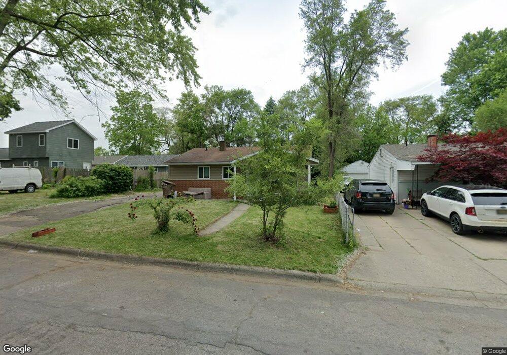
713 Hollister St Pontiac, MI 48340
Estimated Value: $104,000 - $125,000
3
Beds
1
Bath
879
Sq Ft
$129/Sq Ft
Est. Value
About This Home
This home is located at 713 Hollister St, Pontiac, MI 48340 and is currently estimated at $113,442, approximately $129 per square foot. 713 Hollister St is a home located in Oakland County with nearby schools including Walt Whitman Elementary School, Pontiac Middle School, and Pontiac High School.
Ownership History
Date
Name
Owned For
Owner Type
Purchase Details
Closed on
Sep 15, 2016
Sold by
Coulter Carl H and Coulter Barbara A
Bought by
Coulter Terry C and Coulter Carl H
Current Estimated Value
Purchase Details
Closed on
Jan 28, 2014
Sold by
Bank Of America Na
Bought by
Coulter Carl H
Purchase Details
Closed on
Nov 13, 2012
Sold by
Deem Pearl E and Long Polliann
Bought by
Bank Of America Na
Purchase Details
Closed on
Aug 4, 2005
Sold by
Deem Pearl E
Bought by
Deem Pearl E and Long Polliann
Purchase Details
Closed on
Sep 25, 1996
Sold by
Deem L
Bought by
Deem Pearl E
Create a Home Valuation Report for This Property
The Home Valuation Report is an in-depth analysis detailing your home's value as well as a comparison with similar homes in the area
Home Values in the Area
Average Home Value in this Area
Purchase History
| Date | Buyer | Sale Price | Title Company |
|---|---|---|---|
| Coulter Terry C | -- | None Available | |
| Coulter Carl H | $2,850 | E Title | |
| Bank Of America Na | $80,330 | None Available | |
| Deem Pearl E | -- | -- | |
| Deem Pearl E | -- | -- | |
| Deem Pearl E | -- | -- |
Source: Public Records
Tax History Compared to Growth
Tax History
| Year | Tax Paid | Tax Assessment Tax Assessment Total Assessment is a certain percentage of the fair market value that is determined by local assessors to be the total taxable value of land and additions on the property. | Land | Improvement |
|---|---|---|---|---|
| 2024 | $946 | $37,020 | $0 | $0 |
| 2023 | $901 | $33,230 | $0 | $0 |
| 2022 | $932 | $29,720 | $0 | $0 |
| 2021 | $906 | $25,690 | $0 | $0 |
| 2020 | $820 | $22,760 | $0 | $0 |
| 2019 | $872 | $19,890 | $0 | $0 |
| 2018 | $836 | $16,890 | $0 | $0 |
| 2017 | $804 | $16,080 | $0 | $0 |
| 2016 | $829 | $14,220 | $0 | $0 |
| 2015 | -- | $13,870 | $0 | $0 |
| 2014 | -- | $13,270 | $0 | $0 |
| 2011 | -- | $17,090 | $0 | $0 |
Source: Public Records
Map
Nearby Homes
- 0000 Blaine Ave
- 793 Orlando Ave
- 841 Orlando Ave
- 686 Lounsbury Ave
- 0 Cesar Chavez Ave Unit 20240016653
- 201 Parkdale Ave
- 1017 Cherrylawn Dr
- 119 W Kennett Rd
- 109 W Kennett Rd
- 998 Dewey St
- 255 W Rutgers Ave
- 32 N Merrimac St
- 54 Hudson Ave
- 1123 Cherrylawn Dr
- 240 W Fairmount Ave
- 33 W Beverly Ave
- 207 W Strathmore Ave
- 1153 Stanley Ave
- 134 W Fairmount Ave
- 78 Cadillac St
- 719 Hollister St
- 725 Hollister St
- 818 Blaine Ave
- 712 Cortwright St
- 822 Blaine Ave
- 716 Cortwright St
- 814 Blaine Ave
- 708 Cortwright St
- 704 Hollister St
- 704 Cortwright St
- 731 Hollister St
- 724 Cortwright St
- 720 Cortwright St
- 803 Crittenden St
- 726 Hollister St
- 806 Blaine Ave
- 735 Hollister St
- 732 Cortwright St
- 802 Crittenden St
- 804 Blaine Ave