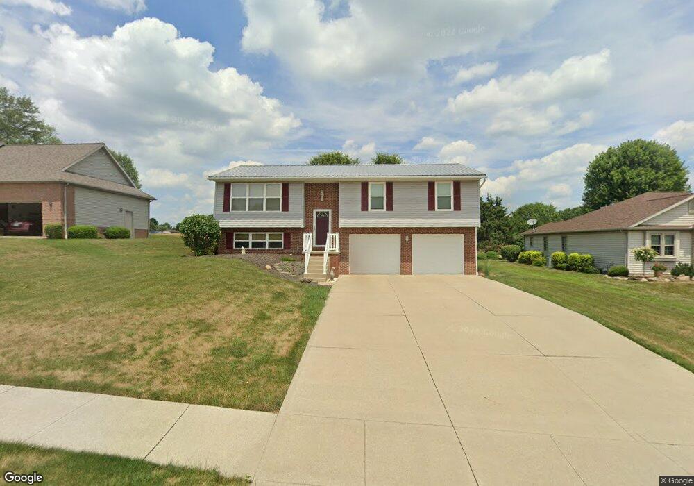
713 Joel Cir Louisville, OH 44641
Estimated Value: $221,015 - $250,000
3
Beds
2
Baths
1,150
Sq Ft
$207/Sq Ft
Est. Value
About This Home
This home is located at 713 Joel Cir, Louisville, OH 44641 and is currently estimated at $238,504, approximately $207 per square foot. 713 Joel Cir is a home located in Stark County with nearby schools including Louisville High School and St. Thomas Aquinas High School & Middle School.
Ownership History
Date
Name
Owned For
Owner Type
Purchase Details
Closed on
Jul 2, 2009
Sold by
Brooks Deborah S
Bought by
Brooks Gregory M
Current Estimated Value
Purchase Details
Closed on
Mar 25, 2002
Sold by
Hunt Pamela J
Bought by
Brooks Gregory M and Brooks Deborah S
Home Financials for this Owner
Home Financials are based on the most recent Mortgage that was taken out on this home.
Original Mortgage
$95,150
Outstanding Balance
$39,439
Interest Rate
6.95%
Mortgage Type
Purchase Money Mortgage
Estimated Equity
$199,065
Purchase Details
Closed on
Jan 27, 1999
Sold by
Constitution Development
Bought by
Hunt Pamela J
Home Financials for this Owner
Home Financials are based on the most recent Mortgage that was taken out on this home.
Original Mortgage
$84,050
Interest Rate
6.75%
Mortgage Type
Construction
Create a Home Valuation Report for This Property
The Home Valuation Report is an in-depth analysis detailing your home's value as well as a comparison with similar homes in the area
Home Values in the Area
Average Home Value in this Area
Purchase History
| Date | Buyer | Sale Price | Title Company |
|---|---|---|---|
| Brooks Gregory M | -- | Attorney | |
| Brooks Gregory M | $126,900 | -- | |
| Hunt Pamela J | $24,900 | -- |
Source: Public Records
Mortgage History
| Date | Status | Borrower | Loan Amount |
|---|---|---|---|
| Open | Brooks Gregory M | $95,150 | |
| Closed | Hunt Pamela J | $84,050 | |
| Closed | Brooks Gregory M | $25,350 |
Source: Public Records
Tax History Compared to Growth
Tax History
| Year | Tax Paid | Tax Assessment Tax Assessment Total Assessment is a certain percentage of the fair market value that is determined by local assessors to be the total taxable value of land and additions on the property. | Land | Improvement |
|---|---|---|---|---|
| 2025 | -- | $62,130 | $16,000 | $46,130 |
| 2024 | -- | $62,130 | $16,000 | $46,130 |
| 2023 | $2,375 | $55,270 | $13,230 | $42,040 |
| 2022 | $2,381 | $55,270 | $13,230 | $42,040 |
| 2021 | $2,388 | $55,270 | $13,230 | $42,040 |
| 2020 | $1,997 | $50,200 | $11,940 | $38,260 |
| 2019 | $2,005 | $50,200 | $11,940 | $38,260 |
| 2018 | $1,997 | $50,200 | $11,940 | $38,260 |
| 2017 | $1,843 | $44,700 | $9,980 | $34,720 |
| 2016 | $1,881 | $44,700 | $9,980 | $34,720 |
| 2015 | $1,872 | $44,350 | $9,980 | $34,370 |
| 2014 | $1,785 | $39,310 | $8,860 | $30,450 |
| 2013 | $896 | $39,310 | $8,860 | $30,450 |
Source: Public Records
Map
Nearby Homes
- 300 Kennedy St
- 1149 Sturbridge Dr
- 1175 Sturbridge Dr
- 614 Reno Dr
- 524 Glenbar St
- 428 Honeycrisp Dr NE
- 3047 Mcintosh Dr NE
- 432 Honeycrisp Dr NE
- 2962 Mcintosh Dr NE
- 2963 Mcintosh Dr NE
- 430 Honeycrisp Dr NE
- 2957 Mcintosh Dr NE
- 0 Brookridge Ave
- 0 Glenbar St
- 3580 Brookridge Ave Lot 15
- 5474 Ravenna Ave
- 316 E Reno Dr
- 325 Lincoln Ave
- 248 Menegay Rd
- 201 Indiana Ave
- 723 Joel Cir
- 703 Joel Cir
- 733 Joel Cir
- 712 Joel Cir
- 722 Joel Cir
- 702 Joel Cir
- 803 Joel Cir
- 1096 Danielle Ave
- 1086 Danielle Ave
- 1078 Danielle Ave
- 802 Joel Cir
- 711 Glencarlyn Ave
- 721 Glencarlyn Ave
- 1070 Danielle Ave
- 813 Joel Cir
- 731 Glencarlyn Ave
- 812 Joel Cir
- 801 Glencarlyn Ave
- 1064 Danielle Ave
- 823 Joel Cir