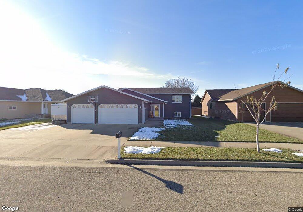
713 Kennedy Loop Pierre, SD 57501
Estimated Value: $377,000 - $421,000
5
Beds
2
Baths
1,352
Sq Ft
$292/Sq Ft
Est. Value
About This Home
This home is located at 713 Kennedy Loop, Pierre, SD 57501 and is currently estimated at $395,355, approximately $292 per square foot. 713 Kennedy Loop is a home with nearby schools including T.F. Riggs High School and Pierre SDA School.
Ownership History
Date
Name
Owned For
Owner Type
Purchase Details
Closed on
Nov 9, 2007
Sold by
Widvey Reid and Krietlow Kurt
Bought by
Foell Jacob D and Foell Vivian L
Current Estimated Value
Home Financials for this Owner
Home Financials are based on the most recent Mortgage that was taken out on this home.
Original Mortgage
$166,400
Outstanding Balance
$105,771
Interest Rate
6.47%
Estimated Equity
$289,584
Purchase Details
Closed on
Apr 30, 2007
Sold by
Kennedy Property Development Llc
Bought by
Widvey Reid and Krietlow Kurt
Home Financials for this Owner
Home Financials are based on the most recent Mortgage that was taken out on this home.
Original Mortgage
$151,551
Interest Rate
6.2%
Mortgage Type
Construction
Create a Home Valuation Report for This Property
The Home Valuation Report is an in-depth analysis detailing your home's value as well as a comparison with similar homes in the area
Home Values in the Area
Average Home Value in this Area
Purchase History
| Date | Buyer | Sale Price | Title Company |
|---|---|---|---|
| Foell Jacob D | $208,000 | -- | |
| Widvey Reid | $36,000 | -- |
Source: Public Records
Mortgage History
| Date | Status | Borrower | Loan Amount |
|---|---|---|---|
| Open | Foell Jacob D | $166,400 | |
| Previous Owner | Widvey Reid | $151,551 |
Source: Public Records
Tax History
| Year | Tax Paid | Tax Assessment Tax Assessment Total Assessment is a certain percentage of the fair market value that is determined by local assessors to be the total taxable value of land and additions on the property. | Land | Improvement |
|---|---|---|---|---|
| 2025 | $4,195 | $359,428 | $50,833 | $308,595 |
| 2024 | $4,188 | $344,733 | $50,833 | $293,900 |
| 2023 | $3,846 | $335,376 | $48,644 | $286,732 |
| 2022 | $3,618 | $285,271 | $46,328 | $238,943 |
| 2021 | $3,544 | $254,706 | $41,364 | $213,342 |
| 2020 | $3,628 | $247,287 | $40,159 | $207,128 |
| 2019 | $3,622 | $247,287 | $40,159 | $207,128 |
| 2018 | $3,468 | $240,084 | $38,989 | $201,095 |
| 2017 | -- | $228,651 | $37,132 | $191,519 |
| 2016 | $3,630 | $228,651 | $37,132 | $191,519 |
| 2015 | -- | $221,991 | $36,050 | $185,941 |
| 2014 | -- | $215,525 | $35,000 | $180,525 |
| 2013 | -- | $215,525 | $35,000 | $180,525 |
| 2011 | -- | $177,854 | $34,278 | $143,576 |
Source: Public Records
Map
Nearby Homes
- 0 Woodview Dr
- TBD Lilac Dr
- 2106 Antelope St
- 404 Yucca Dr
- 620 N Harrison Ave
- 109 Baja Dr
- 2004 Buffalo St
- 131 Hampton Dr
- 1217 Hilgers Dr
- 1621 Abbey Rd
- 313 N Taylor Ave
- Lot 13R N Garfield Ave
- 203 N Tyler Ave
- 2013 Ridgeway Place
- 129 Norbeck Dr
- 1602 E Cabot St
- 2400 E Capitol Ave
- 1814 Camden Ct
- 115 S Tyler Ave
- 1515 E Capitol Ave
- 717 Kennedy Loop
- 709 Kennedy Loop
- 1640 Circle Dr
- 705 Kennedy Loop
- 721 Kennedy Loop
- 712 Kennedy Loop
- 1636 Circle Dr
- 708 Kennedy Loop
- 704 Kennedy Loop
- 725 Kennedy Loop
- 1812 Kennedy Dr
- 1632 Circle Dr
- 1644 Circle Dr
- 1808 Kennedy Dr
- 1816 Kennedy Dr
- 1629 Circle Dr
- 734 Kennedy Loop
- 1633 Circle Dr
- 1648 Circle Dr
- 20405 Falcon Ridge Rd
Your Personal Tour Guide
Ask me questions while you tour the home.