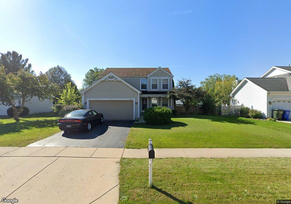
713 Medford Dr South Elgin, IL 60177
Estimated Value: $427,000 - $446,000
4
Beds
3
Baths
2,050
Sq Ft
$213/Sq Ft
Est. Value
About This Home
This home is located at 713 Medford Dr, South Elgin, IL 60177 and is currently estimated at $436,462, approximately $212 per square foot. 713 Medford Dr is a home located in Kane County with nearby schools including Clinton Elementary School, Kenyon Woods Middle School, and South Elgin High School.
Ownership History
Date
Name
Owned For
Owner Type
Purchase Details
Closed on
May 13, 2005
Sold by
Lesage Todd J and Power Lesage Patricia L
Bought by
Koller Paul and Koller Patricia
Current Estimated Value
Purchase Details
Closed on
Dec 19, 1996
Sold by
Firstar Bank Illinois
Bought by
Lesage Todd J and Power Lesage Patricia L
Home Financials for this Owner
Home Financials are based on the most recent Mortgage that was taken out on this home.
Original Mortgage
$155,790
Interest Rate
7.66%
Mortgage Type
FHA
Create a Home Valuation Report for This Property
The Home Valuation Report is an in-depth analysis detailing your home's value as well as a comparison with similar homes in the area
Home Values in the Area
Average Home Value in this Area
Purchase History
| Date | Buyer | Sale Price | Title Company |
|---|---|---|---|
| Koller Paul | $294,500 | Chicago Title Insurance Comp | |
| Lesage Todd J | $175,500 | First American Title |
Source: Public Records
Mortgage History
| Date | Status | Borrower | Loan Amount |
|---|---|---|---|
| Previous Owner | Lesage Todd J | $155,790 |
Source: Public Records
Tax History Compared to Growth
Tax History
| Year | Tax Paid | Tax Assessment Tax Assessment Total Assessment is a certain percentage of the fair market value that is determined by local assessors to be the total taxable value of land and additions on the property. | Land | Improvement |
|---|---|---|---|---|
| 2024 | $4,303 | $132,967 | $28,317 | $104,650 |
| 2023 | $8,736 | $120,125 | $25,582 | $94,543 |
| 2022 | $8,479 | $109,533 | $23,326 | $86,207 |
| 2021 | $5,184 | $102,405 | $21,808 | $80,597 |
| 2020 | $5,285 | $97,761 | $20,819 | $76,942 |
| 2019 | $5,364 | $93,123 | $19,831 | $73,292 |
| 2018 | $5,610 | $87,728 | $18,682 | $69,046 |
| 2017 | $5,668 | $82,934 | $17,661 | $65,273 |
| 2016 | $5,859 | $76,941 | $16,385 | $60,556 |
| 2015 | -- | $70,523 | $15,018 | $55,505 |
| 2014 | -- | $58,919 | $14,833 | $44,086 |
| 2013 | -- | $60,473 | $15,224 | $45,249 |
Source: Public Records
Map
Nearby Homes
- 308 Cornwall Ave
- 194 S Collins St
- 295 S Walnut St
- 400 S Collins St
- 273 Windsor Ct Unit A
- 447 Hancock Ave
- 897 N Camden Ln
- 280 Virginia Dr
- 7N905 Woodcliff Dr
- 275 Quarry St
- 8N594 S Mclean Blvd
- 1030 West Dr
- 1063 Manchester Ct Unit 1
- 291 Kingsport Dr
- 311 Kingsport Dr
- 289 Kingsport Dr
- 309 Kingsport Dr
- 287 Kingsport Dr
- 307 Kingsport Dr
- 285 Kingsport Dr
- 727 Medford Dr
- 689 Medford Dr
- 712 Brookline St
- 728 Brookline St
- 741 Medford Dr
- 250 Valley Forge Ave Unit 6
- 260 Valley Forge Ave
- 714 Medford Dr
- 744 Brookline St
- 700 Medford Dr
- 728 Medford Dr
- 240 Valley Forge Ave
- 268 Valley Forge Ave
- 755 Medford Dr
- 684 Medford Dr
- 742 Medford Dr
- 760 Brookline St
- 664 Medford Dr
- 756 Medford Dr
- 769 Medford Dr