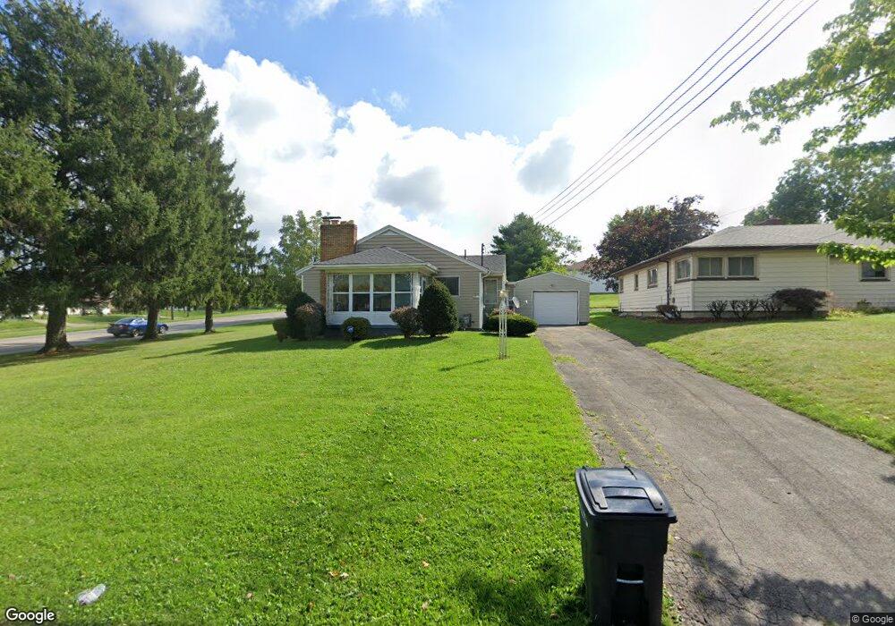
713 Moore Ave Campbell, OH 44405
Estimated Value: $107,935 - $130,000
2
Beds
2
Baths
1,104
Sq Ft
$111/Sq Ft
Est. Value
About This Home
This home is located at 713 Moore Ave, Campbell, OH 44405 and is currently estimated at $122,734, approximately $111 per square foot. 713 Moore Ave is a home located in Mahoning County with nearby schools including Campbell Elementary School, Memorial High School, and Northeast Ohio Impact Academy.
Ownership History
Date
Name
Owned For
Owner Type
Purchase Details
Closed on
Dec 27, 2004
Sold by
Gary M Crim Inc
Bought by
Crim Real Estate Investment Co Ltd #2
Current Estimated Value
Home Financials for this Owner
Home Financials are based on the most recent Mortgage that was taken out on this home.
Original Mortgage
$549,750
Interest Rate
5.84%
Mortgage Type
Purchase Money Mortgage
Purchase Details
Closed on
Aug 19, 1993
Bought by
Crim Gary M Inc
Create a Home Valuation Report for This Property
The Home Valuation Report is an in-depth analysis detailing your home's value as well as a comparison with similar homes in the area
Home Values in the Area
Average Home Value in this Area
Purchase History
| Date | Buyer | Sale Price | Title Company |
|---|---|---|---|
| Crim Real Estate Investment Co Ltd #2 | -- | -- | |
| Crim Gary M Inc | $23,000 | -- |
Source: Public Records
Mortgage History
| Date | Status | Borrower | Loan Amount |
|---|---|---|---|
| Closed | Crim Real Estate Investment Co Ltd #2 | $549,750 |
Source: Public Records
Tax History Compared to Growth
Tax History
| Year | Tax Paid | Tax Assessment Tax Assessment Total Assessment is a certain percentage of the fair market value that is determined by local assessors to be the total taxable value of land and additions on the property. | Land | Improvement |
|---|---|---|---|---|
| 2024 | $1,290 | $24,030 | $1,970 | $22,060 |
| 2023 | $1,275 | $24,030 | $1,970 | $22,060 |
| 2022 | $1,071 | $16,880 | $1,790 | $15,090 |
| 2021 | $1,004 | $16,880 | $1,790 | $15,090 |
| 2020 | $1,020 | $16,880 | $1,790 | $15,090 |
| 2019 | $1,081 | $15,920 | $1,690 | $14,230 |
| 2018 | $1,107 | $15,920 | $1,690 | $14,230 |
| 2017 | $1,104 | $15,920 | $1,690 | $14,230 |
| 2016 | $1,077 | $16,490 | $1,980 | $14,510 |
| 2015 | $1,057 | $16,490 | $1,980 | $14,510 |
| 2014 | $1,053 | $16,490 | $1,980 | $14,510 |
| 2013 | $1,033 | $16,490 | $1,980 | $14,510 |
Source: Public Records
Map
Nearby Homes
- 250 Harold Ln
- 565 12th St
- OL 38 Mccartney Rd
- 671 Coitsville Rd
- 533 12th St
- 301 Park Dr
- 311 Park Dr
- 200 Hamrock Dr
- 321 Park Dr
- 369 6th St
- 575 Breetz Dr
- 461 Park Dr
- 554 Neoka Dr
- 338 Blossom Ave
- 0 Heidi Dr Unit 5141604
- 494 Camden Ave
- 64 Creed Cir
- 296 Sanderson Ave
- 331 Sanderson Ave
- 0 Mccartney Rd Unit 5030673
- 711 Moore Ave
- 694 Martha Ave
- 707 Moore Ave
- 690 Martha Ave
- 708 Moore Ave
- 2408 Mccartney Rd
- 2392 Mccartney Rd
- 703 Moore Ave
- 704 Moore Ave
- 2440 Mccartney Rd
- 688 Martha Ave
- 2456 Mccartney Rd
- 2360 Mccartney Rd
- 0 Mc Cartney Rd
- 700 Moore Ave
- 693 Martha Ave
- 699 Moore Ave
- 47 Wilmette Ln
- 691 Martha Ave
- 25 Wilmette Ln