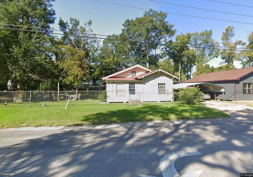
713 N Chestnut St Lufkin, TX 75901
Estimated Value: $76,665 - $178,000
--
Bed
5
Baths
1,148
Sq Ft
$106/Sq Ft
Est. Value
About This Home
This home is located at 713 N Chestnut St, Lufkin, TX 75901 and is currently estimated at $121,166, approximately $105 per square foot. 713 N Chestnut St is a home located in Angelina County with nearby schools including Herty Primary School, Coston Elementary School, and Lufkin Middle School.
Ownership History
Date
Name
Owned For
Owner Type
Purchase Details
Closed on
Jul 22, 2015
Sold by
Rodriguez David Lopez
Bought by
Santoyo Maria Del Rosario
Current Estimated Value
Home Financials for this Owner
Home Financials are based on the most recent Mortgage that was taken out on this home.
Original Mortgage
$14,000
Interest Rate
4.08%
Mortgage Type
Seller Take Back
Purchase Details
Closed on
Sep 5, 2005
Sold by
Castillo Raul and Castillo Maria
Bought by
David Lopez Efrain Madera and Lopez Maria Rosario
Create a Home Valuation Report for This Property
The Home Valuation Report is an in-depth analysis detailing your home's value as well as a comparison with similar homes in the area
Home Values in the Area
Average Home Value in this Area
Purchase History
| Date | Buyer | Sale Price | Title Company |
|---|---|---|---|
| Santoyo Maria Del Rosario | -- | None Available | |
| David Lopez Efrain Madera | -- | None Available |
Source: Public Records
Mortgage History
| Date | Status | Borrower | Loan Amount |
|---|---|---|---|
| Closed | Santoyo Maria Del Rosario | $14,000 |
Source: Public Records
Tax History Compared to Growth
Tax History
| Year | Tax Paid | Tax Assessment Tax Assessment Total Assessment is a certain percentage of the fair market value that is determined by local assessors to be the total taxable value of land and additions on the property. | Land | Improvement |
|---|---|---|---|---|
| 2025 | $1,252 | $62,110 | $5,480 | $56,630 |
| 2024 | $1,138 | $60,950 | $5,480 | $55,470 |
| 2023 | $984 | $60,210 | $5,480 | $54,730 |
| 2022 | $1,026 | $52,110 | $2,710 | $49,400 |
| 2021 | $1,008 | $41,510 | $2,710 | $38,800 |
| 2020 | $914 | $37,210 | $2,120 | $35,090 |
| 2019 | $968 | $37,240 | $2,120 | $35,120 |
| 2018 | $733 | $36,040 | $2,120 | $33,920 |
| 2017 | $733 | $30,740 | $2,120 | $28,620 |
| 2016 | $720 | $30,190 | $2,120 | $28,070 |
| 2015 | $626 | $30,190 | $2,120 | $28,070 |
| 2014 | $626 | $28,050 | $2,120 | $25,930 |
Source: Public Records
Map
Nearby Homes
- 521 N 1st St
- 505 N 1st St
- 301 Culverhouse St
- 1101 N 1st St
- 322 Montrose St
- TBD State Highway 103
- 420 Mantooth Ave
- 902 Cain St
- 333 Humason Ave
- Lt 5.2 & 6 Treadwell Ave
- 408 Bob St
- 801 Rowe Ave
- 417 Martin Luther King jr Blvd
- 329 Humason Ave
- 115 Ward St
- 1618 Paul Ave
- 318 Lake Alley
- 5700 Fm 2497
- 8250 Hwy 103w
- 10683 Hwy 103w
- 717 N Chestnut St
- 614 N 4th St
- 411 E Howe Ave
- 618 N 4th St
- 722 N Chestnut St
- 612 N 4th St
- 720 N Chestnut St
- 415 E Howe Ave
- 716 N Chestnut St
- 413 E Howe Ave
- 714 N Chestnut St
- 615 N 4th St
- 712 N Chestnut St
- 617 N 4th St
- 613 N 4th St
- 704 N Chestnut St
- 315 E Howe Ave
- 408 E Howe Ave
- 402 E Howe Ave
- 514 N 5th St