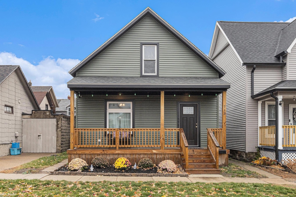
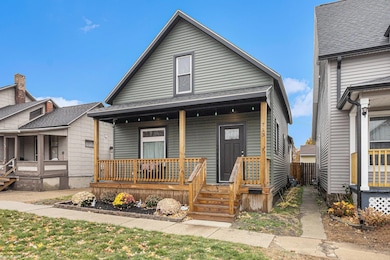
713 Rawlins St Port Huron, MI 48060
Estimated payment $1,041/month
About This Home
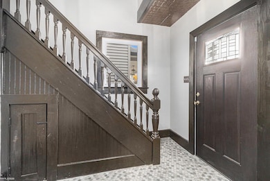
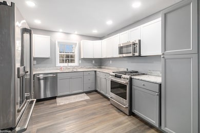
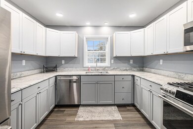
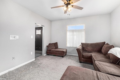
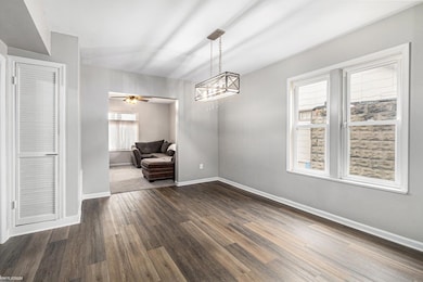
Updated 3bed/1 bath. Everything is done here and the appliances stay. Large room sizes, exceptional storage spaces PLUS historic charm. Traditional floor plan, with main bedroom on first floor. No basement to worry about. Fully fenced yard, quiet and walkable to Port Huron Hospital, Bluewater Bridge, downtown entertainment area, restaurants and waterfront. Partially furnished if you wish. Small mortgage can make way for a HUGE life. Be in your new home before the holidays!!!
Listing Agent
KW Platinum Port Huron License #MISPE-6506044608 Listed on: 11/11/2025

Home Details
Home Type
- Single Family
Est. Annual Taxes
Lot Details
- 2,178 Sq Ft Lot
- Lot Dimensions are 30x73
Home Design
- Bungalow
- Vinyl Siding
Interior Spaces
- 1,082 Sq Ft Home
- 2-Story Property
- Basement
- Crawl Space
Bedrooms and Bathrooms
- 3 Bedrooms
- 1 Full Bathroom
Utilities
- Forced Air Heating System
- Heating System Uses Natural Gas
Community Details
- Fort Gratiot Military Reservation Sub Subdivision
Listing and Financial Details
- Assessor Parcel Number 06-365-0203-000
Map
Home Values in the Area
Average Home Value in this Area
Tax History
| Year | Tax Paid | Tax Assessment Tax Assessment Total Assessment is a certain percentage of the fair market value that is determined by local assessors to be the total taxable value of land and additions on the property. | Land | Improvement |
|---|---|---|---|---|
| 2025 | $2,325 | $42,100 | $0 | $0 |
| 2024 | $2,048 | $39,800 | $0 | $0 |
| 2023 | $1,835 | $33,600 | $0 | $0 |
| 2022 | $1,835 | $29,300 | $0 | $0 |
| 2021 | $1,728 | $27,900 | $0 | $0 |
| 2020 | $1,238 | $27,900 | $27,900 | $0 |
| 2019 | $1,216 | $18,700 | $0 | $0 |
| 2018 | $1,189 | $18,700 | $0 | $0 |
| 2017 | $1,092 | $17,900 | $0 | $0 |
| 2016 | $964 | $17,900 | $0 | $0 |
| 2015 | $985 | $18,400 | $18,400 | $0 |
| 2014 | $985 | $18,700 | $18,700 | $0 |
| 2013 | -- | $18,000 | $0 | $0 |
Property History
| Date | Event | Price | List to Sale | Price per Sq Ft |
|---|---|---|---|---|
| 11/11/2025 11/11/25 | For Sale | $159,900 | -- | $148 / Sq Ft |
Purchase History
| Date | Type | Sale Price | Title Company |
|---|---|---|---|
| Quit Claim Deed | -- | Madison Settlement Services | |
| Quit Claim Deed | -- | Madison Settlement Services | |
| Warranty Deed | $30,000 | None Listed On Document | |
| Contract Of Sale | -- | None Listed On Document |
Source: Michigan Multiple Listing Service
MLS Number: 50194053
APN: 06-365-0203-000
Disclaimer: Certain information contained herein is derived from information provided by parties other than Homes.com. All information provided is deemed reliable, but is not guaranteed to be accurate and should be independently verified.
![]() Source MLS: MiRealSource
Source MLS: MiRealSource
Provided through IDX via MiRealSource. Courtesy of MiRealSource Shareholder. Copyright MiRealSource.
The information published and disseminated by MiRealSource is communicated verbatim, without change by MiRealSource, as filed with MiRealSource by its members. The accuracy of all information, regardless of source, is not guaranteed or warranted. All information should be independently verified.
Copyright 2025 MiRealSource. All rights reserved. The information provided hereby constitutes proprietary information of MiRealSource, Inc. and its shareholders, affiliates and licensees and may not be reproduced or transmitted in any form or by any means, electronic or mechanical, including photocopy, recording, scanning or any information storage and retrieval system, without written permission from MiRealSource, Inc.
- 1002 Erie St
- 917 Saint Clair St
- 822 Saint Clair St
- 805 Pine Grove Ave
- 915 10th Ave
- 201 Beers St Unit 32
- 201 Beers St Unit 53
- 201 Beers St Unit 44
- 201 Beers St Unit 34
- 1503 Elk St
- 1433 Poplar St
- 1013 Miller St
- 443 11th St
- 1704 Edison Shores Ln Unit 52
- 1011 Pearl St
- 1227 Young St
- 1203 Varney St
- 1123 Wells St
- 1534 12th Ave
- 624 12th St
- 607 11th St Unit 2
- 1422 Lyon St Unit C
- 1104 4th St
- 2210 Willow St
- 2423 Walnut St
- 1805 Military St
- 1104 Minnie St
- 1905 16th St Unit 1
- 2849 15th Ave
- 2312 12th St
- 2455 Military St Unit 5
- 2900 Golden Crest Ct
- 3900 Aspen Dr
- 2060 Parkdale Dr
- 3345 Military St
- 2851 Glenview Ct
- 3501 N River Rd
- 2960-2968 Beach Rd
- 4117 Gratiot Ave
- 2300 Krafft Rd