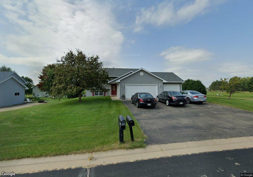
713 Robert Phillip Rd Roberts, WI 54023
Warren NeighborhoodEstimated Value: $345,000 - $403,000
Studio
--
Bath
--
Sq Ft
12,632
Sq Ft Lot
About This Home
This home is located at 713 Robert Phillip Rd, Roberts, WI 54023 and is currently estimated at $361,580. 713 Robert Phillip Rd is a home located in St. Croix County with nearby schools including Saint Croix Central Elementary School, Saint Croix Central Middle School, and St. Croix Central High School.
Ownership History
Date
Name
Owned For
Owner Type
Purchase Details
Closed on
Jul 20, 2006
Sold by
Gefeke Hansen Zachary J and Gefeke Hansen Beverly S
Bought by
Skoglund Matthew R and Skoglund Stephanie M
Current Estimated Value
Home Financials for this Owner
Home Financials are based on the most recent Mortgage that was taken out on this home.
Original Mortgage
$208,724
Outstanding Balance
$121,159
Interest Rate
6.73%
Mortgage Type
FHA
Estimated Equity
$240,421
Create a Home Valuation Report for This Property
The Home Valuation Report is an in-depth analysis detailing your home's value as well as a comparison with similar homes in the area
Home Values in the Area
Average Home Value in this Area
Purchase History
| Date | Buyer | Sale Price | Title Company |
|---|---|---|---|
| Skoglund Matthew R | $212,000 | None Available |
Source: Public Records
Mortgage History
| Date | Status | Borrower | Loan Amount |
|---|---|---|---|
| Open | Skoglund Matthew R | $208,724 |
Source: Public Records
Tax History
| Year | Tax Paid | Tax Assessment Tax Assessment Total Assessment is a certain percentage of the fair market value that is determined by local assessors to be the total taxable value of land and additions on the property. | Land | Improvement |
|---|---|---|---|---|
| 2025 | $4,985 | $314,400 | $62,900 | $251,500 |
| 2024 | $41 | $314,400 | $62,900 | $251,500 |
| 2023 | $4,169 | $186,600 | $31,500 | $155,100 |
| 2022 | $3,833 | $186,600 | $31,500 | $155,100 |
| 2021 | $3,851 | $186,600 | $31,500 | $155,100 |
| 2020 | $3,901 | $186,600 | $31,500 | $155,100 |
| 2019 | $3,797 | $186,600 | $31,500 | $155,100 |
| 2018 | $3,660 | $186,600 | $31,500 | $155,100 |
| 2017 | $3,224 | $186,600 | $31,500 | $155,100 |
| 2016 | $3,224 | $136,600 | $27,100 | $109,500 |
| 2015 | $3,203 | $136,600 | $27,100 | $109,500 |
| 2014 | $3,016 | $136,600 | $27,100 | $109,500 |
| 2013 | $2,841 | $136,600 | $27,100 | $109,500 |
Source: Public Records
Map
Nearby Homes
- xxx N Division St
- 405 N Cheyenne St
- 403 N Cheyenne St
- 1224 US Highway 12
- 256 Dakota Ave
- 249 (Lot 240) Dakota Ave
- 241 (Lot 241) Dakota Ave
- 306 N Division St
- 1108 Susan Ln
- 278 Eagle Ridge Dr
- 239 (Lot 254) Eagle Ridge Dr
- 262 (Lot 247) Eagle Ridge Dr
- 254 (Lot 246) Eagle Ridge Dr
- 246 (Lot 245) Eagle Ridge Dr
- 247 (Lot 253) Eagle Ridge Dr
- 239 Eagle Ridge Dr
- 222 (Lot 242) Eagle Ridge Dr
- 223 Eagle Ridge Dr
- 254 Eagle Ridge Dr
- 270 Eagle Ridge Dr
- 713 Robert Phillip Place
- 711 Robert Phillip Rd
- 712 Ryan Ronald Rd
- 710 Ryan Ronald Rd
- 710 Robert Phillip Place
- 710 Robert Phillip Rd
- 709 Robert Phillip Rd
- 709 Robert Phillip Place
- 708 Robert Phillip Rd
- 708 Ryan Ronald Rd
- 706 Robert Phillip Place
- 153 Jennifer Rae Jct N
- 707 Robert Phillip Rd
- 706 Robert Phillip Road Rd
- 706 Robert Phillip Rd
- 711 Sarah Anne Ave
- 713 Ryan Ronald Rd
- 706 Ryan Ronald Rd
- 711 Ryan Ronald Rd
- 709 Sarah Anne Ave
Your Personal Tour Guide
Ask me questions while you tour the home.