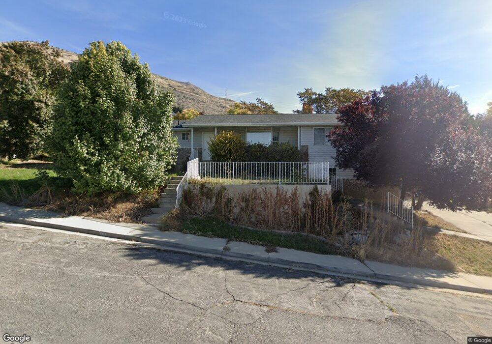
713 S 1680 E Pleasant Grove, UT 84062
Estimated Value: $621,000 - $673,882
5
Beds
4
Baths
3,256
Sq Ft
$198/Sq Ft
Est. Value
About This Home
This home is located at 713 S 1680 E, Pleasant Grove, UT 84062 and is currently estimated at $644,971, approximately $198 per square foot. 713 S 1680 E is a home located in Utah County with nearby schools including Valley View Elementary, Central Elementary School, and Oak Canyon Junior High School.
Ownership History
Date
Name
Owned For
Owner Type
Purchase Details
Closed on
Feb 4, 2013
Sold by
Miller Rick and Miller Tracy L
Bought by
American Homes 4 Rent Properties Three L
Current Estimated Value
Purchase Details
Closed on
Jan 10, 2005
Sold by
Miller Rick
Bought by
Miller Rick and Miller Tracy L
Home Financials for this Owner
Home Financials are based on the most recent Mortgage that was taken out on this home.
Original Mortgage
$87,000
Interest Rate
5.8%
Mortgage Type
New Conventional
Create a Home Valuation Report for This Property
The Home Valuation Report is an in-depth analysis detailing your home's value as well as a comparison with similar homes in the area
Home Values in the Area
Average Home Value in this Area
Purchase History
| Date | Buyer | Sale Price | Title Company |
|---|---|---|---|
| American Homes 4 Rent Properties Three L | -- | North American Title Llc | |
| Miller Rick | -- | Quality Title |
Source: Public Records
Mortgage History
| Date | Status | Borrower | Loan Amount |
|---|---|---|---|
| Previous Owner | Miller Rick | $87,000 |
Source: Public Records
Tax History Compared to Growth
Tax History
| Year | Tax Paid | Tax Assessment Tax Assessment Total Assessment is a certain percentage of the fair market value that is determined by local assessors to be the total taxable value of land and additions on the property. | Land | Improvement |
|---|---|---|---|---|
| 2025 | $2,674 | $355,520 | $243,500 | $402,900 |
| 2024 | $2,674 | $319,110 | $0 | $0 |
| 2023 | $2,605 | $318,230 | $0 | $0 |
| 2022 | $2,718 | $330,440 | $0 | $0 |
| 2021 | $2,404 | $444,900 | $152,900 | $292,000 |
| 2020 | $2,202 | $399,600 | $136,500 | $263,100 |
| 2019 | $2,005 | $376,200 | $120,400 | $255,800 |
| 2018 | $1,887 | $334,800 | $112,400 | $222,400 |
| 2017 | $1,757 | $165,935 | $0 | $0 |
| 2016 | $1,631 | $148,775 | $0 | $0 |
| 2015 | $1,642 | $141,845 | $0 | $0 |
| 2014 | $1,532 | $131,065 | $0 | $0 |
Source: Public Records
Map
Nearby Homes
- 650 S 1600 E
- 897 Cherokee Dr
- 1515 E 720 S
- 521 S 1660 E
- 745 S 1500 St E
- 935 S 1500 E
- 1172 E Murdock Dr
- 10 S 1400 E
- 778 S 1100 E
- 177 S 1150 E
- 286 S 1150 E
- Prelude Plan at Blossom Hill
- Treble Plan at Blossom Hill
- Browning Plan at Blossom Hill
- Cantata Plan at Blossom Hill
- 176 S 1150 E
- Accord Plan at Blossom Hill
- Canon Plan at Blossom Hill
- Trio Plan at Blossom Hill
- Harrison Plan at Blossom Hill
- 1704 Cherokee Dr
- 720 S 1680 E
- 1709 Cherokee Dr
- 1709 E Cherokee Dr
- 755 S 1680 E
- 700 S 1680 E
- 1715 Cherokee Dr
- 740 S 1680 E
- 1718 Cherokee Dr
- 1697 Cherokee Dr
- 1725 Cherokee Dr
- 1685 Cherokee Dr
- 671 S 1600 E
- 1670 Cherokee Dr
- 669 S 1600 E
- 1722 E Blackhawk Dr
- 1722 E Blackhawk Dr
- 1722 Blackhawk Dr
- 713 S 1600 E
- 1734 Blackhawk Dr