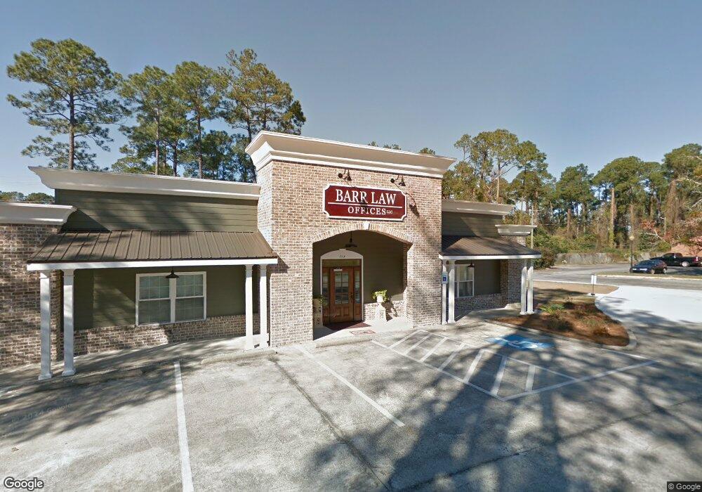
713 S Main St Statesboro, GA 30458
Estimated Value: $549,800
--
Bed
--
Bath
3,600
Sq Ft
$153/Sq Ft
Est. Value
About This Home
This home is located at 713 S Main St, Statesboro, GA 30458 and is currently estimated at $549,800, approximately $152 per square foot. 713 S Main St is a home located in Bulloch County with nearby schools including Langston Chapel Elementary School, Statesboro High School, and Langston Chapel Middle School.
Ownership History
Date
Name
Owned For
Owner Type
Purchase Details
Closed on
Nov 14, 2014
Sold by
Chip N Dale Llc
Bought by
Ellias Holdings Llc
Current Estimated Value
Purchase Details
Closed on
Sep 27, 2008
Sold by
Not Provided
Bought by
Dickens George C
Purchase Details
Closed on
Sep 18, 2006
Sold by
Not Provided
Bought by
Dickens George C
Purchase Details
Closed on
Nov 1, 2003
Bought by
Chip N Dale Llc
Purchase Details
Closed on
May 1, 2000
Bought by
Moore Richard D
Purchase Details
Closed on
Feb 1, 1973
Bought by
Olliff William L
Create a Home Valuation Report for This Property
The Home Valuation Report is an in-depth analysis detailing your home's value as well as a comparison with similar homes in the area
Home Values in the Area
Average Home Value in this Area
Purchase History
| Date | Buyer | Sale Price | Title Company |
|---|---|---|---|
| Ellias Holdings Llc | $225,000 | -- | |
| Dickens George C | -- | -- | |
| Dickens George C | $132,000 | -- | |
| Chip N Dale Llc | -- | -- | |
| Moore Richard D | -- | -- | |
| Olliff William L | -- | -- |
Source: Public Records
Tax History Compared to Growth
Tax History
| Year | Tax Paid | Tax Assessment Tax Assessment Total Assessment is a certain percentage of the fair market value that is determined by local assessors to be the total taxable value of land and additions on the property. | Land | Improvement |
|---|---|---|---|---|
| 2024 | $3,674 | $156,360 | $31,200 | $125,160 |
| 2023 | $3,838 | $127,339 | $40,560 | $86,779 |
| 2022 | $2,629 | $127,548 | $40,560 | $86,988 |
| 2021 | $2,704 | $127,548 | $40,560 | $86,988 |
| 2020 | $2,782 | $127,680 | $40,560 | $87,120 |
| 2019 | $2,798 | $144,881 | $40,560 | $104,321 |
| 2018 | $2,918 | $145,013 | $40,560 | $104,453 |
| 2017 | $2,953 | $145,276 | $40,560 | $104,716 |
| 2016 | $3,005 | $145,276 | $40,560 | $104,716 |
| 2015 | $1,979 | $106,447 | $40,560 | $65,887 |
| 2014 | $1,615 | $106,447 | $40,560 | $65,887 |
Source: Public Records
Map
Nearby Homes
- 215 Azalea Dr
- 510 S College St
- 723 1/2 S Main St
- 111 Griffith Ln
- 321 Farmington Rd
- 133 Landmark Cir Unit LOT 17
- 133 Landmark Cir
- 301 Keystone Dr Unit LOT 75
- 123 Landmark Cir Unit LOT 12
- 123 Landmark Cir
- 121 Landmark Cir
- 301 Keystone Dr
- 121 Landmark Cir Unit LOT 11
- 219 Bald Cypress Ct
- 905 Rye Grass Rd Unit LOT 79
- 416 Mayberry Way
- 220 Aunt Bee Blvd Unit 87
- 907 Rye Grass Rd Unit LOT 80
- 471 Sandbar Ln
- 407 Mayberry Way
- 713 S Main St Unit A
- 1 Azalia Dr
- 3 Azalea Dr
- 3 Azalea Dr Unit A
- 3 Azalea Dr Unit B
- 6 Azalea Dr
- 6 Azalea Dr
- 3 Azalia Dr Unit B
- 3 Azalia Dr
- 3 Azalia Dr Unit A
- 0 Azalea Dr Unit 7486564
- 0 Azalea Dr Unit 8711533
- 0 Azalea Dr Unit 8622767
- 0 Azalea Dr Unit 8609485
- 0 Azalea Dr Unit 7489900
- 0 Azalea Dr Unit 3251935
- 0 Azalea Dr Unit 7144211
- 0 Azalea Dr Unit 8314863
- 0 Azalea Dr Unit 8186925
- 0 Azalea Dr