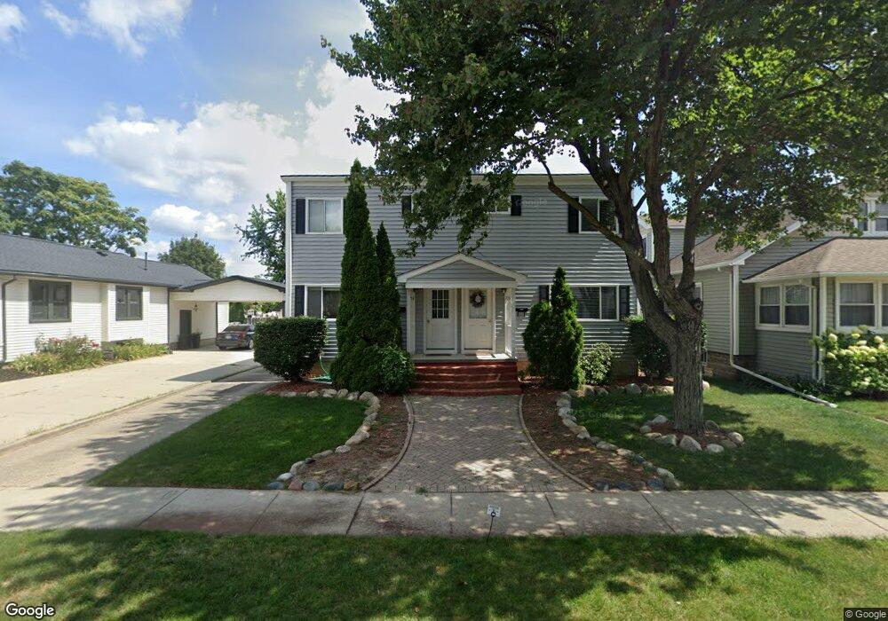
713 Virginia St Plymouth, MI 48170
Estimated Value: $422,000 - $641,307
5
Beds
3
Baths
2,160
Sq Ft
$244/Sq Ft
Est. Value
About This Home
This home is located at 713 Virginia St, Plymouth, MI 48170 and is currently estimated at $527,327, approximately $244 per square foot. 713 Virginia St is a home located in Wayne County with nearby schools including Canton High School, Smith Elementary School, and East Middle School.
Ownership History
Date
Name
Owned For
Owner Type
Purchase Details
Closed on
May 18, 2011
Sold by
Bloem James H and Bloem Diane
Bought by
Kluitenberg Mitchell L
Current Estimated Value
Purchase Details
Closed on
Dec 3, 2008
Sold by
Bloem Diane
Bought by
Bloem Diane and Bloem James H
Purchase Details
Closed on
May 15, 2008
Sold by
Hsbc Bank Usa Na
Bought by
Bloem Diane
Purchase Details
Closed on
Sep 19, 2007
Sold by
Cermak Kevin
Bought by
Wells Fargo Bank Na
Purchase Details
Closed on
Feb 3, 2005
Sold by
Cermak Robert A and Cermak Marianne
Bought by
Cermak Kevin
Purchase Details
Closed on
Oct 13, 1995
Sold by
Robert A and Robert Marianne Cerm
Bought by
Robert A and Robert Marianne Cermak
Create a Home Valuation Report for This Property
The Home Valuation Report is an in-depth analysis detailing your home's value as well as a comparison with similar homes in the area
Home Values in the Area
Average Home Value in this Area
Purchase History
| Date | Buyer | Sale Price | Title Company |
|---|---|---|---|
| Kluitenberg Mitchell L | -- | None Available | |
| Bloem Diane | -- | Attorneys Title Agency Llc | |
| Bloem Diane | $149,000 | Attorneys Title | |
| Hsbc Bank Usa Na | -- | Attorneys Title Agency Llc | |
| Wells Fargo Bank Na | $232,171 | None Available | |
| Cermak Kevin | -- | Metro Title Corp | |
| Robert A | $165,000 | -- |
Source: Public Records
Tax History Compared to Growth
Tax History
| Year | Tax Paid | Tax Assessment Tax Assessment Total Assessment is a certain percentage of the fair market value that is determined by local assessors to be the total taxable value of land and additions on the property. | Land | Improvement |
|---|---|---|---|---|
| 2025 | $10,083 | $290,900 | $0 | $0 |
| 2024 | $10,083 | $265,400 | $0 | $0 |
| 2023 | $9,750 | $258,800 | $0 | $0 |
| 2022 | $9,999 | $240,400 | $0 | $0 |
| 2021 | $9,686 | $236,100 | $0 | $0 |
| 2020 | $9,629 | $231,900 | $0 | $0 |
| 2019 | $8,764 | $206,800 | $0 | $0 |
| 2018 | $7,167 | $195,400 | $0 | $0 |
| 2017 | $1,230 | $188,700 | $0 | $0 |
| 2016 | $7,646 | $183,600 | $0 | $0 |
| 2015 | $14,487 | $165,370 | $0 | $0 |
| 2013 | $14,034 | $151,210 | $0 | $0 |
| 2011 | -- | $133,450 | $0 | $0 |
Source: Public Records
Map
Nearby Homes
- 256 Maple St
- 278 Maple St
- 221 Pinewood Cir Unit 25
- 381 Hamilton St
- 42071 Lindsay Dr
- 300 Hamilton St Unit 201
- 300 Hamilton St Unit 306
- 525 W Ann Arbor Trail
- 628 Maple St
- 644 Maple St
- 775 Deer Ct Unit 104
- 636 Maple St
- 543 Deer St
- 190 Hamilton St
- 660 Maple St
- 668 Maple St
- 163 Hamilton St
- 730 Penniman Ave Unit 205
- 302 N Sydney Ct
- 320 N Sydney Ct