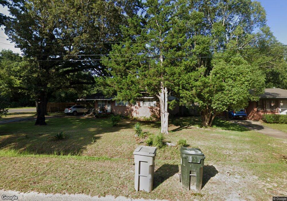
7130 Dale St Pensacola, FL 32503
Estimated Value: $148,000 - $177,000
--
Bed
2
Baths
1,050
Sq Ft
$157/Sq Ft
Est. Value
About This Home
This home is located at 7130 Dale St, Pensacola, FL 32503 and is currently estimated at $165,281, approximately $157 per square foot. 7130 Dale St is a home located in Escambia County with nearby schools including Ensley Elementary School, Ferry Pass Middle School, and Pine Forest High School.
Ownership History
Date
Name
Owned For
Owner Type
Purchase Details
Closed on
Aug 5, 2005
Sold by
Perkins John C and Perkins Victoria P
Bought by
Hartzell William
Current Estimated Value
Home Financials for this Owner
Home Financials are based on the most recent Mortgage that was taken out on this home.
Original Mortgage
$99,750
Outstanding Balance
$52,232
Interest Rate
5.61%
Mortgage Type
Fannie Mae Freddie Mac
Estimated Equity
$113,050
Purchase Details
Closed on
Aug 31, 2004
Sold by
Condon Adell M
Bought by
Perkins John C and Perkins Victoria P
Home Financials for this Owner
Home Financials are based on the most recent Mortgage that was taken out on this home.
Original Mortgage
$77,650
Interest Rate
5.91%
Mortgage Type
VA
Purchase Details
Closed on
Jul 8, 1999
Sold by
Clerk Circuit Court
Bought by
Werner Bobby
Create a Home Valuation Report for This Property
The Home Valuation Report is an in-depth analysis detailing your home's value as well as a comparison with similar homes in the area
Home Values in the Area
Average Home Value in this Area
Purchase History
| Date | Buyer | Sale Price | Title Company |
|---|---|---|---|
| Hartzell William | $105,000 | First American Title Ins Co | |
| Perkins John C | $73,000 | Title Offices Llc | |
| Werner Bobby | $600 | -- |
Source: Public Records
Mortgage History
| Date | Status | Borrower | Loan Amount |
|---|---|---|---|
| Open | Hartzell William | $99,750 | |
| Previous Owner | Perkins John C | $77,650 | |
| Previous Owner | Werner Bobby | $50,400 |
Source: Public Records
Tax History Compared to Growth
Tax History
| Year | Tax Paid | Tax Assessment Tax Assessment Total Assessment is a certain percentage of the fair market value that is determined by local assessors to be the total taxable value of land and additions on the property. | Land | Improvement |
|---|---|---|---|---|
| 2024 | $473 | $54,699 | -- | -- |
| 2023 | $473 | $53,106 | $0 | $0 |
| 2022 | $468 | $51,560 | $0 | $0 |
| 2021 | $472 | $50,059 | $0 | $0 |
| 2020 | $457 | $49,368 | $0 | $0 |
| 2019 | $445 | $48,259 | $0 | $0 |
| 2018 | $439 | $47,360 | $0 | $0 |
| 2017 | $432 | $46,386 | $0 | $0 |
| 2016 | $423 | $45,432 | $0 | $0 |
| 2015 | $398 | $45,117 | $0 | $0 |
| 2014 | $241 | $35,393 | $0 | $0 |
Source: Public Records
Map
Nearby Homes
- 7116 Dale St
- 7117 Dale St
- 6970 Rhoda St
- 6208 Brosnaham Ave
- 6206 Lucy St
- 112 Myrtlewood Dr
- 7000 Forshalee St
- 142 W Burgess Rd
- 112 Redbreast Ln
- 176 Creekview Dr
- 129 Redbreast Ln
- 6802 Tiki Ln
- 6122 Trent St
- 6235 Confederate Dr
- 6269 Confederate Dr
- 16 Whitehead Dr
- 6220 Appomattox Dr
- 110 Gettysburg Dr
- 6337 Parakeet Trail
- 416 Cornwall Cir