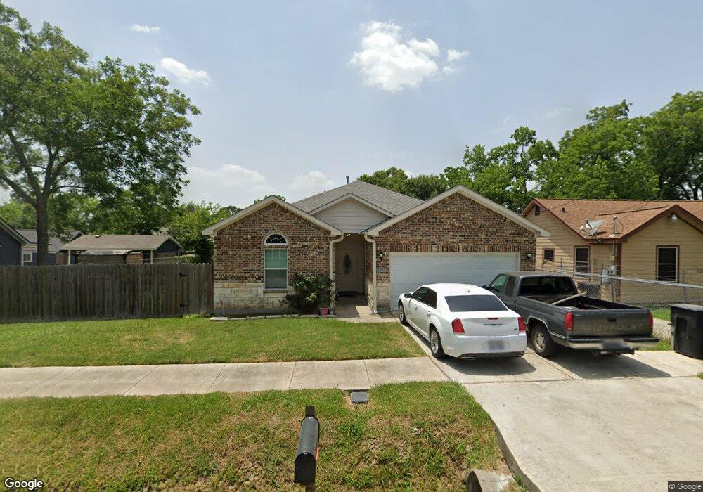
7132 Foster St Houston, TX 77021
OST-South Union NeighborhoodEstimated Value: $273,000 - $289,000
3
Beds
2
Baths
1,325
Sq Ft
$211/Sq Ft
Est. Value
About This Home
This home is located at 7132 Foster St, Houston, TX 77021 and is currently estimated at $279,121, approximately $210 per square foot. 7132 Foster St is a home located in Harris County with nearby schools including Marcellus Elliot Foster Elementary, Cullen Middle School, and Yates High School.
Ownership History
Date
Name
Owned For
Owner Type
Purchase Details
Closed on
Jan 18, 2022
Sold by
Beason Jr Cary H
Bought by
Beason Quintin A
Current Estimated Value
Purchase Details
Closed on
Jul 9, 2015
Sold by
Beason Aaron Leon and Beason Loretha Ann
Bought by
Beason Cary
Purchase Details
Closed on
Jun 26, 2015
Sold by
Beason Cary
Bought by
Beason Cary
Purchase Details
Closed on
Mar 4, 2013
Sold by
Beason Cary H
Bought by
Beason Cary H
Create a Home Valuation Report for This Property
The Home Valuation Report is an in-depth analysis detailing your home's value as well as a comparison with similar homes in the area
Home Values in the Area
Average Home Value in this Area
Purchase History
| Date | Buyer | Sale Price | Title Company |
|---|---|---|---|
| Beason Quintin A | -- | None Listed On Document | |
| Beason Cary | -- | None Available | |
| Beason Cary | -- | None Available | |
| Beason Cary H | -- | None Available |
Source: Public Records
Tax History Compared to Growth
Tax History
| Year | Tax Paid | Tax Assessment Tax Assessment Total Assessment is a certain percentage of the fair market value that is determined by local assessors to be the total taxable value of land and additions on the property. | Land | Improvement |
|---|---|---|---|---|
| 2025 | $6,717 | $318,869 | $128,750 | $190,119 |
| 2024 | $6,717 | $321,005 | $128,750 | $192,255 |
| 2023 | $6,553 | $325,227 | $115,875 | $209,352 |
| 2022 | $5,718 | $259,664 | $90,125 | $169,539 |
| 2021 | $5,393 | $231,411 | $57,938 | $173,473 |
| 2020 | $4,575 | $188,922 | $38,625 | $150,297 |
| 2019 | $4,658 | $184,067 | $32,188 | $151,879 |
| 2018 | $2,920 | $115,378 | $22,531 | $92,847 |
| 2017 | $2,465 | $97,504 | $16,094 | $81,410 |
| 2016 | $2,465 | $97,504 | $16,094 | $81,410 |
| 2015 | -- | $16,094 | $16,094 | $0 |
| 2014 | -- | $16,094 | $16,094 | $0 |
Source: Public Records
Map
Nearby Homes
- 7129 Foster St
- 7130 Eastwood St
- 7131 Eastwood St Unit A
- 7131 Eastwood St Unit C
- 7107 Foster St Unit A
- 7127 England St
- 7129 England St
- 7125 England St
- 7117 England St Unit C
- 7117 England St Unit A
- 7117 England St Unit B
- 7115 England St Unit A
- 7115 England St Unit B
- 7210 England St
- 7241 England St
- 7226 England St
- 4407 Alice St
- 6910 Cullen Blvd Unit 1
- 7301 Conley St
- 7117 Saint Augustine St
- 7128 Foster St
- 7136 Foster St
- 7131 Goforth St
- 7124 Foster St
- 7135 Goforth St
- 7129 Goforth St
- 7129 Foster St
- 7135 Foster St
- 7125 Goforth St
- 7118 Foster St
- 7123 Foster St
- 4338 Dreyfus St
- 4402 Dreyfus St
- 4330 Dreyfus St
- 7123 Goforth St
- 7117 Foster St
- 7128 Goforth St
- 7134 Eastwood St Unit C
- 7136 Goforth St
- 7124 Goforth St