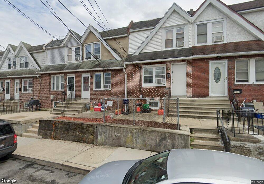
7132 Seaford Rd Upper Darby, PA 19082
Estimated Value: $123,216 - $142,000
2
Beds
1
Bath
996
Sq Ft
$131/Sq Ft
Est. Value
About This Home
This home is located at 7132 Seaford Rd, Upper Darby, PA 19082 and is currently estimated at $130,072, approximately $130 per square foot. 7132 Seaford Rd is a home located in Delaware County with nearby schools including Upper Darby High School, Vision Academy Charter School, and Lansdowne Friends School.
Ownership History
Date
Name
Owned For
Owner Type
Purchase Details
Closed on
Sep 11, 2023
Sold by
Sheriff Of Delaware County
Bought by
Jsp Real Estate Llc
Current Estimated Value
Purchase Details
Closed on
Apr 28, 2003
Sold by
Maugeri Thomas M
Bought by
Yarbray Sheree A
Home Financials for this Owner
Home Financials are based on the most recent Mortgage that was taken out on this home.
Original Mortgage
$45,590
Interest Rate
5.82%
Mortgage Type
Purchase Money Mortgage
Purchase Details
Closed on
Feb 28, 1994
Sold by
Petherbridge Jeffrey S and Petherbridge Patricia A
Bought by
Maugeri Thomas M
Home Financials for this Owner
Home Financials are based on the most recent Mortgage that was taken out on this home.
Original Mortgage
$50,315
Interest Rate
7.01%
Mortgage Type
FHA
Create a Home Valuation Report for This Property
The Home Valuation Report is an in-depth analysis detailing your home's value as well as a comparison with similar homes in the area
Home Values in the Area
Average Home Value in this Area
Purchase History
| Date | Buyer | Sale Price | Title Company |
|---|---|---|---|
| Jsp Real Estate Llc | $78,000 | None Listed On Document | |
| Yarbray Sheree A | $47,000 | T A Title Insurance Company | |
| Maugeri Thomas M | $50,000 | T A Title Insurance Company |
Source: Public Records
Mortgage History
| Date | Status | Borrower | Loan Amount |
|---|---|---|---|
| Previous Owner | Yarbray Sheree A | $45,590 | |
| Previous Owner | Maugeri Thomas M | $50,315 |
Source: Public Records
Tax History Compared to Growth
Tax History
| Year | Tax Paid | Tax Assessment Tax Assessment Total Assessment is a certain percentage of the fair market value that is determined by local assessors to be the total taxable value of land and additions on the property. | Land | Improvement |
|---|---|---|---|---|
| 2025 | $2,691 | $63,640 | $13,460 | $50,180 |
| 2024 | $2,691 | $63,640 | $13,460 | $50,180 |
| 2023 | $2,666 | $63,640 | $13,460 | $50,180 |
| 2022 | $2,594 | $63,640 | $13,460 | $50,180 |
| 2021 | $3,498 | $63,640 | $13,460 | $50,180 |
| 2020 | $2,706 | $41,830 | $12,240 | $29,590 |
| 2019 | $2,658 | $41,830 | $12,240 | $29,590 |
| 2018 | $2,628 | $41,830 | $0 | $0 |
| 2017 | $2,559 | $41,830 | $0 | $0 |
| 2016 | $230 | $41,830 | $0 | $0 |
| 2015 | $230 | $41,830 | $0 | $0 |
| 2014 | $230 | $41,830 | $0 | $0 |
Source: Public Records
Map
Nearby Homes
- 7129 Seaford Rd
- 7123 Seaford Rd
- 7026 Atlantic Ave
- 726 Copley Rd
- 7162 Radbourne Rd
- 7000 Greenwood Ave
- 7046 Radbourne Rd
- 7155 Radbourne Rd
- 7042 Clinton Rd
- 6858 Clover Ln
- 669 Long Ln
- 7216 Clinton Rd
- 6997 Guilford Rd
- 7229 Clinton Rd
- 607 Littlecroft Rd
- 608 Pembroke Ave
- 558 Snowden Rd
- 540 Snowden Rd
- 703 Briarcliff Rd
- 7154 Ruskin Ln
- 7130 Seaford Rd
- 7134 Seaford Rd
- 7128 Seaford Rd
- 7136 Seaford Rd
- 7126 Seaford Rd
- 7131 Emerson Ave
- 7138 Seaford Rd
- 7129 Emerson Ave
- 7127 Emerson Ave
- 7122 Seaford Rd
- 7125 Emerson Ave
- 7124 Seaford Ave
- 7123 Emerson Ave
- 7120 Seaford Rd
- 7121 Emerson Ave
- 7118 Seaford Rd
- 7133 Seaford Rd
- 7131 Seaford Rd
- 7135 Seaford Rd
- 7127 Seaford Rd