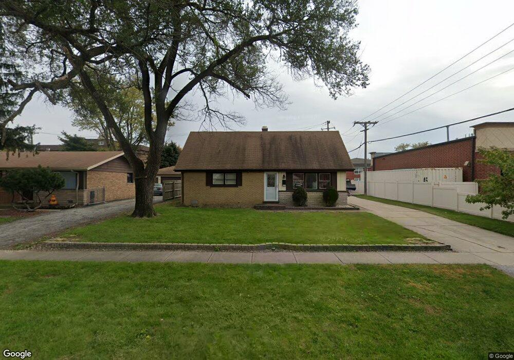
7133 Stanford Dr Bridgeview, IL 60455
Little Palestine NeighborhoodEstimated Value: $280,146 - $300,000
3
Beds
1
Bath
1,425
Sq Ft
$204/Sq Ft
Est. Value
About This Home
This home is located at 7133 Stanford Dr, Bridgeview, IL 60455 and is currently estimated at $290,537, approximately $203 per square foot. 7133 Stanford Dr is a home located in Cook County with nearby schools including George W Lieb Elementary School, Simmons Middle School, and Oak Lawn Community High School.
Ownership History
Date
Name
Owned For
Owner Type
Purchase Details
Closed on
Jan 22, 2014
Sold by
Straka Jacqueline
Bought by
Straka John J and Straka John L
Current Estimated Value
Purchase Details
Closed on
May 2, 2003
Sold by
Thompson Harvey E and Thompson Bonnie K
Bought by
Straka John L and Straka Jacqueline
Home Financials for this Owner
Home Financials are based on the most recent Mortgage that was taken out on this home.
Original Mortgage
$152,800
Interest Rate
5.51%
Mortgage Type
FHA
Create a Home Valuation Report for This Property
The Home Valuation Report is an in-depth analysis detailing your home's value as well as a comparison with similar homes in the area
Home Values in the Area
Average Home Value in this Area
Purchase History
| Date | Buyer | Sale Price | Title Company |
|---|---|---|---|
| Straka John J | -- | None Available | |
| Straka John L | $155,000 | Atgf Inc |
Source: Public Records
Mortgage History
| Date | Status | Borrower | Loan Amount |
|---|---|---|---|
| Previous Owner | Straka John L | $152,800 |
Source: Public Records
Tax History Compared to Growth
Tax History
| Year | Tax Paid | Tax Assessment Tax Assessment Total Assessment is a certain percentage of the fair market value that is determined by local assessors to be the total taxable value of land and additions on the property. | Land | Improvement |
|---|---|---|---|---|
| 2024 | $6,646 | $23,000 | $4,468 | $18,532 |
| 2023 | $5,220 | $23,000 | $4,468 | $18,532 |
| 2022 | $5,220 | $16,503 | $3,885 | $12,618 |
| 2021 | $5,110 | $16,503 | $3,885 | $12,618 |
| 2020 | $5,094 | $16,503 | $3,885 | $12,618 |
| 2019 | $5,091 | $16,772 | $3,496 | $13,276 |
| 2018 | $4,861 | $16,772 | $3,496 | $13,276 |
| 2017 | $4,849 | $16,772 | $3,496 | $13,276 |
| 2016 | $4,456 | $14,094 | $2,913 | $11,181 |
| 2015 | $4,205 | $14,094 | $2,913 | $11,181 |
| 2014 | $4,108 | $14,094 | $2,913 | $11,181 |
| 2013 | $4,491 | $16,628 | $2,913 | $13,715 |
Source: Public Records
Map
Nearby Homes
- 9201 Willow Ln
- 9348 Sayre Ave
- 9128 Homestead Ln
- 9128 Pembroke Ln
- 9236 Stanford Dr
- 6906 W 91st St
- 9149 Beloit Ave
- 8937 Fairlane Dr
- 6821 Saratoga Dr
- 6705 W 91st Place
- 8912 Windsor Ln
- 9721 S Harlem Ave Unit 2C
- 9708 Nottingham Ave Unit 11
- 6937 97th St
- 6913 97th St
- 8907 Saratoga Dr
- 6632 W 95th St Unit 2C
- 6634 W 95th St Unit 1D
- 7000 Mather Ave Unit 303
- 7000 Mather Ave Unit 101
- 7125 Stanford Dr
- 7119 Stanford Dr
- 7113 Stanford Dr
- 7132 Stanford Dr
- 7124 Stanford Dr
- 7118 Stanford Dr
- 9301 S Harlem Ave Unit 11B
- 9301 S Harlem Ave Unit 9B
- 9301 S Harlem Ave Unit 13B
- 9301 S Harlem Ave Unit 7A
- 9301 S Harlem Ave Unit 3B
- 9301 S Harlem Ave Unit 12B
- 9301 S Harlem Ave Unit 7B
- 9301 S Harlem Ave Unit 2B
- 9301 S Harlem Ave Unit 11A
- 9301 S Harlem Ave Unit 5A
- 9301 S Harlem Ave Unit 5A
- 9301 S Harlem Ave Unit 13B
- 9301 S Harlem Ave Unit 5B
- 9301 S Harlem Ave Unit 14A