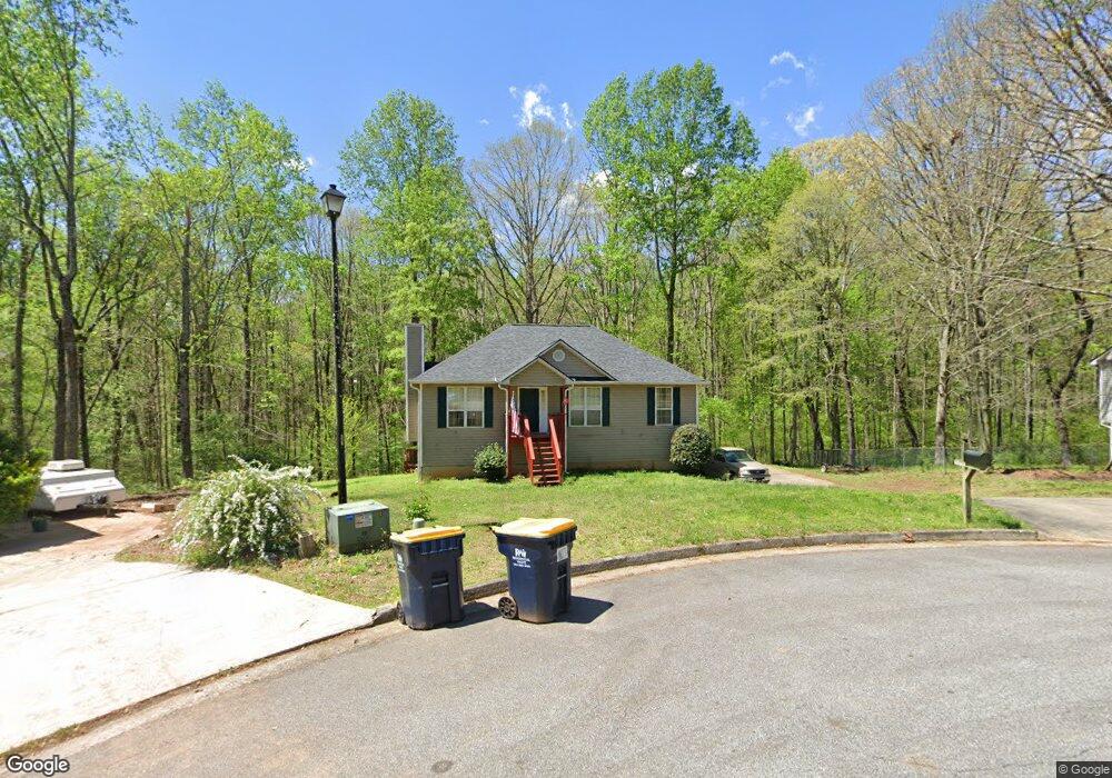
7135 Bristol Trail Cumming, GA 30028
Estimated Value: $345,376 - $364,000
3
Beds
2
Baths
1,204
Sq Ft
$295/Sq Ft
Est. Value
About This Home
This home is located at 7135 Bristol Trail, Cumming, GA 30028 and is currently estimated at $355,344, approximately $295 per square foot. 7135 Bristol Trail is a home located in Forsyth County with nearby schools including Silver City Elementary School, North Forsyth Middle School, and North Forsyth High School.
Ownership History
Date
Name
Owned For
Owner Type
Purchase Details
Closed on
Feb 21, 2003
Sold by
Church George M and Church Kerri L
Bought by
Bailey Robert S and Bailey Sandra
Current Estimated Value
Home Financials for this Owner
Home Financials are based on the most recent Mortgage that was taken out on this home.
Original Mortgage
$119,365
Outstanding Balance
$51,121
Interest Rate
5.95%
Mortgage Type
New Conventional
Estimated Equity
$304,223
Purchase Details
Closed on
Apr 26, 1996
Sold by
Keith Built Homes Inc
Bought by
Church Geo Kerri
Purchase Details
Closed on
Feb 12, 1996
Sold by
Phil A Smithdev Co
Bought by
Keith Builthomes Inc
Create a Home Valuation Report for This Property
The Home Valuation Report is an in-depth analysis detailing your home's value as well as a comparison with similar homes in the area
Home Values in the Area
Average Home Value in this Area
Purchase History
| Date | Buyer | Sale Price | Title Company |
|---|---|---|---|
| Bailey Robert S | $129,900 | -- | |
| Church Geo Kerri | $98,900 | -- | |
| Keith Builthomes Inc | $19,500 | -- |
Source: Public Records
Mortgage History
| Date | Status | Borrower | Loan Amount |
|---|---|---|---|
| Open | Bailey Robert S | $119,365 | |
| Closed | Keith Builthomes Inc | $0 |
Source: Public Records
Tax History Compared to Growth
Tax History
| Year | Tax Paid | Tax Assessment Tax Assessment Total Assessment is a certain percentage of the fair market value that is determined by local assessors to be the total taxable value of land and additions on the property. | Land | Improvement |
|---|---|---|---|---|
| 2025 | $2,371 | $125,696 | $36,000 | $89,696 |
| 2024 | $2,371 | $120,288 | $34,000 | $86,288 |
| 2023 | $2,045 | $122,512 | $26,000 | $96,512 |
| 2022 | $2,207 | $75,740 | $16,000 | $59,740 |
| 2021 | $1,844 | $75,740 | $16,000 | $59,740 |
| 2020 | $1,737 | $70,568 | $16,000 | $54,568 |
| 2019 | $1,666 | $66,992 | $16,000 | $50,992 |
| 2018 | $1,528 | $60,096 | $16,000 | $44,096 |
| 2017 | $1,491 | $58,036 | $16,000 | $42,036 |
| 2016 | $1,132 | $155,464 | $40,000 | $115,464 |
| 2015 | $1,358 | $52,076 | $12,000 | $40,076 |
| 2014 | $1,204 | $48,784 | $0 | $0 |
Source: Public Records
Map
Nearby Homes
- 7155 Bannister Park Ln
- 6330 Talking Tree Ct
- 7040 Devon Dr
- 7030 Devon Dr
- 7010 Devon Dr
- 7030 Wessex Way
- 6535 Riley Rd
- 6545 Riley Rd
- 0 Bannister Unit 27.55 ACRES 10274598
- 7040 Wessex Way
- 0 Concord Rd Unit 10483290
- 6660 Wallace Farms Dr
- 6245 Bannister Rd
- 6380 Concord Rd
- 6525 Wallace Pond Way
- 6810 Wallace Creek Ct
- 6910 Concord Brook Ln
- 7170 Pond View Dr
- Wieuca Plan at Southbrooke
- Antioch Plan at Southbrooke
- 7125 Bristol Trail
- 7145 Bristol Trail
- 7120 Bristol Trail
- 7140 Bristol Trail
- 7130 Bristol Trail
- 6440 Manor Estates Dr
- 6430 Manor Estates Dr
- 7115 Bristol Trail
- 6420 Manor Estates Dr
- 7105 Royston Way
- 7190 Bannister Park Ln
- 6410 Manor Estates Dr
- 7045 Bristol Trail
- 6450 Manor Estates Dr
- 7115 Royston Way
- 7185 Bannister Park Ln
- 6360 Manor Estates Dr
- 7180 Bannister Park Ln
- 7125 Royston Way
- 7035 Bristol Trail
