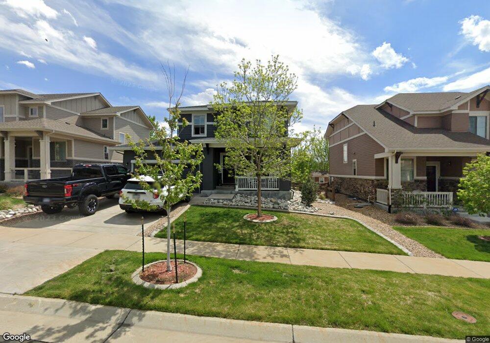
7135 S Robertsdale Way Aurora, CO 80016
Southeast Aurora NeighborhoodEstimated Value: $631,000 - $683,000
3
Beds
3
Baths
2,269
Sq Ft
$289/Sq Ft
Est. Value
About This Home
This home is located at 7135 S Robertsdale Way, Aurora, CO 80016 and is currently estimated at $654,846, approximately $288 per square foot. 7135 S Robertsdale Way is a home located in Arapahoe County with nearby schools including Altitude Elementary School, Fox Ridge Middle School, and Cherokee Trail High School.
Ownership History
Date
Name
Owned For
Owner Type
Purchase Details
Closed on
Dec 30, 2021
Sold by
Olympus Borrower Llc
Bought by
Olympus Borrower 1 Llc
Current Estimated Value
Purchase Details
Closed on
Apr 17, 2015
Sold by
William Lyon Homes Inc
Bought by
Highland Lance J
Home Financials for this Owner
Home Financials are based on the most recent Mortgage that was taken out on this home.
Original Mortgage
$399,727
Interest Rate
3.82%
Mortgage Type
VA
Create a Home Valuation Report for This Property
The Home Valuation Report is an in-depth analysis detailing your home's value as well as a comparison with similar homes in the area
Home Values in the Area
Average Home Value in this Area
Purchase History
| Date | Buyer | Sale Price | Title Company |
|---|---|---|---|
| Olympus Borrower 1 Llc | -- | New Title Company Name | |
| Highland Lance J | $399,727 | Land Title Guarantee Company |
Source: Public Records
Mortgage History
| Date | Status | Borrower | Loan Amount |
|---|---|---|---|
| Previous Owner | Highland Lance J | $399,727 |
Source: Public Records
Tax History Compared to Growth
Tax History
| Year | Tax Paid | Tax Assessment Tax Assessment Total Assessment is a certain percentage of the fair market value that is determined by local assessors to be the total taxable value of land and additions on the property. | Land | Improvement |
|---|---|---|---|---|
| 2024 | $5,644 | $40,656 | -- | -- |
| 2023 | $5,644 | $40,803 | $0 | $0 |
| 2022 | $4,351 | $32,950 | $0 | $0 |
| 2021 | $4,063 | $32,950 | $0 | $0 |
| 2020 | $4,203 | $32,404 | $0 | $0 |
| 2019 | $4,121 | $32,404 | $0 | $0 |
| 2018 | $3,989 | $30,384 | $0 | $0 |
| 2017 | $3,957 | $30,384 | $0 | $0 |
| 2016 | $3,857 | $29,770 | $0 | $0 |
| 2015 | $2,964 | $23,562 | $0 | $0 |
| 2014 | $612 | $4,524 | $0 | $0 |
| 2013 | -- | $4,700 | $0 | $0 |
Source: Public Records
Map
Nearby Homes
- 26881 E Roxbury Place
- 7163 S Shady Grove Ct
- 26903 E Easter Place
- 7285 S Titus Way
- 7359 S Queensburg St
- 26731 E Hinsdale Place
- 7145 S Uriah St
- 6946 S Titus St
- 26994 E Indore Ave
- 6915 S Titus St
- 26554 E Indore Ave
- 6980 S Uriah St
- 26889 E Irish Place
- 7253 S Valleyhead Ct
- 6758 S Riverwood Way
- 25960 E Davies Dr
- 26043 E Geddes Cir
- 27746 E Frost Place
- 27705 E Davies Dr
- 7133 S Waterloo Way
- 7125 S Robertsdale Way
- 7145 S Robertsdale Way
- 7155 S Robertsdale Way
- 7150 S Robertsdale Way
- 7140 S Robertsdale Way
- 7165 S Robertsdale Way
- 7160 S Robertsdale Way
- 7130 S Robertsdale Way
- 7170 S Robertsdale Way
- 7120 S Robertsdale Way
- 7175 S Robertsdale Way
- 26890 E Roxbury Place
- 7180 S Robertsdale Way
- 26900 E Roxbury Place
- 26880 E Roxbury Place
- 7110 S Robertsdale Way
- 26860 E Roxbury Place
- 7203 S Scottsburg Way
- 26910 E Roxbury Place
- 7185 S Robertsdale Way