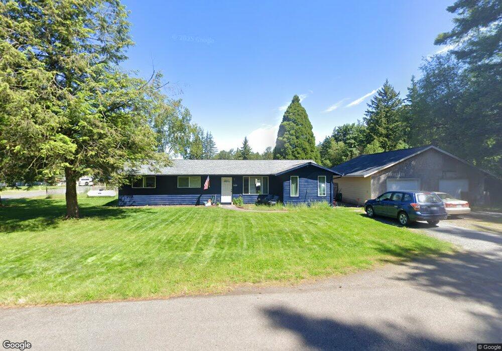
7136 Sutton Dr Everson, WA 98247
Estimated Value: $433,625 - $517,000
3
Beds
1
Bath
1,392
Sq Ft
$333/Sq Ft
Est. Value
About This Home
This home is located at 7136 Sutton Dr, Everson, WA 98247 and is currently estimated at $463,406, approximately $332 per square foot. 7136 Sutton Dr is a home located in Whatcom County with nearby schools including Everson Elementary School, Nooksack Elementary School, and Sumas Elementary School.
Ownership History
Date
Name
Owned For
Owner Type
Purchase Details
Closed on
Aug 31, 2022
Sold by
Bliss Joel S and Bliss Valerie S
Bought by
Lyng Joshua David and Lyng Allison Marie
Current Estimated Value
Home Financials for this Owner
Home Financials are based on the most recent Mortgage that was taken out on this home.
Original Mortgage
$311,200
Outstanding Balance
$295,554
Interest Rate
5.22%
Mortgage Type
New Conventional
Estimated Equity
$167,852
Create a Home Valuation Report for This Property
The Home Valuation Report is an in-depth analysis detailing your home's value as well as a comparison with similar homes in the area
Purchase History
| Date | Buyer | Sale Price | Title Company |
|---|---|---|---|
| Lyng Joshua David | -- | -- |
Source: Public Records
Mortgage History
| Date | Status | Borrower | Loan Amount |
|---|---|---|---|
| Open | Lyng Joshua David | $311,200 |
Source: Public Records
Tax History
| Year | Tax Paid | Tax Assessment Tax Assessment Total Assessment is a certain percentage of the fair market value that is determined by local assessors to be the total taxable value of land and additions on the property. | Land | Improvement |
|---|---|---|---|---|
| 2025 | $3,836 | $437,088 | $207,900 | $229,188 |
| 2024 | $3,233 | $412,598 | $189,000 | $223,598 |
| 2023 | $3,233 | $364,140 | $146,353 | $217,787 |
| 2022 | $2,999 | $328,060 | $131,852 | $196,208 |
| 2021 | $2,762 | $271,128 | $108,970 | $162,158 |
| 2020 | $2,664 | $220,434 | $88,596 | $131,838 |
| 2019 | $2,261 | $220,434 | $88,596 | $131,838 |
| 2018 | $2,166 | $211,488 | $85,000 | $126,488 |
| 2017 | $1,929 | $151,757 | $58,000 | $93,757 |
| 2016 | $1,848 | $140,032 | $53,500 | $86,532 |
| 2015 | $1,578 | $134,440 | $51,600 | $82,840 |
| 2014 | -- | $130,271 | $50,000 | $80,271 |
| 2013 | -- | $130,271 | $50,000 | $80,271 |
Source: Public Records
Map
Nearby Homes
- 1822 E Pole Rd
- 1302 Night Hawk Way
- 1203 Red Tail Ct
- 1005 Night Hawk Way
- 809 Pine Crest Dr
- 800 Cedar Dr
- 616 Strandell St
- 2495 River Rock Dr
- 1817 Central Rd
- 0 Walnut Grove Ct
- 107 River St
- 408 W 3rd St
- 416 W 3rd St
- 108 Baker St Unit 1-4
- 409 W 4th St
- 207 E Main St
- 702 N Washington St
- 3037 Massey Rd
- 1375 Ten Mile Rd
- 1383 Ten Mile Rd
- 7142 Sutton Dr
- 1981 Sutton Dr
- 7146 Sutton Dr
- 1975 Sutton Dr
- 1964 Sutton Dr
- 1969 Sutton Dr
- 7143 Sutton Dr
- 7154 Sutton Dr
- 7149 Sutton Dr
- 1963 Sutton Dr
- 7155 Sutton Dr
- 7160 Sutton Dr
- 1958 Sutton Dr
- 7142 Mecklem Rd
- 1957 Sutton Dr
- 7148 Mecklem Rd
- 7161 Sutton Dr
- 7122 Mecklem Rd
- 7166 Sutton Dr
- 7154 Mecklem Rd
Your Personal Tour Guide
Ask me questions while you tour the home.