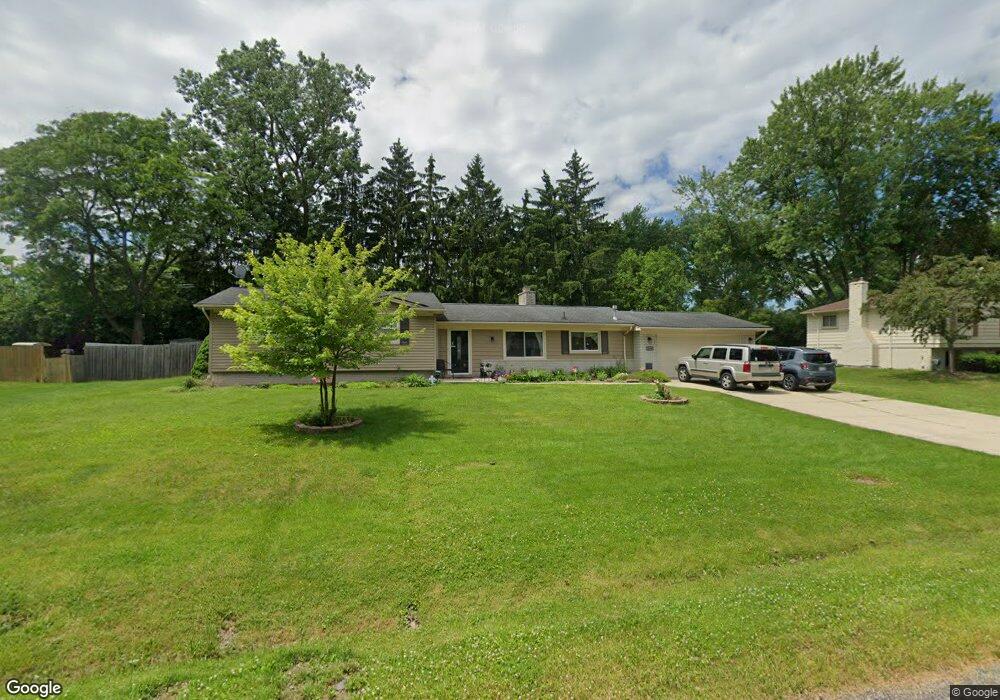
7138 Stonebrook Rd West Bloomfield, MI 48322
Estimated Value: $340,414 - $432,000
3
Beds
2
Baths
1,615
Sq Ft
$236/Sq Ft
Est. Value
About This Home
This home is located at 7138 Stonebrook Rd, West Bloomfield, MI 48322 and is currently estimated at $381,354, approximately $236 per square foot. 7138 Stonebrook Rd is a home located in Oakland County with nearby schools including Wood Creek Elementary School, Warner Upper Elementary School, and Bloomfield Maples Montessori.
Ownership History
Date
Name
Owned For
Owner Type
Purchase Details
Closed on
Apr 12, 2004
Sold by
Yono Sam and Yono Christina
Bought by
Awdish Richard M
Current Estimated Value
Purchase Details
Closed on
Aug 7, 2003
Sold by
Shimoun Salwan and Shimoun Eva
Bought by
Yono Sam
Purchase Details
Closed on
Jun 14, 1996
Sold by
Weinberg Mitzi
Bought by
Shimoun Salwan
Home Financials for this Owner
Home Financials are based on the most recent Mortgage that was taken out on this home.
Original Mortgage
$130,000
Interest Rate
8.29%
Create a Home Valuation Report for This Property
The Home Valuation Report is an in-depth analysis detailing your home's value as well as a comparison with similar homes in the area
Home Values in the Area
Average Home Value in this Area
Purchase History
| Date | Buyer | Sale Price | Title Company |
|---|---|---|---|
| Awdish Richard M | $228,000 | Metropolitan Title Company | |
| Yono Sam | $225,000 | -- | |
| Shimoun Salwan | $153,000 | -- |
Source: Public Records
Mortgage History
| Date | Status | Borrower | Loan Amount |
|---|---|---|---|
| Previous Owner | Shimoun Salwan | $130,000 |
Source: Public Records
Tax History Compared to Growth
Tax History
| Year | Tax Paid | Tax Assessment Tax Assessment Total Assessment is a certain percentage of the fair market value that is determined by local assessors to be the total taxable value of land and additions on the property. | Land | Improvement |
|---|---|---|---|---|
| 2024 | $1,580 | $155,930 | $0 | $0 |
| 2022 | $1,522 | $151,180 | $47,500 | $103,680 |
| 2021 | $2,786 | $130,560 | $0 | $0 |
| 2020 | $1,456 | $123,230 | $39,310 | $83,920 |
| 2018 | $2,783 | $113,550 | $27,300 | $86,250 |
| 2015 | -- | $77,400 | $0 | $0 |
| 2014 | -- | $72,270 | $0 | $0 |
| 2011 | -- | $62,490 | $0 | $0 |
Source: Public Records
Map
Nearby Homes
- 5312 Cambourne Place
- 7209 Stonebrook Rd
- 7477 Gramercy Cir Unit 17
- 7479 Gramercy Cir Unit 16
- 7251 N Briarcliff Knoll Dr
- 7507 Gramercy Cir
- 7250 Ten Hill
- 7496 Cornwall Ct
- 29020 Ramblewood Dr
- 6545 Post Oak Dr
- 6564 Alderley Way
- 28786 Rockledge Dr
- 7023 Wild Ridge Ln
- 7335 Coach Ln
- 30070 Lochmoor St
- 32411 Tareyton St
- 32615 Briarcrest Knoll
- 30515 W 14 Mile Rd Unit 30
- 30515 W 14 Mile Rd Unit 37
- 30475 W 14 Mile Rd Unit 80
- 7164 Stonebrook Rd
- 7112 Stonebrook Rd
- 7137 Stonebrook Rd
- 7163 Stonebrook Rd
- 7111 Stonebrook Rd
- 7188 Stonebrook Rd
- 7094 Stonebrook Rd
- 7187 Stonebrook Rd
- 5304 W Briarcliff Knoll Dr
- 5318 Cambourne Place
- 7150 Riverstone Rd
- 7093 Stonebrook Rd
- 7122 Riverstone Rd
- 5324 Cambourne Place
- 7212 Stonebrook Rd
- 7066 Stonebrook Rd
- 7178 Riverstone Rd
- 7096 Riverstone Rd
- 5303 W Briarcliff Knoll Dr Unit Bldg-Unit
- 5303 W Briarcliff Knoll Dr