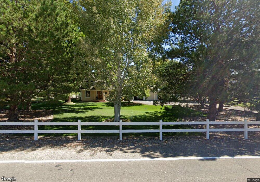
714 36 1/10 Rd Palisade, CO 81526
Palisade Area NeighborhoodEstimated Value: $704,169 - $1,049,000
3
Beds
3
Baths
2,619
Sq Ft
$328/Sq Ft
Est. Value
About This Home
This home is located at 714 36 1/10 Rd, Palisade, CO 81526 and is currently estimated at $859,042, approximately $328 per square foot. 714 36 1/10 Rd is a home located in Mesa County with nearby schools including Taylor Elementary School, Mount Garfield Middle School, and Palisade High School.
Ownership History
Date
Name
Owned For
Owner Type
Purchase Details
Closed on
Apr 30, 2004
Sold by
Anderson David W and Anderson Sandra L
Bought by
Peterson David M and Peterson Debra N
Current Estimated Value
Home Financials for this Owner
Home Financials are based on the most recent Mortgage that was taken out on this home.
Original Mortgage
$310,000
Outstanding Balance
$144,118
Interest Rate
5.38%
Mortgage Type
Credit Line Revolving
Estimated Equity
$714,924
Purchase Details
Closed on
Feb 9, 2001
Sold by
Thompson H Robert Thompson Frances M
Bought by
Anderson David W and Anderson Sandra L
Home Financials for this Owner
Home Financials are based on the most recent Mortgage that was taken out on this home.
Original Mortgage
$220,000
Interest Rate
7.04%
Purchase Details
Closed on
Sep 15, 1997
Sold by
Joan Warren G Bodie
Bought by
Thompson H Robert and Thompson Frances M
Purchase Details
Closed on
Jul 7, 1997
Sold by
Joan Warren G Bodie
Bought by
Bodie Warren G and Bodie Joan
Create a Home Valuation Report for This Property
The Home Valuation Report is an in-depth analysis detailing your home's value as well as a comparison with similar homes in the area
Home Values in the Area
Average Home Value in this Area
Purchase History
| Date | Buyer | Sale Price | Title Company |
|---|---|---|---|
| Peterson David M | $358,500 | Meridian Land Title Llc | |
| Anderson David W | $275,000 | First American Heritage Titl | |
| Thompson H Robert | $239,000 | First American Title | |
| Bodie Warren G | -- | -- | |
| Francis Mark J | -- | -- |
Source: Public Records
Mortgage History
| Date | Status | Borrower | Loan Amount |
|---|---|---|---|
| Open | Peterson David M | $310,000 | |
| Previous Owner | Anderson David W | $220,000 | |
| Closed | Anderson David W | $27,500 |
Source: Public Records
Tax History Compared to Growth
Tax History
| Year | Tax Paid | Tax Assessment Tax Assessment Total Assessment is a certain percentage of the fair market value that is determined by local assessors to be the total taxable value of land and additions on the property. | Land | Improvement |
|---|---|---|---|---|
| 2024 | $3,067 | $49,740 | $12,410 | $37,330 |
| 2023 | $3,067 | $49,740 | $12,410 | $37,330 |
| 2022 | $2,652 | $43,240 | $8,340 | $34,900 |
| 2021 | $2,658 | $44,490 | $8,580 | $35,910 |
| 2020 | $1,925 | $34,430 | $8,220 | $26,210 |
| 2019 | $1,823 | $34,430 | $8,220 | $26,210 |
| 2018 | $1,667 | $29,940 | $7,560 | $22,380 |
| 2017 | $1,637 | $29,940 | $7,560 | $22,380 |
| 2016 | $1,492 | $31,230 | $8,360 | $22,870 |
| 2015 | $1,511 | $31,230 | $8,360 | $22,870 |
| 2014 | $1,847 | $28,930 | $8,360 | $20,570 |
Source: Public Records
Map
Nearby Homes
- 707 36 3 10 Rd
- 759 36 3 10 Rd
- 733 35 6 10 Rd
- 3603 Grand Valley Canal Rd
- 3669 G Rd
- 3652 1/2 G 7 10 Rd
- 822 Cabernet Ct
- 745 Fairhaven Rd
- 602 Elberta Ave
- 548 Crawford Ln
- 537 Crawford Ln
- 532 Crawford Ln
- 819 Elberta Ave
- 577 Cicero Dr
- 846 Cabernet Dr
- 512 Crawford Ln
- 549 Cicero Dr
- 828 Logan Ct
- 829 Logan St
- 845 Logan St