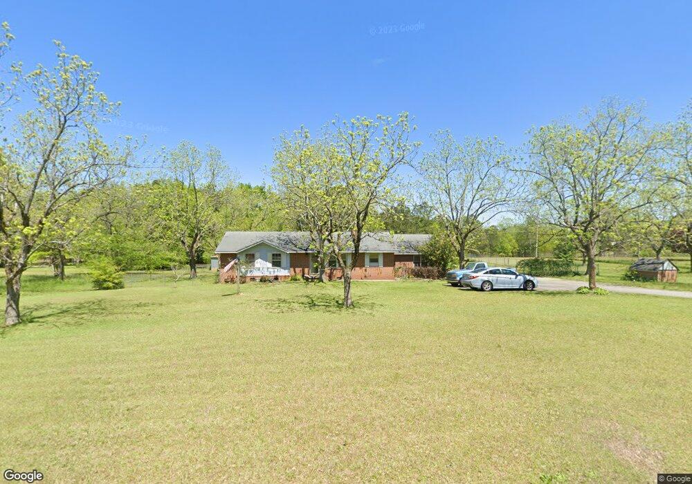
714 Cannafax Rd Barnesville, GA 30204
Estimated Value: $267,696 - $347,000
3
Beds
2
Baths
2,158
Sq Ft
$140/Sq Ft
Est. Value
About This Home
This home is located at 714 Cannafax Rd, Barnesville, GA 30204 and is currently estimated at $302,565, approximately $140 per square foot. 714 Cannafax Rd is a home located in Lamar County with nearby schools including Lamar County Primary School, Lamar County Elementary School, and Lamar County Middle School.
Ownership History
Date
Name
Owned For
Owner Type
Purchase Details
Closed on
Dec 29, 2017
Sold by
Kilchriss David A
Bought by
Kilchriss David A and Kilchriss Lesley
Current Estimated Value
Purchase Details
Closed on
Feb 22, 1999
Sold by
Kilchriss David A
Bought by
Kilchriss Lesley
Purchase Details
Closed on
Oct 1, 1970
Sold by
Kilchriss David S
Bought by
Kilchriss David A
Create a Home Valuation Report for This Property
The Home Valuation Report is an in-depth analysis detailing your home's value as well as a comparison with similar homes in the area
Home Values in the Area
Average Home Value in this Area
Purchase History
| Date | Buyer | Sale Price | Title Company |
|---|---|---|---|
| Kilchriss David A | -- | -- | |
| Kilchriss Lesley | -- | -- | |
| Kilchriss David A | -- | -- |
Source: Public Records
Tax History Compared to Growth
Tax History
| Year | Tax Paid | Tax Assessment Tax Assessment Total Assessment is a certain percentage of the fair market value that is determined by local assessors to be the total taxable value of land and additions on the property. | Land | Improvement |
|---|---|---|---|---|
| 2024 | $1,191 | $64,736 | $18,000 | $46,736 |
| 2023 | $1,818 | $74,940 | $18,000 | $56,940 |
| 2022 | $1,672 | $69,619 | $9,433 | $60,186 |
| 2021 | $1,127 | $46,834 | $9,433 | $37,401 |
| 2020 | $1,185 | $46,834 | $9,433 | $37,401 |
| 2019 | $1,189 | $46,834 | $9,433 | $37,401 |
| 2018 | $1,017 | $46,834 | $9,433 | $37,401 |
| 2017 | $953 | $40,517 | $3,116 | $37,401 |
| 2016 | $963 | $40,517 | $3,116 | $37,401 |
| 2015 | $1,166 | $40,516 | $3,116 | $37,401 |
| 2014 | $1,130 | $40,516 | $3,116 | $37,401 |
| 2013 | -- | $40,516 | $3,115 | $37,400 |
Source: Public Records
Map
Nearby Homes
- 818 Cannafax Rd
- 254 Needleleaf Dr
- 144 Berry Rd
- 150 Berry Rd
- 146 Berry Rd
- 148 Berry Rd
- 0 Perkins Rd Unit 253616
- 0 Perkins Rd Unit 10625263
- 0 Perkins Rd Unit 10635198
- 725 Mccollum Rd
- 746 Highway 18 W
- 0 Old Milner Rd Unit 10630085
- 500 Rose Ave
- 0 Washington Cir
- 0 Veterns Pkwy Unit 10515268
- 410 Country Kitchen Rd
- 0 Highway 341 S Unit 181569
- 0 Highway 341 S Unit 10610486
- 13 Brown St
- 0 Yatesville Rd Unit 24570293
- 722 Cannafax Rd
- 0 Rogers Cir
- 0 Rogers Cir Unit 8351983
- 0 Rogers Cir Unit 8896086
- 0 Rogers Cir Unit 8808036
- 0 Rogers Cir Unit 3157636
- 0 Rogers Cir Unit 8632817
- 0 Rogers Cir Unit 8626492
- 707 Cannafax Rd
- 696 Cannafax Rd
- 700 Cannafax Rd
- 733 Cannafax Rd
- 683 Cannafax Rd
- 273 Rogers Cir Unit 19
- 693 Cannafax Rd
- 744 Cannafax Rd
- 745 Cannafax Rd
- 678 Cannafax Rd
- 265 Rogers Cir
- 262 Rogers Cir