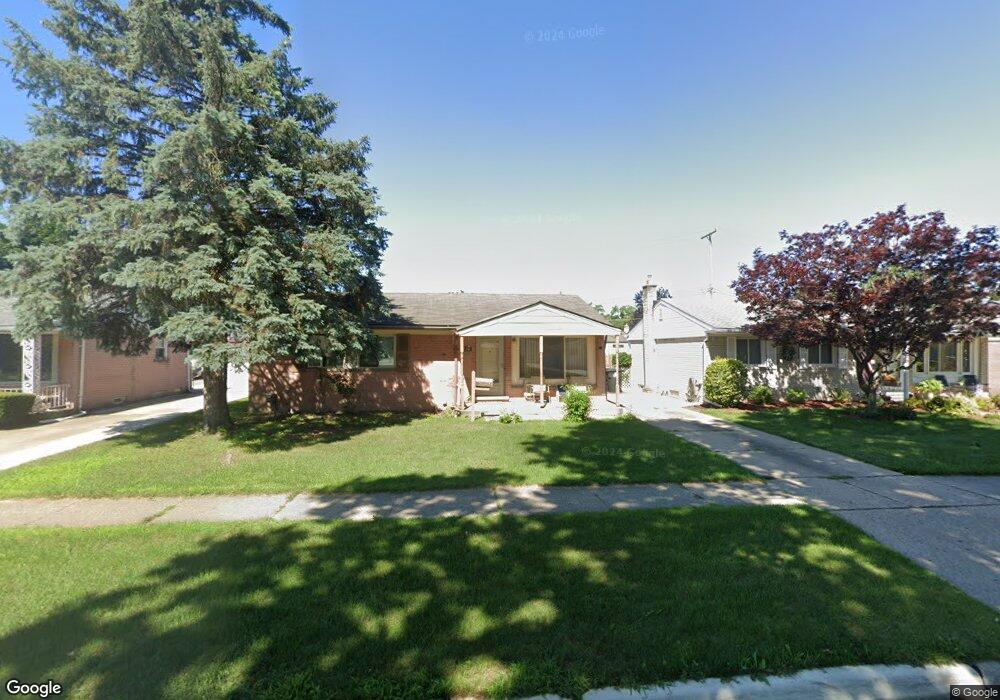
714 Forest St Westland, MI 48186
Estimated Value: $202,000 - $239,000
--
Bed
1
Bath
1,225
Sq Ft
$178/Sq Ft
Est. Value
About This Home
This home is located at 714 Forest St, Westland, MI 48186 and is currently estimated at $218,187, approximately $178 per square foot. 714 Forest St is a home located in Wayne County with nearby schools including Alexander Hamilton Elementary School, Marshall Upper Elementary School, and John Glenn High School.
Ownership History
Date
Name
Owned For
Owner Type
Purchase Details
Closed on
Oct 1, 2021
Sold by
Covault Sharon
Bought by
Covault Janet and Hill Karen Covault
Current Estimated Value
Purchase Details
Closed on
Mar 29, 2002
Sold by
Covault Ann M
Bought by
Covault Sharon
Home Financials for this Owner
Home Financials are based on the most recent Mortgage that was taken out on this home.
Original Mortgage
$131,950
Interest Rate
6.7%
Purchase Details
Closed on
Apr 24, 1996
Sold by
Gary D Covault
Bought by
Melton Thomas O and Melton Shannon
Create a Home Valuation Report for This Property
The Home Valuation Report is an in-depth analysis detailing your home's value as well as a comparison with similar homes in the area
Home Values in the Area
Average Home Value in this Area
Purchase History
| Date | Buyer | Sale Price | Title Company |
|---|---|---|---|
| Covault Janet | -- | None Listed On Document | |
| Covault Sharon | $145,000 | -- | |
| Melton Thomas O | $103,050 | -- |
Source: Public Records
Mortgage History
| Date | Status | Borrower | Loan Amount |
|---|---|---|---|
| Previous Owner | Covault Sharon | $131,950 |
Source: Public Records
Tax History Compared to Growth
Tax History
| Year | Tax Paid | Tax Assessment Tax Assessment Total Assessment is a certain percentage of the fair market value that is determined by local assessors to be the total taxable value of land and additions on the property. | Land | Improvement |
|---|---|---|---|---|
| 2025 | $3,655 | $108,500 | $0 | $0 |
| 2024 | $3,655 | $102,200 | $0 | $0 |
| 2023 | $2,401 | $90,000 | $0 | $0 |
| 2022 | $2,787 | $80,900 | $0 | $0 |
| 2021 | $2,717 | $75,300 | $0 | $0 |
| 2020 | $2,688 | $69,300 | $0 | $0 |
| 2019 | $2,590 | $64,800 | $0 | $0 |
| 2018 | $1,650 | $55,200 | $0 | $0 |
| 2017 | $920 | $54,300 | $0 | $0 |
| 2016 | $2,514 | $54,400 | $0 | $0 |
| 2015 | $4,889 | $51,060 | $0 | $0 |
| 2013 | $4,787 | $49,010 | $0 | $0 |
| 2012 | $2,724 | $51,490 | $0 | $0 |
Source: Public Records
Map
Nearby Homes
- 711 S Hawthorne St
- 34114 Avondale St
- 451 Darwin St
- 366 S Wildwood St
- 754 Alvin St
- 232 S Wildwood St
- 284 S Byfield St
- 34728 Somerset St
- 00000 Cherry Hill Rd
- 33532 Leona St
- 183 Daniel Ave Unit 6
- 344 S Christine
- 34553 Hazelwood St
- 1163 Denice St
- 360 van Sull St
- 34610 School St
- 1631 Ackley Ave
- 35052 Cherry Hill Rd
- 35193 Sansburn St
- 1681 Stieber St
- 704 Forest St
- 726 Forest St
- 664 Forest St
- 736 Forest St
- 701 S Hawthorne St
- 723 S Hawthorne St
- 652 Forest St
- 669 S Hawthorne St
- 733 S Hawthorne St
- 748 Forest St
- 657 S Hawthorne St
- 715 Forest St
- 705 Forest St
- 727 Forest St
- 642 Forest St
- 743 S Hawthorne St
- 665 Forest St
- 737 Forest St
- 758 Forest St
- 647 S Hawthorne St