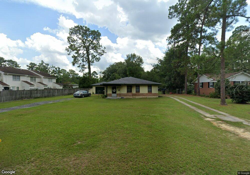
714 Magnolia Dr Waycross, GA 31501
Estimated Value: $134,000 - $166,369
2
Beds
2
Baths
1,811
Sq Ft
$85/Sq Ft
Est. Value
About This Home
This home is located at 714 Magnolia Dr, Waycross, GA 31501 and is currently estimated at $154,592, approximately $85 per square foot. 714 Magnolia Dr is a home located in Ware County with nearby schools including Williams Heights Elementary School, Waycross Middle School, and Ware County High School.
Ownership History
Date
Name
Owned For
Owner Type
Purchase Details
Closed on
May 30, 2014
Sold by
Evans Dennis W
Bought by
Harson Holdings Llc
Current Estimated Value
Purchase Details
Closed on
Apr 17, 1998
Sold by
Blount Thomas E Mcg
Bought by
Evans Dennis W
Purchase Details
Closed on
Feb 1, 1996
Sold by
Wade Farms Of Blackshear
Bought by
Blount Thomas E Mcg
Purchase Details
Closed on
Jan 29, 1992
Bought by
Wade Farms Of Blackshear
Purchase Details
Closed on
Dec 20, 1985
Create a Home Valuation Report for This Property
The Home Valuation Report is an in-depth analysis detailing your home's value as well as a comparison with similar homes in the area
Home Values in the Area
Average Home Value in this Area
Purchase History
| Date | Buyer | Sale Price | Title Company |
|---|---|---|---|
| Harson Holdings Llc | $40,000 | -- | |
| Evans Dennis W | $57,500 | -- | |
| Blount Thomas E Mcg | $43,500 | -- | |
| Wade Farms Of Blackshear | $40,000 | -- | |
| -- | $36,000 | -- |
Source: Public Records
Tax History Compared to Growth
Tax History
| Year | Tax Paid | Tax Assessment Tax Assessment Total Assessment is a certain percentage of the fair market value that is determined by local assessors to be the total taxable value of land and additions on the property. | Land | Improvement |
|---|---|---|---|---|
| 2024 | $2,057 | $52,123 | $6,080 | $46,043 |
| 2023 | $1,797 | $44,570 | $3,730 | $40,840 |
| 2022 | $1,776 | $44,570 | $3,730 | $40,840 |
| 2021 | $1,599 | $36,987 | $3,730 | $33,257 |
| 2020 | $1,403 | $32,201 | $3,730 | $28,471 |
| 2019 | $1,379 | $31,204 | $3,730 | $27,474 |
| 2018 | $1,368 | $30,650 | $3,730 | $26,920 |
| 2017 | $1,336 | $30,650 | $3,730 | $26,920 |
| 2016 | $1,336 | $30,650 | $3,730 | $26,920 |
| 2015 | $703 | $30,649 | $3,730 | $26,920 |
| 2014 | $1,539 | $35,077 | $3,730 | $31,348 |
| 2013 | -- | $34,394 | $3,729 | $30,664 |
Source: Public Records
Map
Nearby Homes
- 713 Magnolia Dr
- 808 Satilla Blvd
- 506 Magnolia Dr
- 1101 Cherokee Dr
- 511 Richmond Ave
- 903 Atlantic Ave
- 0 Saint Marys Dr Unit (TRACT 2 0.25 ACRES)
- 707 Euclid Ave
- 1100 Atlantic Ave
- 0 Goodwin St
- 907 Euclid Ave
- 1205 Dean Dr
- 807 College St
- 7438 Central Ave
- 1009 Euclid Ave
- 1002 Baltimore Ave
- 1100 Euclid Ave
- 1001 Coral Rd
- 706 Cherokee Cir
- 1204 Richmond Ave
- 712 Magnolia Dr
- 809 Saint Marys Dr
- 810 Shadow Lawn
- 711 Magnolia Dr
- 808 Shadow Lawn
- 807 Saint Marys Dr
- 709 Magnolia Dr
- 710 Magnolia Dr
- 901 Saint Marys Dr
- 834 St Mary's Dr
- 807 St Mary's Dr
- 828 Saint Marys Dr
- 830 Saint Marys Dr
- 828 St Marys Dr
- 834 Saint Marys Dr
- 822 Saint Marys Dr
- 805 Saint Marys Dr
- 912 Shadow Lawn
- 826 Saint Marys Dr
- 824 Saint Marys Dr