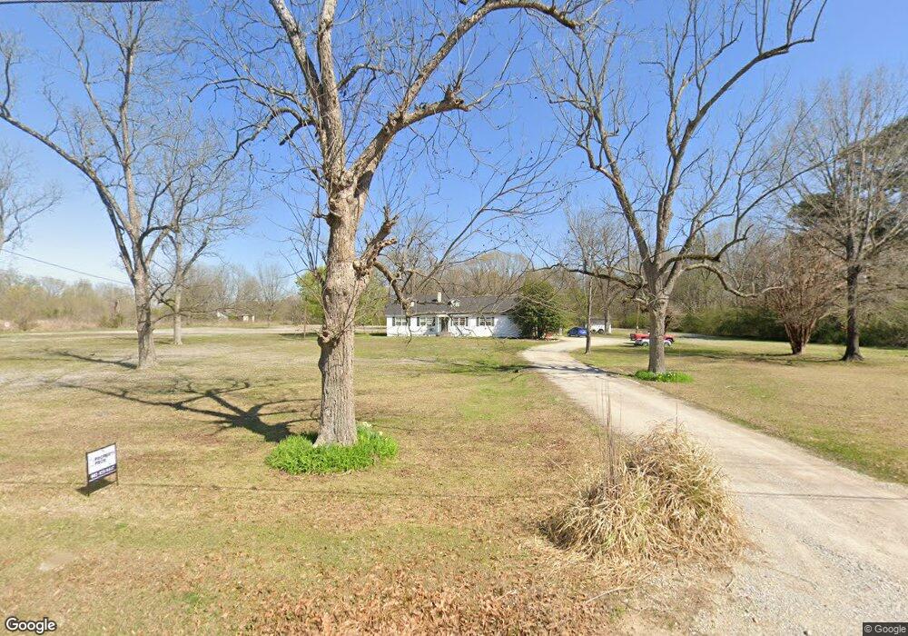
714 N 2nd St Baldwyn, MI 38824
Estimated Value: $55,178 - $228,000
5
Beds
2
Baths
2,800
Sq Ft
$37/Sq Ft
Est. Value
About This Home
This home is located at 714 N 2nd St, Baldwyn, MI 38824 and is currently estimated at $102,795, approximately $36 per square foot. 714 N 2nd St is a home located in Prentiss County with nearby schools including Baldwyn Elementary School, Baldwyn High School, and Baldwyn Middle School.
Ownership History
Date
Name
Owned For
Owner Type
Purchase Details
Closed on
Jul 7, 2025
Sold by
Fannie Mae and Federal National Mortgage Association
Bought by
Schrock Marvin Thence
Current Estimated Value
Home Financials for this Owner
Home Financials are based on the most recent Mortgage that was taken out on this home.
Original Mortgage
$52,534
Outstanding Balance
$51,056
Interest Rate
6.84%
Mortgage Type
New Conventional
Estimated Equity
$51,739
Purchase Details
Closed on
May 9, 2024
Sold by
Oswalt Kathy
Bought by
Gmfs Llc
Purchase Details
Closed on
Sep 21, 2023
Sold by
Haynes and Haynes H
Bought by
Llg Ms Llc and Oswalt
Create a Home Valuation Report for This Property
The Home Valuation Report is an in-depth analysis detailing your home's value as well as a comparison with similar homes in the area
Home Values in the Area
Average Home Value in this Area
Purchase History
| Date | Buyer | Sale Price | Title Company |
|---|---|---|---|
| Schrock Marvin Thence | -- | None Listed On Document | |
| Gmfs Llc | -- | None Listed On Document | |
| Llg Ms Llc | -- | None Listed On Document |
Source: Public Records
Mortgage History
| Date | Status | Borrower | Loan Amount |
|---|---|---|---|
| Open | Schrock Marvin Thence | $52,534 |
Source: Public Records
Tax History
| Year | Tax Paid | Tax Assessment Tax Assessment Total Assessment is a certain percentage of the fair market value that is determined by local assessors to be the total taxable value of land and additions on the property. | Land | Improvement |
|---|---|---|---|---|
| 2024 | $458 | $9,398 | $0 | $0 |
| 2023 | $397 | $8,457 | $0 | $0 |
| 2022 | $397 | $8,457 | $0 | $0 |
| 2021 | $397 | $8,461 | $0 | $0 |
| 2020 | $387 | $8,405 | $0 | $0 |
| 2019 | $355 | $7,903 | $0 | $0 |
| 2018 | $355 | $7,899 | $0 | $0 |
| 2017 | $354 | $7,894 | $0 | $0 |
| 2016 | $350 | $7,826 | $0 | $0 |
| 2015 | -- | $7,810 | $0 | $0 |
| 2014 | -- | $7,142 | $0 | $0 |
Source: Public Records
Map
Nearby Homes
- 137 Cox St
- 742 N 4th St
- 550 Park St
- 418 E Clayton St
- 512 Karen Ln
- 1105 Carrollville Ave
- 420 Windance Dr
- 0 Windance Dr
- 0 Emmanuel Dr
- 0 Church Dr
- 0 Sandhill Ave
- 0 U S 45
- 12.40ac U S 45
- 889 Mallard Lake Dr
- 907 Cemetery Rd
- Lot 52 & 33 Mallard Lake Ridgewood Dr
- Lot 17 Mallard Lake Dr
- Lot 18 Mallard Lake Dr
- Lot 15 Mallard Lake Dr
- Lot 19 Mallard Lake Dr