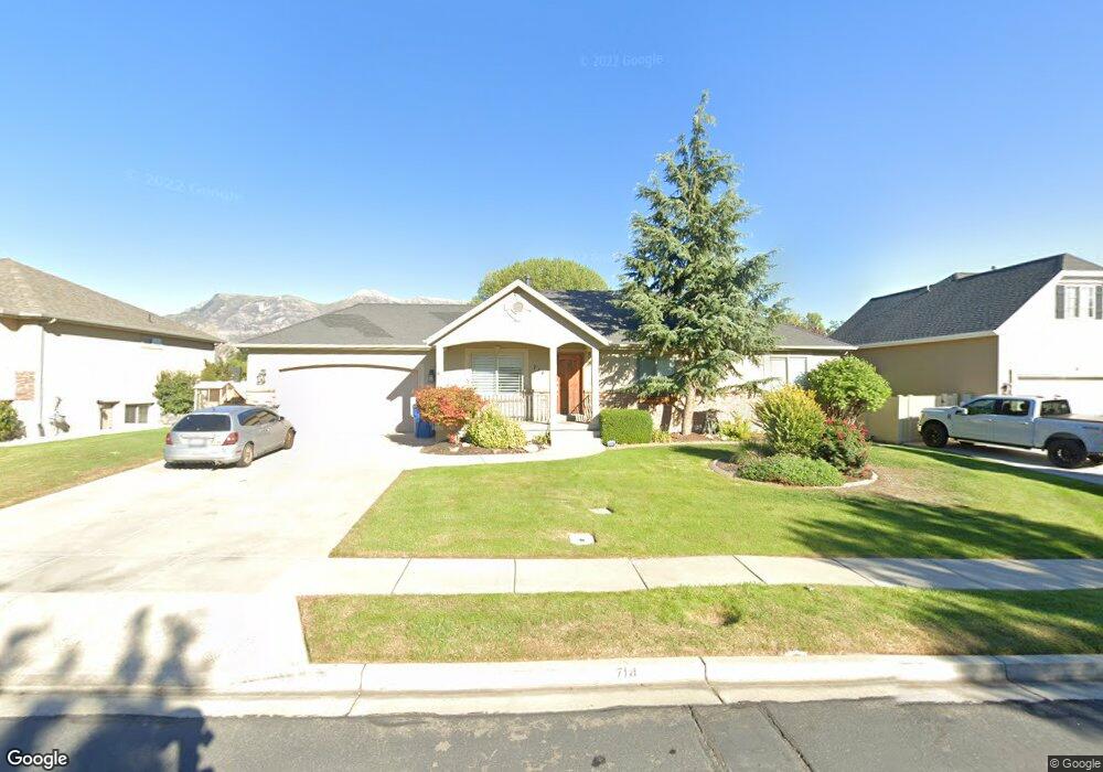
714 N 600 W American Fork, UT 84003
Estimated Value: $574,000 - $803,000
5
Beds
3
Baths
2,910
Sq Ft
$237/Sq Ft
Est. Value
About This Home
This home is located at 714 N 600 W, American Fork, UT 84003 and is currently estimated at $688,260, approximately $236 per square foot. 714 N 600 W is a home located in Utah County with nearby schools including Shelley Elementary School, American Fork Junior High School, and American Fork High School.
Ownership History
Date
Name
Owned For
Owner Type
Purchase Details
Closed on
Sep 6, 2022
Sold by
Leonard James
Bought by
Leonard Trust and Leonard
Current Estimated Value
Purchase Details
Closed on
Jan 7, 2022
Sold by
Niu and Melissa
Bought by
Leonard James
Purchase Details
Closed on
Jul 3, 2019
Sold by
Davies Bradley J and Davies Mary C
Bought by
Niu Philip and Niu Melissa
Home Financials for this Owner
Home Financials are based on the most recent Mortgage that was taken out on this home.
Original Mortgage
$423,630
Interest Rate
4%
Mortgage Type
New Conventional
Purchase Details
Closed on
May 26, 2016
Sold by
Carneseecca Chad A and Carneseecca Michele L
Bought by
Davies Bradley J and Davies Mary C
Purchase Details
Closed on
Dec 21, 2013
Sold by
Carnesecca Chad A and Carnesecca Michelle L
Bought by
Carnesecca Chad A and Carnesecca Michele L
Home Financials for this Owner
Home Financials are based on the most recent Mortgage that was taken out on this home.
Original Mortgage
$275,500
Interest Rate
4.13%
Mortgage Type
New Conventional
Purchase Details
Closed on
Dec 17, 2013
Sold by
Campbell Stephanie Smart
Bought by
Carnesecca Chad A and Carnesecca Michelle L
Home Financials for this Owner
Home Financials are based on the most recent Mortgage that was taken out on this home.
Original Mortgage
$275,500
Interest Rate
4.13%
Mortgage Type
New Conventional
Purchase Details
Closed on
Oct 27, 2011
Sold by
Campbell Stephanie Smart and Campbell Edward J
Bought by
Campbell Stephanie Smart
Purchase Details
Closed on
Jun 29, 2009
Sold by
Smart Jodie E
Bought by
Campbell Stephanie Smart and Campbell Edward J
Purchase Details
Closed on
Dec 14, 2006
Sold by
Hobbs Ryan and Hobbs Stephanie
Bought by
Smart Jodie E and Smart Ronald A
Purchase Details
Closed on
Dec 1, 2003
Sold by
Rogers Steven P and Rogers Amy E
Bought by
Hobbs Ryan and Hobbs Stephanie
Home Financials for this Owner
Home Financials are based on the most recent Mortgage that was taken out on this home.
Original Mortgage
$167,200
Interest Rate
6%
Mortgage Type
Balloon
Purchase Details
Closed on
Jul 16, 2002
Sold by
All American Development & Const Ii Lc
Bought by
Rogers Steven P and Rogers Amy E
Home Financials for this Owner
Home Financials are based on the most recent Mortgage that was taken out on this home.
Original Mortgage
$165,300
Interest Rate
6.69%
Purchase Details
Closed on
Jul 15, 2002
Sold by
L P I Lc
Bought by
All American Development & Const Ii Lc
Home Financials for this Owner
Home Financials are based on the most recent Mortgage that was taken out on this home.
Original Mortgage
$165,300
Interest Rate
6.69%
Purchase Details
Closed on
Apr 17, 2002
Sold by
Lpi Lc
Bought by
All American Development & Construction
Create a Home Valuation Report for This Property
The Home Valuation Report is an in-depth analysis detailing your home's value as well as a comparison with similar homes in the area
Home Values in the Area
Average Home Value in this Area
Purchase History
| Date | Buyer | Sale Price | Title Company |
|---|---|---|---|
| Leonard Trust | -- | None Listed On Document | |
| Leonard James | -- | None Listed On Document | |
| Niu Philip | -- | Access Title Company | |
| Davies Bradley J | -- | Provo Land Title Co | |
| Carnesecca Chad A | -- | Atlas Title | |
| Carnesecca Chad A | -- | Atlas Title | |
| Carnesecca Chad A | -- | Atlas Title | |
| Campbell Stephanie Smart | -- | None Available | |
| Campbell Stephanie Smart | -- | None Available | |
| Smart Jodie E | -- | None Available | |
| Hobbs Ryan | -- | Mountain West Title Co | |
| Rogers Steven P | -- | First American Title Insuran | |
| All American Development & Const Ii Lc | -- | First American Title Insuran | |
| All American Development & Construction | -- | First American Title Co |
Source: Public Records
Mortgage History
| Date | Status | Borrower | Loan Amount |
|---|---|---|---|
| Previous Owner | Niu Philip | $423,630 | |
| Previous Owner | Carnesecca Chad A | $275,500 | |
| Previous Owner | Hobbs Ryan | $167,200 | |
| Previous Owner | Rogers Steven P | $165,300 | |
| Closed | Rogers Steven P | $16,900 | |
| Closed | Hobbs Ryan | $31,350 |
Source: Public Records
Tax History Compared to Growth
Tax History
| Year | Tax Paid | Tax Assessment Tax Assessment Total Assessment is a certain percentage of the fair market value that is determined by local assessors to be the total taxable value of land and additions on the property. | Land | Improvement |
|---|---|---|---|---|
| 2025 | $2,814 | $339,625 | $221,000 | $396,500 |
| 2024 | $2,814 | $312,620 | $0 | $0 |
| 2023 | $2,650 | $312,125 | $0 | $0 |
| 2022 | $2,750 | $319,660 | $0 | $0 |
| 2021 | $2,361 | $428,700 | $158,600 | $270,100 |
| 2020 | $2,211 | $389,400 | $141,600 | $247,800 |
| 2019 | $2,049 | $373,200 | $131,000 | $242,200 |
| 2018 | $1,937 | $337,300 | $123,900 | $213,400 |
| 2017 | $1,819 | $170,995 | $0 | $0 |
| 2016 | $1,882 | $164,395 | $0 | $0 |
| 2015 | $1,827 | $151,415 | $0 | $0 |
| 2014 | $1,775 | $145,145 | $0 | $0 |
Source: Public Records
Map
Nearby Homes
- 641 N 420 W
- 602 W 860 N
- 962 N 780 St W Unit 508
- 974 N 780 St W Unit 509
- 916 N 780 St W Unit 501
- 822 W 800 St N Unit LOT319
- 822 N 860 W Unit 317
- 914 N 400 W Unit A
- 987 N 410 W
- 3889 W 950 Cir N Unit 366
- 777 W State Rd
- 540 N 300 W
- 356 N 480 W
- 471 W 1040 N
- 3935 W 1000 N Unit 438
- 3983 W 1000 N Unit 442
- 4007 W 1000 N
- 3947 W 1000 N Unit 439
- 3959 W 1000 N
- 984 N 300 W