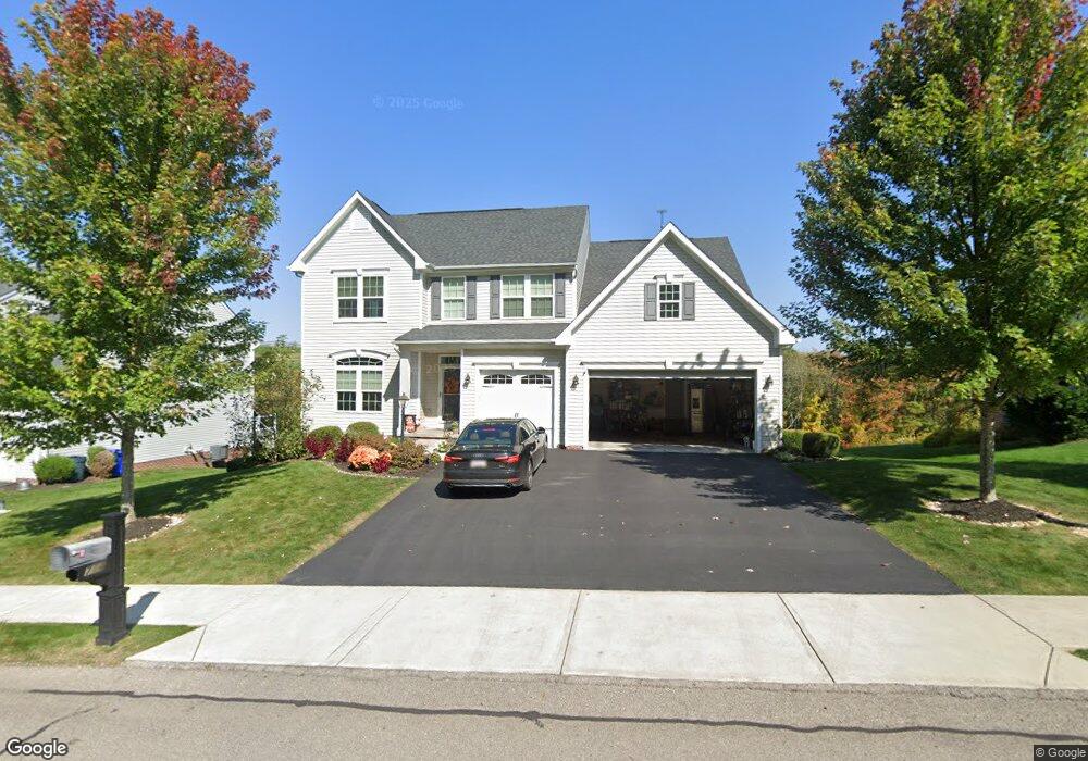
714 Packsaddle Trail Gibsonia, PA 15044
Estimated Value: $627,000 - $673,000
4
Beds
4
Baths
3,396
Sq Ft
$194/Sq Ft
Est. Value
About This Home
This home is located at 714 Packsaddle Trail, Gibsonia, PA 15044 and is currently estimated at $657,379, approximately $193 per square foot. 714 Packsaddle Trail is a home with nearby schools including Richland Elementary School, Eden Hall Upper Elementary, and Pine-Richland Middle School.
Ownership History
Date
Name
Owned For
Owner Type
Purchase Details
Closed on
Oct 5, 2015
Sold by
Nvr Inc
Bought by
Boyers Ashley M and Pagone Vivian R
Current Estimated Value
Home Financials for this Owner
Home Financials are based on the most recent Mortgage that was taken out on this home.
Original Mortgage
$374,270
Outstanding Balance
$294,472
Interest Rate
3.88%
Mortgage Type
New Conventional
Estimated Equity
$362,907
Purchase Details
Closed on
Jul 8, 2015
Sold by
Marathon Partners Lp
Bought by
Nvr Inc
Create a Home Valuation Report for This Property
The Home Valuation Report is an in-depth analysis detailing your home's value as well as a comparison with similar homes in the area
Home Values in the Area
Average Home Value in this Area
Purchase History
| Date | Buyer | Sale Price | Title Company |
|---|---|---|---|
| Boyers Ashley M | $395,975 | None Available | |
| Nvr Inc | $76,000 | -- |
Source: Public Records
Mortgage History
| Date | Status | Borrower | Loan Amount |
|---|---|---|---|
| Open | Boyers Ashley M | $374,270 |
Source: Public Records
Tax History Compared to Growth
Tax History
| Year | Tax Paid | Tax Assessment Tax Assessment Total Assessment is a certain percentage of the fair market value that is determined by local assessors to be the total taxable value of land and additions on the property. | Land | Improvement |
|---|---|---|---|---|
| 2025 | $10,438 | $386,500 | $50,100 | $336,400 |
| 2024 | $10,438 | $386,500 | $50,100 | $336,400 |
| 2023 | $10,438 | $386,500 | $50,100 | $336,400 |
| 2022 | $10,438 | $386,500 | $50,100 | $336,400 |
| 2021 | $1,828 | $386,500 | $50,100 | $336,400 |
| 2020 | $10,249 | $386,500 | $50,100 | $336,400 |
| 2019 | $10,249 | $386,500 | $50,100 | $336,400 |
| 2018 | $1,828 | $386,500 | $50,100 | $336,400 |
| 2017 | $10,102 | $386,500 | $50,100 | $336,400 |
| 2016 | $1,889 | $399,400 | $50,100 | $349,300 |
| 2015 | $1,889 | $7,600 | $7,600 | $0 |
| 2014 | $199 | $7,600 | $7,600 | $0 |
Source: Public Records
Map
Nearby Homes
- 404 Minglewood Dr
- 251 Estates Dr
- 132 Bellefield Ct
- 121 Bellefield Ct
- 1043 van Velsor Dr
- 113 Bellefield Ct
- 106 Maple Dr
- 503 Kyle Ct
- 0 Legion Dr
- 5910 Heckert Rd
- 211 Central Dr
- 1042 Beacon Hill Rd
- 632 Sandy Hill Rd
- 744 Galloway Dr
- 146 Tanglewood Dr
- 6076 William Flinn Hwy
- 3901 Bakerstown Rd
- 539 Madison Dr
- 1010 Blackhawk Dr
- 4 Field Brook Ct
- 716 Packsaddle Trail
- 712 Packsaddle Trail
- 718 Packsaddle Trail
- 710 Packsaddle Trail
- 708 Packsaddle Trail
- 721 Packsaddle Trail
- 723 Packsaddle Trail
- 726 Packsaddle Trail
- 706 Packsaddle Trail
- 725 Packsaddle Trail
- 728 Packsaddle Trail
- 704 Packsaddle Trail
- 727 Packsaddle Trail
- 421 Minglewood Dr
- 6048 Morrow Ln
- 730 Packsaddle Trail
- 729 Packsaddle Trail
- 702 Packsaddle Trail
- 731 Packsaddle Trail
- 732 Packsaddle Trail