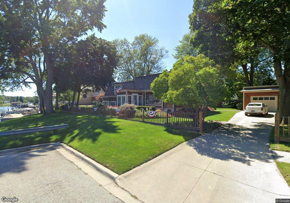
714 S 5th St Saint Clair, MI 48079
Estimated Value: $297,000 - $383,000
3
Beds
3
Baths
2,500
Sq Ft
$135/Sq Ft
Est. Value
About This Home
This home is located at 714 S 5th St, Saint Clair, MI 48079 and is currently estimated at $336,684, approximately $134 per square foot. 714 S 5th St is a home located in St. Clair County with nearby schools including Pine River Elementary School, St. Clair Middle School, and St. Clair High School.
Ownership History
Date
Name
Owned For
Owner Type
Purchase Details
Closed on
Jul 20, 2022
Sold by
Craig Romine
Bought by
Romine Craig and Romine Jill Lynn
Current Estimated Value
Purchase Details
Closed on
May 9, 2017
Sold by
Sivec Betsy Laurie and Laurle Betsey
Bought by
Romine Craig
Home Financials for this Owner
Home Financials are based on the most recent Mortgage that was taken out on this home.
Original Mortgage
$164,500
Interest Rate
3.75%
Mortgage Type
Adjustable Rate Mortgage/ARM
Purchase Details
Closed on
May 22, 2015
Sold by
Sivec Betsey Laurie and Sivec Jon
Bought by
Romine Craig
Create a Home Valuation Report for This Property
The Home Valuation Report is an in-depth analysis detailing your home's value as well as a comparison with similar homes in the area
Home Values in the Area
Average Home Value in this Area
Purchase History
| Date | Buyer | Sale Price | Title Company |
|---|---|---|---|
| Romine Craig | -- | Beadle Smith Plc | |
| Romine Craig | $190,000 | None Available | |
| Romine Craig | -- | None Available |
Source: Public Records
Mortgage History
| Date | Status | Borrower | Loan Amount |
|---|---|---|---|
| Previous Owner | Romine Craig | $164,500 |
Source: Public Records
Tax History
| Year | Tax Paid | Tax Assessment Tax Assessment Total Assessment is a certain percentage of the fair market value that is determined by local assessors to be the total taxable value of land and additions on the property. | Land | Improvement |
|---|---|---|---|---|
| 2025 | $4,004 | $192,500 | $0 | $0 |
| 2024 | $3,896 | $186,100 | $0 | $0 |
| 2023 | $3,654 | $163,100 | $0 | $0 |
| 2022 | $4,022 | $127,100 | $0 | $0 |
| 2020 | $3,803 | $107,300 | $107,300 | $0 |
| 2019 | $3,591 | $100,400 | $0 | $0 |
| 2018 | $3,613 | $94,700 | $0 | $0 |
| 2017 | $3,542 | $88,300 | $0 | $0 |
| 2016 | $3,273 | $88,300 | $0 | $0 |
| 2015 | -- | $63,900 | $63,900 | $0 |
| 2014 | -- | $62,300 | $62,300 | $0 |
| 2013 | -- | $63,000 | $0 | $0 |
Source: Public Records
Map
Nearby Homes
- 310 S 6th St
- TBD Range
- 920 Clinton Ave
- 206 S 4th St
- 1207 Clinton Ave
- 715 Thornapple St
- 513 N 6th St
- 592 Snowbird Cir E
- 1551 Oakland Ave
- 231 S Carney Dr
- 1627 S Riverside Ave
- 2 S Carney Dr Unit Lot TBD
- 3 S Carney Dr
- 211 N Carney Dr
- 3 Riley Rd
- 1826 Riley Rd
- 1 S Carney Dr
- 2 Riley
- 669 N Riverside Ave Unit 4
- 1 Shelldrake Ln
- 702 S 5th St
- 215 Fred W Moore Hwy
- 209 Fred W Moore Hwy
- 201 Fred W Moore Hwy
- 507 Cedar St
- 309 Fred W Moore Hwy
- 115 Fred W Moore Hwy
- 208 Fred W Moore Hwy
- 214 Fred W Moore Hwy
- 202 Fred W Moore Hwy
- 615 S 5th St
- 315 Fred W Moore Hwy
- 302 Fred W Moore Hwy
- 109 Fred W Moore Hwy
- 609 S 5th St
- 308 Fred W Moore Hwy
- 715 S 7th St
- 114 Fred W Moore Hwy
- 703 S 7th St
- 112 Fred W Moore Hwy