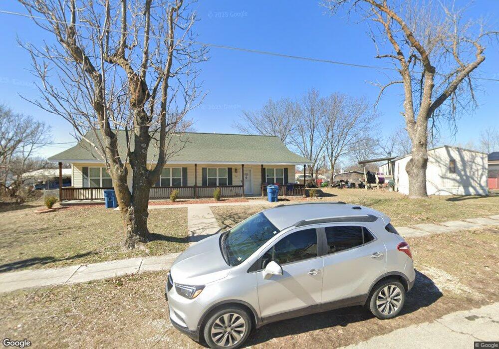
714 S Roney St Unit 1 Carl Junction, MO 64834
Estimated Value: $130,000
2
Beds
2
Baths
920
Sq Ft
$141/Sq Ft
Est. Value
About This Home
This home is located at 714 S Roney St Unit 1, Carl Junction, MO 64834 and is currently estimated at $130,000, approximately $141 per square foot. 714 S Roney St Unit 1 is a home located in Jasper County with nearby schools including Carl Junction Primary School (K-1), Carl Junction Intermediate School, and Carl Junction Primary School (2-3).
Ownership History
Date
Name
Owned For
Owner Type
Purchase Details
Closed on
Feb 10, 2021
Sold by
E Farms Holdings Llc
Bought by
Watkins Wesley and Watkins Kathy
Current Estimated Value
Home Financials for this Owner
Home Financials are based on the most recent Mortgage that was taken out on this home.
Original Mortgage
$204,400
Outstanding Balance
$14,501
Interest Rate
2.7%
Mortgage Type
Stand Alone Refi Refinance Of Original Loan
Estimated Equity
$115,499
Purchase Details
Closed on
Aug 16, 2019
Sold by
Sharples Cheryl
Bought by
E Farms Hldg Llc
Purchase Details
Closed on
Jul 31, 2017
Sold by
Alford Don C
Bought by
Sharples Cheryl
Purchase Details
Closed on
Jan 30, 2015
Sold by
Decastro Mary Sue
Bought by
Alford Don C
Purchase Details
Closed on
Jun 25, 2010
Sold by
Snow Lewis Mark and Snow Sharon E
Bought by
Bowman Ii Melvin R
Purchase Details
Closed on
Jun 17, 2010
Sold by
Bowman Melvin R and Bowman Gwendolyn C
Bought by
Snow Lewis Mark
Create a Home Valuation Report for This Property
The Home Valuation Report is an in-depth analysis detailing your home's value as well as a comparison with similar homes in the area
Home Values in the Area
Average Home Value in this Area
Purchase History
| Date | Buyer | Sale Price | Title Company |
|---|---|---|---|
| Watkins Wesley | -- | None Available | |
| E Farms Hldg Llc | -- | -- | |
| Sharples Cheryl | -- | None Available | |
| Alford Don C | -- | None Available | |
| Alford Don C | -- | None Available | |
| Bowman Ii Melvin R | -- | None Available | |
| Snow Lewis Mark | -- | None Available |
Source: Public Records
Mortgage History
| Date | Status | Borrower | Loan Amount |
|---|---|---|---|
| Open | Watkins Wesley | $204,400 |
Source: Public Records
Tax History Compared to Growth
Tax History
| Year | Tax Paid | Tax Assessment Tax Assessment Total Assessment is a certain percentage of the fair market value that is determined by local assessors to be the total taxable value of land and additions on the property. | Land | Improvement |
|---|---|---|---|---|
| 2025 | $802 | $15,290 | $530 | $14,760 |
| 2024 | $807 | $13,700 | $530 | $13,170 |
| 2023 | $807 | $13,700 | $530 | $13,170 |
| 2022 | $822 | $13,920 | $530 | $13,390 |
| 2021 | $705 | $13,920 | $530 | $13,390 |
| 2020 | $659 | $12,780 | $530 | $12,250 |
| 2019 | $625 | $12,780 | $530 | $12,250 |
| 2018 | $611 | $12,510 | $0 | $0 |
| 2017 | $256 | $5,240 | $0 | $0 |
| 2016 | $70 | $1,440 | $0 | $0 |
| 2015 | $169 | $3,490 | $0 | $0 |
| 2014 | $169 | $3,490 | $0 | $0 |
Source: Public Records
Map
Nearby Homes
- 408 W Walton Ave
- 114 W Walton Ave
- 505 W Walton Ave
- 409 W Gault St
- 409 Gault St
- TBD S Roney St
- 802 Aberdeen Ave
- 311 S Roney St
- 106 S Roney St
- 205 Allen St
- 503 Valley View
- 819 Delaney Dr
- 815 Delaney Dr
- 105 Summit St
- Tract 3 Prairie Ln
- Tract 2 Prairie Ln
- Tract 1 Prairie Ln
- Tract 4 Prairie Ln
- 711 Prairie Ln
- 720 Sheridan Ave
- 714 S Roney St
- 714&716 S Roney St
- 716 S Roney St
- 718 S Roney St
- 708 S Roney St
- 720 S Roney St
- 713XX S Roney St
- 713 S Roney St
- 713 S Roney St
- 306 Walton St
- 702 S Roney St
- 707 S Roney St
- 214 Walton St
- 308 Walton St
- 402 Marshall Ave
- 212 Walton St
- 710 S Broadway Ave
- 403 Marshall
- 616 S Roney St
- 212 W Walton Ave