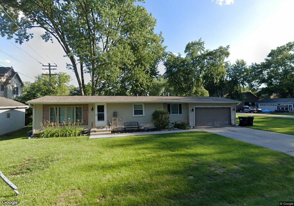
714 Sheridan Dr Wauconda, IL 60084
Estimated Value: $251,160 - $292,000
2
Beds
1
Bath
1,064
Sq Ft
$248/Sq Ft
Est. Value
About This Home
This home is located at 714 Sheridan Dr, Wauconda, IL 60084 and is currently estimated at $263,790, approximately $247 per square foot. 714 Sheridan Dr is a home located in Lake County with nearby schools including Wauconda Grade School, Wauconda Middle School, and Wauconda High School.
Ownership History
Date
Name
Owned For
Owner Type
Purchase Details
Closed on
Dec 8, 2010
Sold by
Fannie Mae
Bought by
Marthinsen Danielle
Current Estimated Value
Purchase Details
Closed on
Oct 22, 2010
Sold by
Black William L
Bought by
Federal National Mortgage Association
Purchase Details
Closed on
Aug 31, 2007
Sold by
Poremba Dorothy M S
Bought by
Black William L
Home Financials for this Owner
Home Financials are based on the most recent Mortgage that was taken out on this home.
Original Mortgage
$142,500
Interest Rate
6.49%
Mortgage Type
Unknown
Create a Home Valuation Report for This Property
The Home Valuation Report is an in-depth analysis detailing your home's value as well as a comparison with similar homes in the area
Home Values in the Area
Average Home Value in this Area
Purchase History
| Date | Buyer | Sale Price | Title Company |
|---|---|---|---|
| Marthinsen Danielle | $61,000 | Attorneys Title Guaranty Fun | |
| Federal National Mortgage Association | -- | None Available | |
| Black William L | $150,000 | Multiple |
Source: Public Records
Mortgage History
| Date | Status | Borrower | Loan Amount |
|---|---|---|---|
| Previous Owner | Black William L | $142,500 |
Source: Public Records
Tax History Compared to Growth
Tax History
| Year | Tax Paid | Tax Assessment Tax Assessment Total Assessment is a certain percentage of the fair market value that is determined by local assessors to be the total taxable value of land and additions on the property. | Land | Improvement |
|---|---|---|---|---|
| 2024 | $4,797 | $62,167 | $19,131 | $43,036 |
| 2023 | $5,001 | $56,825 | $17,487 | $39,338 |
| 2022 | $5,001 | $51,835 | $21,046 | $30,789 |
| 2021 | $4,700 | $48,458 | $19,887 | $28,571 |
| 2020 | $4,534 | $46,185 | $18,954 | $27,231 |
| 2019 | $4,015 | $43,649 | $17,913 | $25,736 |
| 2018 | $4,135 | $41,979 | $21,240 | $20,739 |
| 2017 | $4,129 | $41,493 | $20,994 | $20,499 |
| 2016 | $3,859 | $39,293 | $19,881 | $19,412 |
| 2015 | $3,596 | $36,072 | $18,251 | $17,821 |
| 2014 | $4,203 | $39,458 | $20,298 | $19,160 |
| 2012 | $4,116 | $41,996 | $19,420 | $22,576 |
Source: Public Records
Map
Nearby Homes
- 0 Bonner Rd
- 1260 Water Stone Cir
- 701 Lake Shore Dr
- 28177 N Garland Rd
- 28855 N Garland Rd
- 26049 N Il Route 59
- 29564 N Garland Rd
- 419 Hill St Unit 2805
- 302 Stillwater Ct Unit 1702
- 136 Parkview Dr Unit 5136
- 303 Stillwater Ct Unit 1106
- 309 Stillwater Ct Unit 1101
- 26241 W Bonner Rd
- 225 Regency Ct Unit A
- 315 Hill St Unit A
- 325 Sundown Ct Unit B
- 310 Sundown Ct Unit E
- 235 Regency Ct Unit B
- 240 Regency Ct
- 450 N Main St Unit S307A
- 718 Sheridan Dr
- 1020 Madison Ave
- 1023 Monroe Ave
- 713 Sheridan Dr
- 708 Sheridan Dr
- 1021 Monroe St
- 1101 Monroe St
- 1021 Madison Ave
- 1104 Madison Ave
- 706 Sheridan Dr
- 705 Sheridan Dr
- 1106 Madison Ave
- 1015 Madison Ave
- 1105 Monroe St
- 704 Sheridan Dr
- 1020 Washington Ave
- 1018 Monroe St
- 1108 Madison Ave
- 1107 Madison Ave
- 1018 Washington Ave