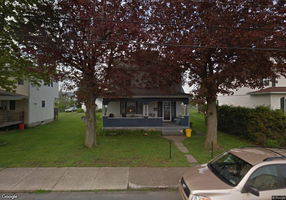
714 W Taylor St Taylor, PA 18517
Estimated Value: $185,683 - $258,000
4
Beds
2
Baths
1,980
Sq Ft
$113/Sq Ft
Est. Value
About This Home
This home is located at 714 W Taylor St, Taylor, PA 18517 and is currently estimated at $223,171, approximately $112 per square foot. 714 W Taylor St is a home located in Lackawanna County with nearby schools including Willard Middle School, Riverside Junior/Senior High School, and Triboro Christian Academy.
Ownership History
Date
Name
Owned For
Owner Type
Purchase Details
Closed on
Mar 30, 2021
Sold by
Setchick Stephen J and Kleha Marjorie Ann
Bought by
Eastman James
Current Estimated Value
Home Financials for this Owner
Home Financials are based on the most recent Mortgage that was taken out on this home.
Original Mortgage
$107,040
Interest Rate
3.1%
Mortgage Type
New Conventional
Purchase Details
Closed on
Mar 13, 2013
Sold by
Seftchick Stephen J
Bought by
Seftchick Stephen J and Kleha Marjorie Ann
Create a Home Valuation Report for This Property
The Home Valuation Report is an in-depth analysis detailing your home's value as well as a comparison with similar homes in the area
Home Values in the Area
Average Home Value in this Area
Purchase History
| Date | Buyer | Sale Price | Title Company |
|---|---|---|---|
| Eastman James | $133,800 | None Available | |
| Seftchick Stephen J | -- | None Available |
Source: Public Records
Mortgage History
| Date | Status | Borrower | Loan Amount |
|---|---|---|---|
| Previous Owner | Eastman James | $107,040 |
Source: Public Records
Tax History Compared to Growth
Tax History
| Year | Tax Paid | Tax Assessment Tax Assessment Total Assessment is a certain percentage of the fair market value that is determined by local assessors to be the total taxable value of land and additions on the property. | Land | Improvement |
|---|---|---|---|---|
| 2025 | $1,683 | $6,985 | $0 | $6,985 |
| 2024 | $1,501 | $6,985 | $0 | $6,985 |
| 2023 | $1,501 | $6,985 | $0 | $6,985 |
| 2022 | $1,501 | $6,985 | $0 | $6,985 |
| 2021 | $1,501 | $6,985 | $0 | $6,985 |
| 2020 | $1,472 | $6,985 | $0 | $6,985 |
| 2019 | $1,402 | $6,985 | $0 | $6,985 |
| 2018 | $1,378 | $6,985 | $0 | $6,985 |
| 2017 | $1,338 | $6,985 | $0 | $6,985 |
| 2016 | $642 | $6,985 | $0 | $0 |
| 2015 | -- | $6,985 | $0 | $0 |
| 2014 | -- | $6,985 | $0 | $0 |
Source: Public Records
Map
Nearby Homes
- 0 Union St Unit GSBSC251501
- 701-703 Union St
- Parcel B Davis Ct
- 115 W High St
- 112 E Taylor St
- 136 E Grove St
- 0 Cooper St Unit GSBSC255606
- Lot 02 Sibley Ave
- Lot 02 Casey Ave
- 0 Oak St Unit GSBSC255768
- 736 Oak St
- 133 Corcoran St
- 103 Davis St
- 448-450 N Main St
- 2932 Penman St
- 0 William St Unit GSBSC253642
- 170 2nd St
- 307 Charles St
- 710 Maple St
- 800 W Oak St
- 720 W Taylor St
- 710 W Taylor St
- 722 W Taylor St
- 706 W Taylor St Unit 708
- 802 W Taylor St
- 711 W Grove St
- 704 W Taylor St
- 713 W Grove St
- 707 W Grove St Unit 709
- 713 W Taylor St Unit 715
- 715 W Grove St
- 711 W Taylor St
- 709 W Taylor St
- 701 W - 703 Grove St
- 701 W Grove St Unit 703
- 701 W Taylor St Unit 703
- 719 W Taylor St
- 705 W Taylor St
- 802 W Taylor (804-806-808) St
- 804 806 W Taylor Ave W