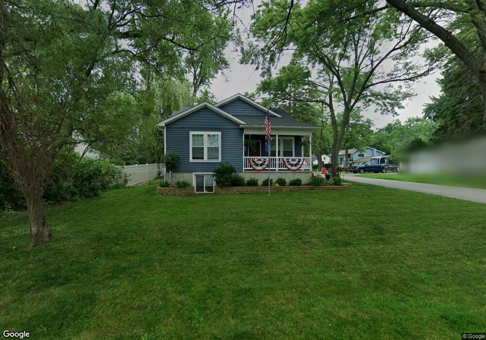
7141 Colony Dr Unit Bldg-Unit West Bloomfield, MI 48323
Estimated Value: $342,000 - $470,000
2
Beds
3
Baths
1,470
Sq Ft
$277/Sq Ft
Est. Value
About This Home
This home is located at 7141 Colony Dr Unit Bldg-Unit, West Bloomfield, MI 48323 and is currently estimated at $407,842, approximately $277 per square foot. 7141 Colony Dr Unit Bldg-Unit is a home located in Oakland County with nearby schools including Clifford H. Smart Middle School, Walled Lake Northern High School, and Our Lady Of Refuge School.
Ownership History
Date
Name
Owned For
Owner Type
Purchase Details
Closed on
Mar 15, 2021
Sold by
Prucknic William J
Bought by
Prucknic William J and Prucknic Kathryn A
Current Estimated Value
Home Financials for this Owner
Home Financials are based on the most recent Mortgage that was taken out on this home.
Original Mortgage
$150,000
Outstanding Balance
$134,691
Interest Rate
2.8%
Mortgage Type
Credit Line Revolving
Estimated Equity
$273,151
Purchase Details
Closed on
Mar 29, 2019
Sold by
Koski Norman A and Koski Mary V
Bought by
Prucknic William J
Purchase Details
Closed on
Sep 8, 2014
Sold by
Jelf Lisa M
Bought by
Koski Norman A and Koski Mary V
Purchase Details
Closed on
May 5, 2011
Sold by
The Carol A Johnson Trust
Bought by
Jeff Lisa M
Purchase Details
Closed on
Dec 18, 1998
Sold by
Johnson Carol A
Bought by
Johnson Carol A
Create a Home Valuation Report for This Property
The Home Valuation Report is an in-depth analysis detailing your home's value as well as a comparison with similar homes in the area
Home Values in the Area
Average Home Value in this Area
Purchase History
| Date | Buyer | Sale Price | Title Company |
|---|---|---|---|
| Prucknic William J | -- | None Available | |
| Prucknic William J | $70,000 | None Available | |
| Koski Norman A | $6,000 | Title One Inc | |
| Jeff Lisa M | -- | None Available | |
| Johnson Carol A | -- | -- |
Source: Public Records
Mortgage History
| Date | Status | Borrower | Loan Amount |
|---|---|---|---|
| Open | Prucknic William J | $150,000 |
Source: Public Records
Tax History Compared to Growth
Tax History
| Year | Tax Paid | Tax Assessment Tax Assessment Total Assessment is a certain percentage of the fair market value that is determined by local assessors to be the total taxable value of land and additions on the property. | Land | Improvement |
|---|---|---|---|---|
| 2024 | $3,404 | $194,050 | $0 | $0 |
| 2022 | $3,209 | $163,680 | $20,980 | $142,700 |
| 2021 | $5,277 | $155,890 | $0 | $0 |
| 2020 | $3,171 | $151,560 | $20,980 | $130,580 |
| 2018 | $783 | $17,340 | $17,340 | $0 |
| 2015 | -- | $14,840 | $0 | $0 |
| 2014 | -- | $14,140 | $0 | $0 |
| 2011 | -- | $30,150 | $0 | $0 |
Source: Public Records
Map
Nearby Homes
- 4245 Bunker Ave
- 6978 Colony Dr
- 6903 Dandison Blvd
- 7381 Crestmore St
- 3991 Fieldview Ave
- 3965 Carrick Ave
- 4066 Green Lake Rd
- 4442 Borland St
- 3950 Bradmore Ave
- 6768 Buckland Ave
- 6980 Hambro St
- 3632 Fieldview Ave
- 7369 Sweetbriar
- 7359 Woodlore Dr
- 7146 Arrowood Dr
- 3655 Walnut
- 6707 Heatherwood Dr
- 7555 Windgate Cir
- 7567 Windgate Cir
- 7065 Deerwood Trail Unit 27
- 7141 Colony Dr
- 7131 Colony Dr
- 7161 Colony Dr
- 7111 Colony Dr
- 4155 Crestdale Ave
- 4126 Middledale Ave
- 4140 Crestdale Ave
- 4134 Middledale Ave
- 7132 Colony Dr
- 7140 Colony Dr
- 7150 Colony Dr
- 7110 Colony Dr
- 7085 Colony Dr
- 7100 Colony Dr
- 4159 Crestdale Ave
- 4152 Crestdale Ave
- 4133 Bunker Ave
- 4150 Middledale Ave
- 7170 Colony Dr
- 4155 Middledale Ave