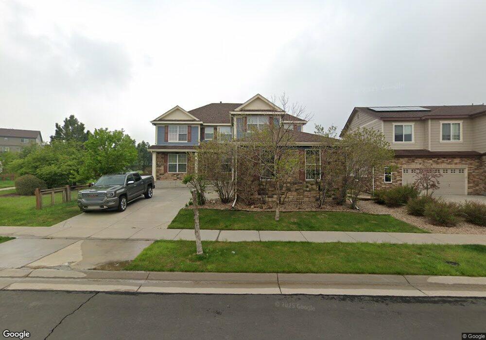
7141 S Oak Hill Cir Aurora, CO 80016
Southeast Aurora NeighborhoodEstimated Value: $735,000 - $833,000
5
Beds
6
Baths
4,646
Sq Ft
$167/Sq Ft
Est. Value
About This Home
This home is located at 7141 S Oak Hill Cir, Aurora, CO 80016 and is currently estimated at $776,480, approximately $167 per square foot. 7141 S Oak Hill Cir is a home located in Arapahoe County with nearby schools including Woodland Elementary School, Fox Ridge Middle School, and Cherokee Trail High School.
Ownership History
Date
Name
Owned For
Owner Type
Purchase Details
Closed on
Nov 22, 2006
Sold by
Neumann Homes Of Colorado Llc
Bought by
Spicer Kelvin and Spicer Melissa L
Current Estimated Value
Home Financials for this Owner
Home Financials are based on the most recent Mortgage that was taken out on this home.
Original Mortgage
$301,922
Outstanding Balance
$180,191
Interest Rate
6.37%
Mortgage Type
Purchase Money Mortgage
Estimated Equity
$596,289
Create a Home Valuation Report for This Property
The Home Valuation Report is an in-depth analysis detailing your home's value as well as a comparison with similar homes in the area
Home Values in the Area
Average Home Value in this Area
Purchase History
| Date | Buyer | Sale Price | Title Company |
|---|---|---|---|
| Spicer Kelvin | $377,403 | Land Title |
Source: Public Records
Mortgage History
| Date | Status | Borrower | Loan Amount |
|---|---|---|---|
| Open | Spicer Kelvin | $301,922 |
Source: Public Records
Tax History Compared to Growth
Tax History
| Year | Tax Paid | Tax Assessment Tax Assessment Total Assessment is a certain percentage of the fair market value that is determined by local assessors to be the total taxable value of land and additions on the property. | Land | Improvement |
|---|---|---|---|---|
| 2024 | $5,591 | $49,466 | -- | -- |
| 2023 | $5,591 | $49,466 | $0 | $0 |
| 2022 | $4,318 | $36,168 | $0 | $0 |
| 2021 | $4,321 | $36,168 | $0 | $0 |
| 2020 | $4,716 | $37,731 | $0 | $0 |
| 2019 | $4,538 | $37,731 | $0 | $0 |
| 2018 | $3,771 | $30,233 | $0 | $0 |
| 2017 | $3,837 | $30,233 | $0 | $0 |
| 2016 | $4,121 | $31,737 | $0 | $0 |
| 2015 | $3,992 | $31,737 | $0 | $0 |
| 2014 | -- | $24,581 | $0 | $0 |
| 2013 | -- | $23,150 | $0 | $0 |
Source: Public Records
Map
Nearby Homes
- 25960 E Davies Dr
- 26043 E Geddes Cir
- 7265 S Millbrook Ct
- 7189 S Little River Ct
- 25845 E Dry Creek Place
- 25412 E Quarto Place
- 7234 S Kellerman Way
- 7243 S Kellerman Way
- 26731 E Hinsdale Place
- 26554 E Indore Ave
- 7163 S Shady Grove Ct
- 25808 E Calhoun Place
- 6758 S Riverwood Way
- 26155 E Jamison Cir S
- 25829 E Calhoun Place
- 25338 E Costilla Place
- 26889 E Irish Place
- 26994 E Indore Ave
- 26591 E Calhoun Place
- 7414 S Scottsburg Way
- 7131 S Oak Hill Cir
- 7151 S Oak Hill Cir
- 7121 S Oak Hill Cir
- 26010 E Davies Dr
- 26020 E Davies Dr
- 26030 E Davies Dr
- 7161 S Oak Hill Cir
- 7111 S Oak Hill Cir
- 26040 E Davies Dr
- 7132 S Oak Hill Cir
- 7122 S Oak Hill Cir
- 7173 S Oak Hill Ct
- 7173 S Oak Hill Ct Unit 10
- 7171 S Oak Hill Cir
- 26050 E Davies Dr
- 7101 S Oak Hill Cir
- 26073 E Fremont Place
- 26093 E Fremont Place
- 7163 S Oak Hill Ct
- 26053 E Fremont Place