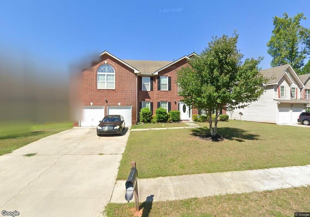
7143 Firethorn Ln Atlanta, GA 30349
Estimated Value: $315,000 - $392,749
4
Beds
3
Baths
2,694
Sq Ft
$128/Sq Ft
Est. Value
About This Home
This home is located at 7143 Firethorn Ln, Atlanta, GA 30349 and is currently estimated at $344,437, approximately $127 per square foot. 7143 Firethorn Ln is a home located in Fulton County with nearby schools including Cliftondale Elementary School, Renaissance Middle School, and Langston Hughes High School.
Ownership History
Date
Name
Owned For
Owner Type
Purchase Details
Closed on
Apr 13, 2007
Sold by
Homelife Cmntys Of South Fulto
Bought by
Hernandez Rodolfo
Current Estimated Value
Home Financials for this Owner
Home Financials are based on the most recent Mortgage that was taken out on this home.
Original Mortgage
$197,476
Outstanding Balance
$158,025
Interest Rate
6.1%
Mortgage Type
New Conventional
Estimated Equity
$186,412
Create a Home Valuation Report for This Property
The Home Valuation Report is an in-depth analysis detailing your home's value as well as a comparison with similar homes in the area
Home Values in the Area
Average Home Value in this Area
Purchase History
| Date | Buyer | Sale Price | Title Company |
|---|---|---|---|
| Hernandez Rodolfo | $197,500 | -- |
Source: Public Records
Mortgage History
| Date | Status | Borrower | Loan Amount |
|---|---|---|---|
| Open | Hernandez Rodolfo | $197,476 |
Source: Public Records
Tax History Compared to Growth
Tax History
| Year | Tax Paid | Tax Assessment Tax Assessment Total Assessment is a certain percentage of the fair market value that is determined by local assessors to be the total taxable value of land and additions on the property. | Land | Improvement |
|---|---|---|---|---|
| 2025 | $2,025 | $135,520 | $33,560 | $101,960 |
| 2023 | $3,875 | $137,280 | $34,400 | $102,880 |
| 2022 | $1,729 | $86,800 | $20,480 | $66,320 |
| 2021 | $1,678 | $81,720 | $18,840 | $62,880 |
| 2020 | $1,683 | $80,760 | $18,640 | $62,120 |
| 2019 | $1,796 | $72,000 | $15,680 | $56,320 |
| 2018 | $1,660 | $59,000 | $11,400 | $47,600 |
| 2017 | $1,311 | $49,240 | $10,920 | $38,320 |
| 2016 | $1,309 | $49,240 | $10,920 | $38,320 |
| 2015 | $1,314 | $49,240 | $10,920 | $38,320 |
| 2014 | $1,359 | $49,240 | $10,920 | $38,320 |
Source: Public Records
Map
Nearby Homes
- 275 Redding Ridge
- 260 Redding Ridge
- 2970 Oxford Rd
- 2980 Oxford Rd
- 0 W Stubbs Rd Unit (11.4 ACRES)
- 0 W Stubbs Rd Unit 7487198
- 7198 Glaspie Way
- 3198 Redwood Run
- 7250 Old Chapel
- 450 Pinevale Ct
- 440 Pinevale Ct
- 7425 Thoreau Cir
- 7459 Old Chapel
- 7648 Cole Ln Unit 1C
- 7656 Cole Ln
- 3185 Highgreen Trail
- 7150 Linden Dr
- 0 Firethorn Ln Unit 8263332
- 0 Firethorn Ln
- 7147 Firethorn Ln
- 3432 Amhurst Pkwy
- 3436 Amhurst Pkwy Unit 3
- 3449 Amhurst Pkwy
- 115 Sandalin Ln
- 105 Sandalin Ln
- 3428 Amhurst Pkwy
- 100 Sandalin Ln
- 100 Sandalin Ln Unit 100
- 3456 Amhurst Pkwy
- 3437 Amhurst Pkwy
- 3441 Amhurst Pkwy
- 3424 Amhurst Pkwy Unit 3
- 3445 Amhurst Pkwy Unit 3
- 3460 Amhurst Pkwy Unit 3
- 200 Redding Ridge
- 200 Redding Ridge
- 0 Redding Ridge Unit 8481215