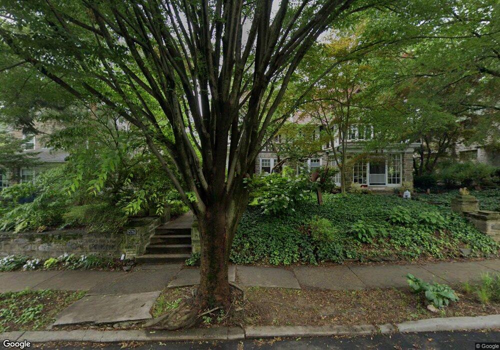
7146 Crittenden St Philadelphia, PA 19119
East Mount Airy NeighborhoodEstimated Value: $558,977 - $747,000
5
Beds
3
Baths
2,503
Sq Ft
$264/Sq Ft
Est. Value
About This Home
This home is located at 7146 Crittenden St, Philadelphia, PA 19119 and is currently estimated at $659,744, approximately $263 per square foot. 7146 Crittenden St is a home with nearby schools including Henry H. Houston School, Roxborough High School, and Renaissance Charter School.
Ownership History
Date
Name
Owned For
Owner Type
Purchase Details
Closed on
Jan 26, 2015
Sold by
Harrod David A and Lehman Katherine L
Bought by
Harrod David A and Lehman Katherine L
Current Estimated Value
Home Financials for this Owner
Home Financials are based on the most recent Mortgage that was taken out on this home.
Original Mortgage
$296,000
Outstanding Balance
$226,063
Interest Rate
3.84%
Mortgage Type
New Conventional
Estimated Equity
$433,681
Purchase Details
Closed on
Dec 27, 2002
Sold by
Cunningham Nancy J
Bought by
Harrod David A and Lehman Kathy L
Home Financials for this Owner
Home Financials are based on the most recent Mortgage that was taken out on this home.
Original Mortgage
$228,000
Interest Rate
6.19%
Create a Home Valuation Report for This Property
The Home Valuation Report is an in-depth analysis detailing your home's value as well as a comparison with similar homes in the area
Home Values in the Area
Average Home Value in this Area
Purchase History
| Date | Buyer | Sale Price | Title Company |
|---|---|---|---|
| Harrod David A | -- | None Available | |
| Harrod David A | $285,000 | T A Title Insurance Co |
Source: Public Records
Mortgage History
| Date | Status | Borrower | Loan Amount |
|---|---|---|---|
| Open | Harrod David A | $296,000 | |
| Closed | Harrod David A | $228,000 |
Source: Public Records
Tax History Compared to Growth
Tax History
| Year | Tax Paid | Tax Assessment Tax Assessment Total Assessment is a certain percentage of the fair market value that is determined by local assessors to be the total taxable value of land and additions on the property. | Land | Improvement |
|---|---|---|---|---|
| 2025 | $5,746 | $476,400 | $95,280 | $381,120 |
| 2024 | $5,746 | $476,400 | $95,280 | $381,120 |
| 2023 | $5,746 | $410,500 | $82,100 | $328,400 |
| 2022 | $3,509 | $365,500 | $82,100 | $283,400 |
| 2021 | $4,139 | $0 | $0 | $0 |
| 2020 | $4,139 | $0 | $0 | $0 |
| 2019 | $4,321 | $0 | $0 | $0 |
| 2018 | $3,749 | $0 | $0 | $0 |
| 2017 | $4,169 | $0 | $0 | $0 |
| 2016 | $3,712 | $0 | $0 | $0 |
| 2015 | $3,614 | $0 | $0 | $0 |
| 2014 | -- | $299,700 | $102,629 | $197,071 |
| 2012 | -- | $44,160 | $6,627 | $37,533 |
Source: Public Records
Map
Nearby Homes
- 523 E Allens Ln
- 501 E Sedgwick St
- 407 E Allens Ln
- 940 E Allens Ln
- 338 E Mount Airy Ave
- 7410 Crittenden St
- 932 E Ellet St
- 8309 Lynnewood Rd
- 1038 E Mount Pleasant Ave
- 506 E Gorgas Ln
- 937 E Gorgas Ln
- 6904 Ardleigh St
- 725 E Vernon Rd
- 226 E Sedgwick St
- 7415 Sprague St
- 8038 Lowber Ave
- 302 Crest Park Rd
- 715 E Dorset St
- 145 E Durham St
- 933 E Slocum St
- 7148 Crittenden St
- 7150 Crittenden St
- 7144 Crittenden St
- 7152 Crittenden St
- 543 E Durham St
- 7154 Crittenden St
- 528 E Mount Airy Ave
- 539 E Durham St
- 7145 Crittenden St
- 7156 Crittenden St
- 7149 Crittenden St
- 7151 Crittenden St
- 526 E Mount Airy Ave
- 7153 Crittenden St
- 535 E Durham St
- 7155 Crittenden St
- 524 E Mount Airy Ave
- 7157 Crittenden St
- 531 E Durham St
- 7159 Crittenden St