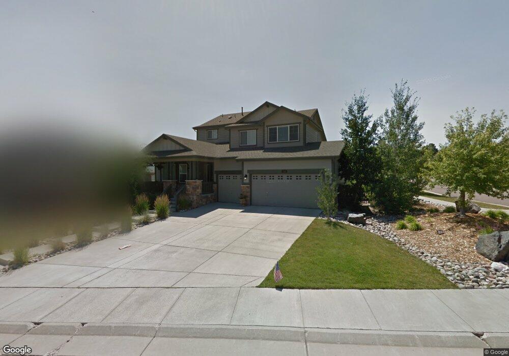
7146 S Flat Rock Ct Aurora, CO 80016
Tallyn's Reach NeighborhoodEstimated Value: $719,849 - $800,000
3
Beds
4
Baths
2,549
Sq Ft
$295/Sq Ft
Est. Value
About This Home
This home is located at 7146 S Flat Rock Ct, Aurora, CO 80016 and is currently estimated at $752,712, approximately $295 per square foot. 7146 S Flat Rock Ct is a home located in Arapahoe County with nearby schools including Black Forest Hills Elementary School, Fox Ridge Middle School, and Cherokee Trail High School.
Ownership History
Date
Name
Owned For
Owner Type
Purchase Details
Closed on
Apr 27, 2005
Sold by
Lennar Colorado Llc
Bought by
Lippold Michael and Lippold Jenny L
Current Estimated Value
Home Financials for this Owner
Home Financials are based on the most recent Mortgage that was taken out on this home.
Original Mortgage
$290,400
Outstanding Balance
$152,291
Interest Rate
5.93%
Mortgage Type
New Conventional
Estimated Equity
$600,421
Create a Home Valuation Report for This Property
The Home Valuation Report is an in-depth analysis detailing your home's value as well as a comparison with similar homes in the area
Home Values in the Area
Average Home Value in this Area
Purchase History
| Date | Buyer | Sale Price | Title Company |
|---|---|---|---|
| Lippold Michael | $363,000 | North American Title |
Source: Public Records
Mortgage History
| Date | Status | Borrower | Loan Amount |
|---|---|---|---|
| Open | Lippold Michael | $290,400 | |
| Closed | Lippold Michael | $36,300 |
Source: Public Records
Tax History Compared to Growth
Tax History
| Year | Tax Paid | Tax Assessment Tax Assessment Total Assessment is a certain percentage of the fair market value that is determined by local assessors to be the total taxable value of land and additions on the property. | Land | Improvement |
|---|---|---|---|---|
| 2024 | $3,516 | $46,679 | -- | -- |
| 2023 | $3,516 | $46,679 | $0 | $0 |
| 2022 | $2,905 | $34,826 | $0 | $0 |
| 2021 | $3,722 | $34,826 | $0 | $0 |
| 2020 | $4,649 | $36,666 | $0 | $0 |
| 2019 | $4,555 | $36,666 | $0 | $0 |
| 2018 | $4,304 | $33,538 | $0 | $0 |
| 2017 | $4,268 | $33,538 | $0 | $0 |
| 2016 | $3,802 | $29,953 | $0 | $0 |
| 2015 | $3,689 | $29,953 | $0 | $0 |
| 2014 | -- | $24,310 | $0 | $0 |
| 2013 | -- | $24,480 | $0 | $0 |
Source: Public Records
Map
Nearby Homes
- 24378 E Roxbury Cir
- 24248 E Roxbury Cir
- 24723 E Quarto Place
- 24277 E Davies Place
- 24791 E Rowland Place
- 23901 E Easter Place
- 24329 E Glasgow Cir
- 7370 S Catawba Way
- 24395 E Briarwood Ave
- 6995 S Buchanan Ct
- 24622 E Ontario Dr
- 24536 E Ottawa Ave
- 7463 S Biloxi Ct
- 23967 E Hinsdale Place
- 25338 E Costilla Place
- 7485 S Jackson Gap Way
- 24846 E Calhoun Place Unit A
- 7243 S Kellerman Way
- 25412 E Quarto Place
- 6911 S Algonquian Ct
- 7136 S Flat Rock Ct
- 24449 E Fremont Dr
- 7126 S Flat Rock Ct
- 24398 E Roxbury Cir
- 24459 E Fremont Dr
- 24395 E Roxbury Cir
- 24439 E Fremont Dr
- 7143 S Flat Rock Ct
- 7133 S Flat Rock Ct
- 7116 S Flat Rock Ct
- 24469 E Fremont Dr
- 24385 E Roxbury Cir
- 24429 E Fremont Dr
- 24368 E Roxbury Cir
- 24375 E Roxbury Cir
- 24436 E Fremont Dr
- 24419 E Fremont Dr
- 24426 E Fremont Dr
- 24446 E Fremont Dr
- 24358 E Roxbury Cir