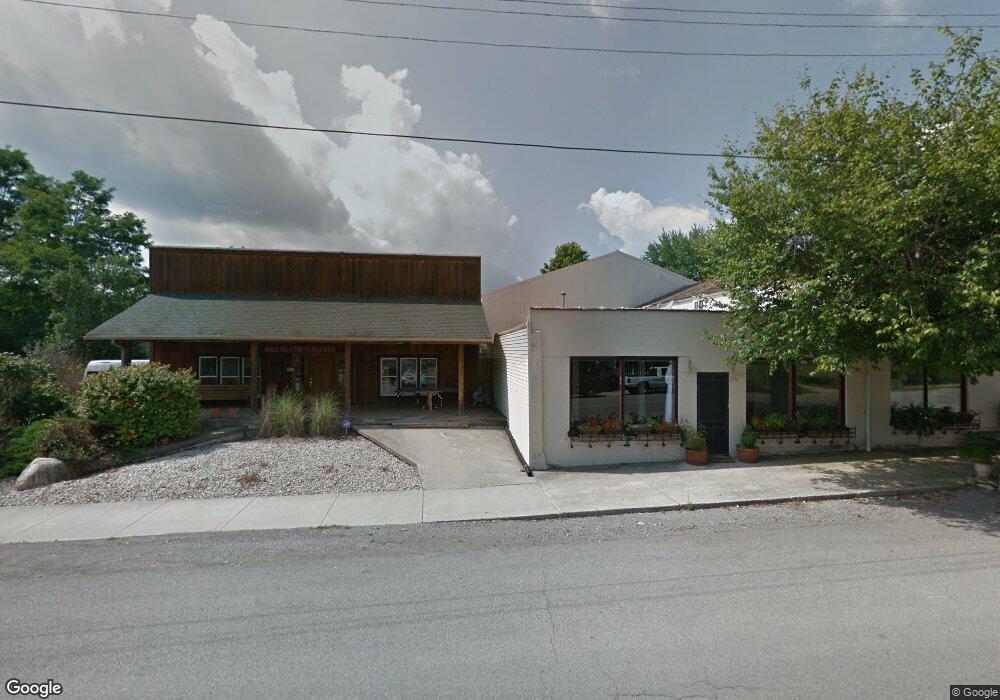
7148 State Route Zanesfield, OH 43360
Estimated Value: $397,000 - $429,000
3
Beds
2
Baths
2,064
Sq Ft
$197/Sq Ft
Est. Value
About This Home
This home is located at 7148 State Route, Zanesfield, OH 43360 and is currently estimated at $407,352, approximately $197 per square foot. 7148 State Route is a home located in Logan County with nearby schools including Benjamin Logan Elementary School, Benjamin Logan Middle School, and Benjamin Logan High School.
Ownership History
Date
Name
Owned For
Owner Type
Purchase Details
Closed on
Jul 24, 2015
Sold by
Bellomy Tommy J and Bellomy Kathleen M
Bought by
Wireman Danny D and Wireman Rebecca E
Current Estimated Value
Home Financials for this Owner
Home Financials are based on the most recent Mortgage that was taken out on this home.
Original Mortgage
$196,377
Interest Rate
4.25%
Mortgage Type
FHA
Create a Home Valuation Report for This Property
The Home Valuation Report is an in-depth analysis detailing your home's value as well as a comparison with similar homes in the area
Home Values in the Area
Average Home Value in this Area
Purchase History
| Date | Buyer | Sale Price | Title Company |
|---|---|---|---|
| Wireman Danny D | $200,000 | Acs Lionhert Title |
Source: Public Records
Mortgage History
| Date | Status | Borrower | Loan Amount |
|---|---|---|---|
| Closed | Wireman Danny D | $196,377 |
Source: Public Records
Tax History Compared to Growth
Tax History
| Year | Tax Paid | Tax Assessment Tax Assessment Total Assessment is a certain percentage of the fair market value that is determined by local assessors to be the total taxable value of land and additions on the property. | Land | Improvement |
|---|---|---|---|---|
| 2024 | $3,265 | $93,620 | $16,010 | $77,610 |
| 2023 | $3,265 | $93,620 | $16,010 | $77,610 |
| 2022 | $3,309 | $72,010 | $12,310 | $59,700 |
| 2021 | $2,709 | $72,010 | $12,310 | $59,700 |
| 2020 | $2,715 | $69,920 | $11,480 | $58,440 |
| 2019 | $2,710 | $69,920 | $11,480 | $58,440 |
| 2018 | $2,556 | $69,920 | $11,480 | $58,440 |
| 2016 | $2,470 | $63,570 | $10,440 | $53,130 |
| 2014 | $2,350 | $63,570 | $10,440 | $53,130 |
| 2013 | $2,330 | $63,570 | $10,440 | $53,130 |
| 2012 | $2,410 | $65,440 | $8,810 | $56,630 |
Source: Public Records
Map
Nearby Homes
- 7756 County Road 158
- 8512 Township Road 29
- 12133 County Road 153
- 7509 State Route 287
- 9799 Township Road 160
- 7026 County Road 44
- 10590 County Road 41
- 328 Lincoln Place
- 89 W Maple St
- 0 Ohio 292
- 6704 Stevenson Rd
- 0 Smokey Rd
- 41 E Townsend St
- 28 Lloyd Dr
- 133 Coates Ct Unit 36
- 133 Coates Ct
- 0 Cox Rd Lot 10
- 5621 Cox Rd
- 0 Johnson Rd Unit 222024368
- 0 Johnson Rd Unit 225027964
- 7148 State Route 559
- 7160 State Route 559
- 7058 State Route 559
- 7160 Ohio 559
- 7141 State Route 559
- 10382 State Route 287
- 10400 State Route 287
- 7208 State Route 559
- 7163 State Route 559
- 7163 Ohio 559
- 7264 State Route 559
- 10254 State Route 287
- 7067 State Route 559
- 7201 Ohio 559
- 7243 State Route 559
- 7243 Ohio 559
- 10522 State Route 287
- 10379 State Route 287
- 7147 State Route 559
- 7316 State Route 559
