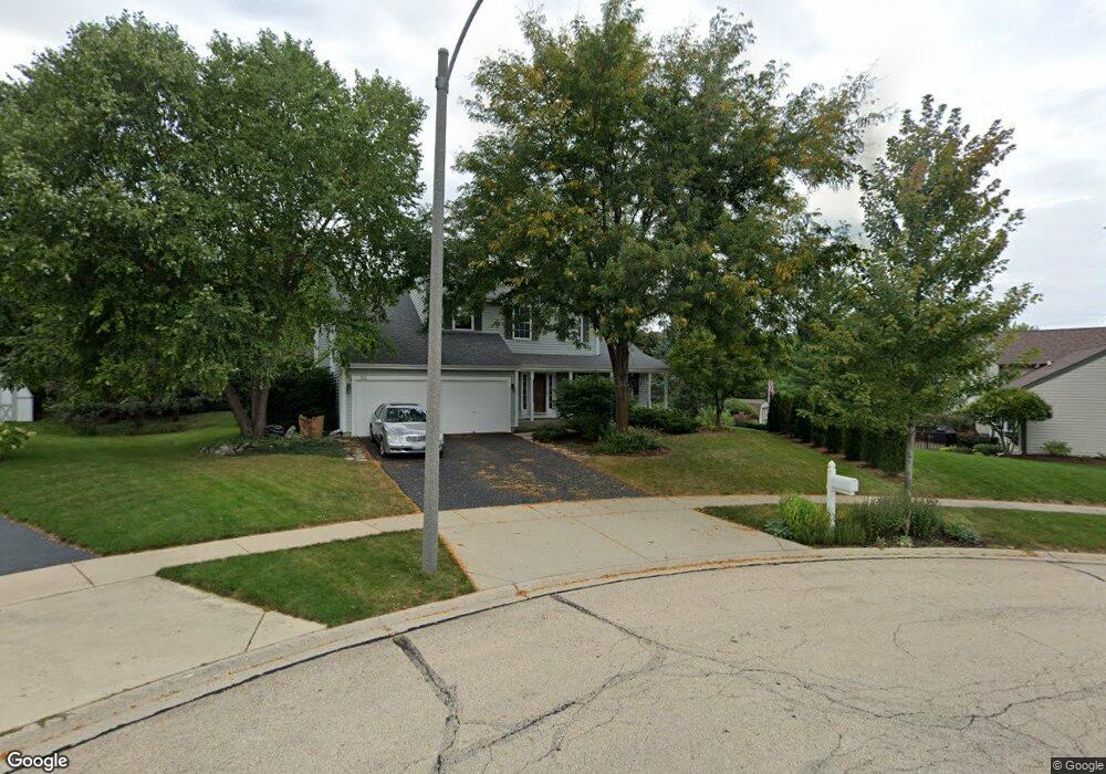
715 Castle Rock Ct West Dundee, IL 60118
Estimated Value: $402,725 - $424,000
4
Beds
--
Bath
2,025
Sq Ft
$205/Sq Ft
Est. Value
About This Home
This home is located at 715 Castle Rock Ct, West Dundee, IL 60118 and is currently estimated at $415,431, approximately $205 per square foot. 715 Castle Rock Ct is a home located in Kane County with nearby schools including Dundee Highlands Elementary School, Dundee Middle School, and Harry D Jacobs High School.
Ownership History
Date
Name
Owned For
Owner Type
Purchase Details
Closed on
Jun 30, 1994
Sold by
Costin Robert M and Costin Kelly A
Bought by
Fluegel John M and Fluegel Kelley J
Current Estimated Value
Home Financials for this Owner
Home Financials are based on the most recent Mortgage that was taken out on this home.
Original Mortgage
$145,600
Interest Rate
8.12%
Create a Home Valuation Report for This Property
The Home Valuation Report is an in-depth analysis detailing your home's value as well as a comparison with similar homes in the area
Home Values in the Area
Average Home Value in this Area
Purchase History
| Date | Buyer | Sale Price | Title Company |
|---|---|---|---|
| Fluegel John M | $182,000 | Attorneys Title Guaranty Fun |
Source: Public Records
Mortgage History
| Date | Status | Borrower | Loan Amount |
|---|---|---|---|
| Closed | Fluegel John M | $145,600 |
Source: Public Records
Tax History Compared to Growth
Tax History
| Year | Tax Paid | Tax Assessment Tax Assessment Total Assessment is a certain percentage of the fair market value that is determined by local assessors to be the total taxable value of land and additions on the property. | Land | Improvement |
|---|---|---|---|---|
| 2024 | $8,491 | $112,175 | $26,492 | $85,683 |
| 2023 | $7,953 | $100,932 | $23,837 | $77,095 |
| 2022 | $7,791 | $94,437 | $23,837 | $70,600 |
| 2021 | $7,515 | $89,167 | $22,507 | $66,660 |
| 2020 | $7,374 | $87,162 | $22,001 | $65,161 |
| 2019 | $7,134 | $82,744 | $20,886 | $61,858 |
| 2018 | $7,163 | $81,105 | $20,472 | $60,633 |
| 2017 | $6,816 | $75,870 | $19,151 | $56,719 |
| 2016 | $6,516 | $69,292 | $23,612 | $45,680 |
| 2015 | -- | $64,929 | $22,125 | $42,804 |
| 2014 | -- | $63,136 | $21,514 | $41,622 |
| 2013 | -- | $65,069 | $22,173 | $42,896 |
Source: Public Records
Map
Nearby Homes
- 1601 Higgins Rd
- 2622 Chesire Ct
- 2622 Wessex Dr
- 1715 W Main St
- 215 Sharon Dr
- Lot 120 Oak Dr
- 812 Lindsay Ln
- 816 Lindsay Ln
- 822 Lindsay Ln
- 825 Lindsay Ln
- 818 Lindsay Ln
- 814 Lindsay Ln
- Lot 80 Ash Dr
- Lot 79 Ash Dr
- 325 Sharon Dr
- Charlotte Plan at Hickory Glen
- Marianne Plan at Hickory Glen
- 496 Edinburgh Ln
- 829 Lindsay Ln
- 906 Shagbark Ln
- 2430 Glenmoor Dr
- 2421 Knowlton Dr
- 718 Castle Rock Ct
- 2420 Glenmoor Dr
- 2419 Knowlton Dr
- 2423 Knowlton Dr
- 2411 Knowlton Dr
- 2410 Glenmoor Dr
- 2433 Knowlton Dr
- 704 Castle Rock Ct
- 2407 Knowlton Dr
- 720 Malcolm Ln
- 625 Prestwick Ct
- 2424 Knowlton Dr
- 2402 Glenmoor Dr
- 2437 Knowlton Dr
- 2403 Knowlton Dr
- 2412 Knowlton Dr
- 710 Malcolm Ln
- 2428 Knowlton Dr