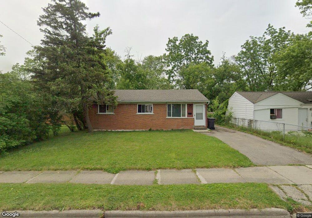
715 Emerson Ave Pontiac, MI 48340
Estimated Value: $123,000 - $138,847
3
Beds
1
Bath
955
Sq Ft
$135/Sq Ft
Est. Value
About This Home
This home is located at 715 Emerson Ave, Pontiac, MI 48340 and is currently estimated at $128,962, approximately $135 per square foot. 715 Emerson Ave is a home located in Oakland County with nearby schools including Herrington Elementary School, Pontiac Middle School, and Pontiac High School.
Ownership History
Date
Name
Owned For
Owner Type
Purchase Details
Closed on
Sep 11, 2019
Sold by
Peterson Lashawn and Jackson Towanna
Bought by
Smith Lucky
Current Estimated Value
Home Financials for this Owner
Home Financials are based on the most recent Mortgage that was taken out on this home.
Original Mortgage
$80,000
Outstanding Balance
$70,074
Interest Rate
3.6%
Mortgage Type
New Conventional
Estimated Equity
$58,888
Purchase Details
Closed on
Jul 17, 2018
Sold by
Charles Laura R and Love Charles Revocable Living
Bought by
Peterson Lashawn and Jackson Towanna
Purchase Details
Closed on
Nov 7, 2000
Sold by
Love Charles
Bought by
Love Charles Tr
Create a Home Valuation Report for This Property
The Home Valuation Report is an in-depth analysis detailing your home's value as well as a comparison with similar homes in the area
Home Values in the Area
Average Home Value in this Area
Purchase History
| Date | Buyer | Sale Price | Title Company |
|---|---|---|---|
| Smith Lucky | $80,000 | None Available | |
| Peterson Lashawn | $14,000 | Amrock | |
| Love Charles Tr | -- | -- |
Source: Public Records
Mortgage History
| Date | Status | Borrower | Loan Amount |
|---|---|---|---|
| Open | Smith Lucky | $80,000 |
Source: Public Records
Tax History Compared to Growth
Tax History
| Year | Tax Paid | Tax Assessment Tax Assessment Total Assessment is a certain percentage of the fair market value that is determined by local assessors to be the total taxable value of land and additions on the property. | Land | Improvement |
|---|---|---|---|---|
| 2024 | $1,566 | $39,610 | $0 | $0 |
| 2023 | $1,493 | $36,600 | $0 | $0 |
| 2022 | $1,503 | $31,560 | $0 | $0 |
| 2021 | $1,458 | $27,700 | $0 | $0 |
| 2020 | $1,357 | $24,710 | $0 | $0 |
| 2019 | $1,333 | $20,940 | $0 | $0 |
| 2018 | $735 | $18,440 | $0 | $0 |
| 2017 | $708 | $17,430 | $0 | $0 |
| 2016 | $734 | $14,580 | $0 | $0 |
| 2015 | -- | $13,200 | $0 | $0 |
| 2014 | -- | $12,790 | $0 | $0 |
| 2011 | -- | $23,210 | $0 | $0 |
Source: Public Records
Map
Nearby Homes
- 715 Kenilworth Ave
- 770 Cameron Ave
- 790 Cameron Ave
- 785 Kenilworth Ave
- 457 Cameron Ave
- 802 Cameron Ave
- 808 Kettering Ave
- 644 Brady Ln
- 1163 Chestnut St Unit 9
- 608 Brady Ln
- 602 Brady Ln
- 821 Robinwood St
- 509 Cameron Ave
- 597 Brady Ln
- 591 Brady Ln
- 790 Parkwood Ave
- 1240 University Dr Unit 2
- Fairfiled Plan at Fairview Village
- Enclave II Plan at Fairview Village
- Enclave Plan at Fairview Village
- 721 Emerson Ave
- 705 Emerson Ave
- 725 Emerson Ave
- 714 Cameron Ave
- 710 Cameron Ave
- 720 Cameron Ave
- 731 Emerson Ave Unit Bldg-Unit
- 731 Emerson Ave
- 704 Cameron Ave
- 724 Cameron Ave
- 714 Emerson Ave
- 701 Emerson Ave
- 720 Emerson Ave
- 710 Emerson Ave
- 700 Cameron Ave
- 0 Emerson Ave
- 730 Cameron Ave
- 724 Emerson Ave
- 704 Emerson Ave
- 735 Emerson Ave