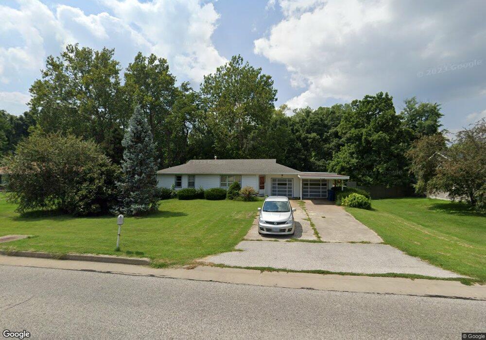
715 Johnson Hill Rd Collinsville, IL 62234
Estimated Value: $146,000 - $228,000
4
Beds
2
Baths
1,276
Sq Ft
$148/Sq Ft
Est. Value
About This Home
This home is located at 715 Johnson Hill Rd, Collinsville, IL 62234 and is currently estimated at $189,389, approximately $148 per square foot. 715 Johnson Hill Rd is a home located in Madison County with nearby schools including Summit Elementary School, Dorris Intermediate School, and Collinsville Middle School.
Ownership History
Date
Name
Owned For
Owner Type
Purchase Details
Closed on
Apr 15, 2025
Sold by
715 Property Llc
Bought by
Buhr Luke and Buchholz Anna
Current Estimated Value
Purchase Details
Closed on
Aug 5, 2021
Sold by
Case Jane and Kerkemeyer Roger
Bought by
715 Property Llc
Purchase Details
Closed on
May 31, 2017
Sold by
Kerkemeyer Elmer G and Kerkemeyer Margaret P
Bought by
Kerkemeyer Elmer G
Create a Home Valuation Report for This Property
The Home Valuation Report is an in-depth analysis detailing your home's value as well as a comparison with similar homes in the area
Home Values in the Area
Average Home Value in this Area
Purchase History
| Date | Buyer | Sale Price | Title Company |
|---|---|---|---|
| Buhr Luke | $139,000 | Ck | |
| 715 Property Llc | -- | None Available | |
| Kerkemeyer Elmer G | -- | None Available |
Source: Public Records
Tax History Compared to Growth
Tax History
| Year | Tax Paid | Tax Assessment Tax Assessment Total Assessment is a certain percentage of the fair market value that is determined by local assessors to be the total taxable value of land and additions on the property. | Land | Improvement |
|---|---|---|---|---|
| 2024 | $3,321 | $51,940 | $7,200 | $44,740 |
| 2023 | $3,321 | $48,070 | $6,660 | $41,410 |
| 2022 | $3,164 | $43,530 | $5,960 | $37,570 |
| 2021 | $2,065 | $40,900 | $5,600 | $35,300 |
| 2020 | $1,956 | $39,020 | $5,340 | $33,680 |
| 2019 | $1,878 | $37,690 | $5,160 | $32,530 |
| 2018 | $1,755 | $34,930 | $5,200 | $29,730 |
| 2017 | $1,657 | $33,120 | $1,820 | $31,300 |
| 2016 | $1,729 | $33,120 | $1,820 | $31,300 |
| 2015 | $1,591 | $32,260 | $1,770 | $30,490 |
| 2014 | $1,591 | $32,260 | $1,770 | $30,490 |
| 2013 | $1,591 | $32,260 | $1,770 | $30,490 |
Source: Public Records
Map
Nearby Homes
- 2007 Belt Line Rd
- 1121 Carraway Ct
- 1059 Lafayette Ct Unit A
- 1035 Lafayette Ct Unit B
- 1051 Lafayette Ct Unit A
- 5 Brookwood Dr
- 22 Brookwood Dr
- 4 Delta Dr
- 100 Debbie Dr
- 123 Elliot St
- 1224 Cedar Ridge Ct
- 0 Strong Ave
- 10 White Lily Dr
- 510 N Combs Ave
- 580 N Guernsey St
- 123 W Wickliffe Ave
- 0 N Keebler Ave
- 617 N Morrison Ave
- 300 N Combs Ave
- 0 Elm St
- 717 Johnson Hill Rd
- 713 Johnson Hill Rd
- 719 Johnson Hill Rd
- 2 Brookhill Ct
- 1 Brookhill Ct
- 256 Sandridge Dr
- 714 Johnson Hill Rd
- 260 Sandridge Dr
- 711 Johnson Hill Rd
- 10 Brookhill Ct
- 9 Brookhill Ct
- 502 Reese Dr
- 94 Rolling Oaks Dr
- 17 Brookhill Ct
- 112 Rolling Oaks Dr
- 110 Rolling Oaks Dr
- 116 Rolling Oaks Dr Unit C
- 118 Rolling Oaks Dr Unit 6
- 116 Rolling Oaks Dr Unit 5
- 108 Rolling Oaks Dr Unit 4