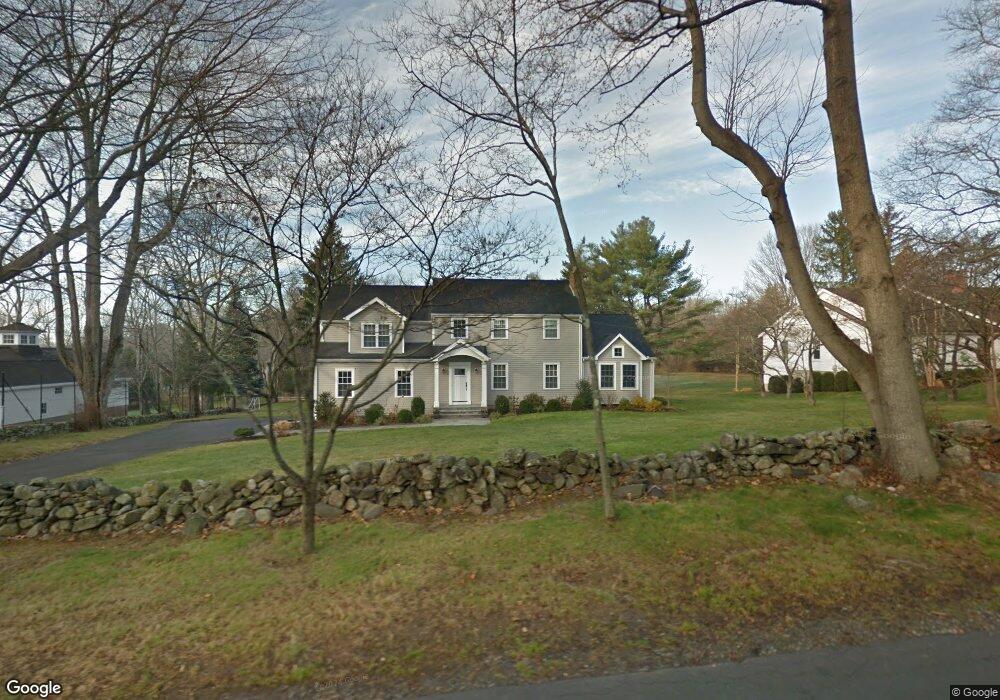
715 Mill Hill Rd Southport, CT 06890
Estimated Value: $1,528,000 - $1,858,000
4
Beds
3
Baths
3,104
Sq Ft
$528/Sq Ft
Est. Value
About This Home
This home is located at 715 Mill Hill Rd, Southport, CT 06890 and is currently estimated at $1,640,461, approximately $528 per square foot. 715 Mill Hill Rd is a home located in Fairfield County with nearby schools including Mill Hill School, Roger Ludlowe Middle School, and Fairfield Ludlowe High School.
Ownership History
Date
Name
Owned For
Owner Type
Purchase Details
Closed on
Aug 29, 2003
Sold by
Edelstein Stewart I and Edelstein Lynn P
Bought by
Monteiro Chris A and Monteiro Jeanine M
Current Estimated Value
Home Financials for this Owner
Home Financials are based on the most recent Mortgage that was taken out on this home.
Original Mortgage
$455,000
Outstanding Balance
$203,059
Interest Rate
5.69%
Estimated Equity
$1,437,402
Create a Home Valuation Report for This Property
The Home Valuation Report is an in-depth analysis detailing your home's value as well as a comparison with similar homes in the area
Home Values in the Area
Average Home Value in this Area
Purchase History
| Date | Buyer | Sale Price | Title Company |
|---|---|---|---|
| Monteiro Chris A | $725,000 | -- | |
| Monteiro Chris A | $725,000 | -- |
Source: Public Records
Mortgage History
| Date | Status | Borrower | Loan Amount |
|---|---|---|---|
| Open | Monteiro Chris A | $200,000 | |
| Closed | Monteiro Chris A | $200,000 | |
| Open | Monteiro Chris A | $455,000 | |
| Closed | Monteiro Chris A | $455,000 |
Source: Public Records
Tax History Compared to Growth
Tax History
| Year | Tax Paid | Tax Assessment Tax Assessment Total Assessment is a certain percentage of the fair market value that is determined by local assessors to be the total taxable value of land and additions on the property. | Land | Improvement |
|---|---|---|---|---|
| 2025 | $20,121 | $708,750 | $435,890 | $272,860 |
| 2024 | $19,774 | $708,750 | $435,890 | $272,860 |
| 2023 | $19,498 | $708,750 | $435,890 | $272,860 |
| 2022 | $19,306 | $708,750 | $435,890 | $272,860 |
| 2021 | $19,122 | $708,750 | $435,890 | $272,860 |
| 2020 | $19,876 | $741,930 | $431,410 | $310,520 |
| 2019 | $19,876 | $741,930 | $431,410 | $310,520 |
| 2018 | $19,299 | $732,130 | $431,410 | $300,720 |
| 2017 | $18,904 | $732,130 | $431,410 | $300,720 |
| 2016 | $18,633 | $732,130 | $431,410 | $300,720 |
| 2015 | $17,858 | $720,370 | $456,190 | $264,180 |
| 2014 | $17,234 | $706,300 | $456,190 | $250,110 |
Source: Public Records
Map
Nearby Homes
- 476 Mill Hill Terrace
- 844 Mill Hill Terrace
- 1135 Mill Hill Rd
- 53 Hilltop Dr
- 647 Bronson Rd
- 28 Mill Hill Rd Unit 28
- 153 Pease Ave
- 232 Pell Meadow Dr
- 2 Elmwood Dr Unit 2
- 100 Overhill Rd
- 88 Overhill Rd
- 21 Beaumont St
- 209 S Pine Creek Rd
- 1213 Cedar Rd
- 43 Helen St
- 688 Hulls Farm Rd
- 57 Beaumont Place
- 85 Patrick Dr
- 65 Thorpe St Unit 65
- 65 Thorpe St
- 739 Mill Hill Rd
- 687 Mill Hill Rd
- 775 Mill Hill Rd
- 657 Mill Hill Rd
- 70 Juniper Ln
- 40 Juniper Ln
- 76 Juniper Ln
- 710 Mill Hill Rd
- 56 Juniper Ln
- 42 Barberry Rd
- 680 Mill Hill Rd
- 762 Mill Hill Rd
- 66 Barberry Rd
- 26 Barberry Rd
- 55 Juniper Ln
- 88 Juniper Ln
- 636 Mill Hill Rd
- 620 Mill Hill Rd
- 778 Mill Hill Rd
- 1 Juniper Ln