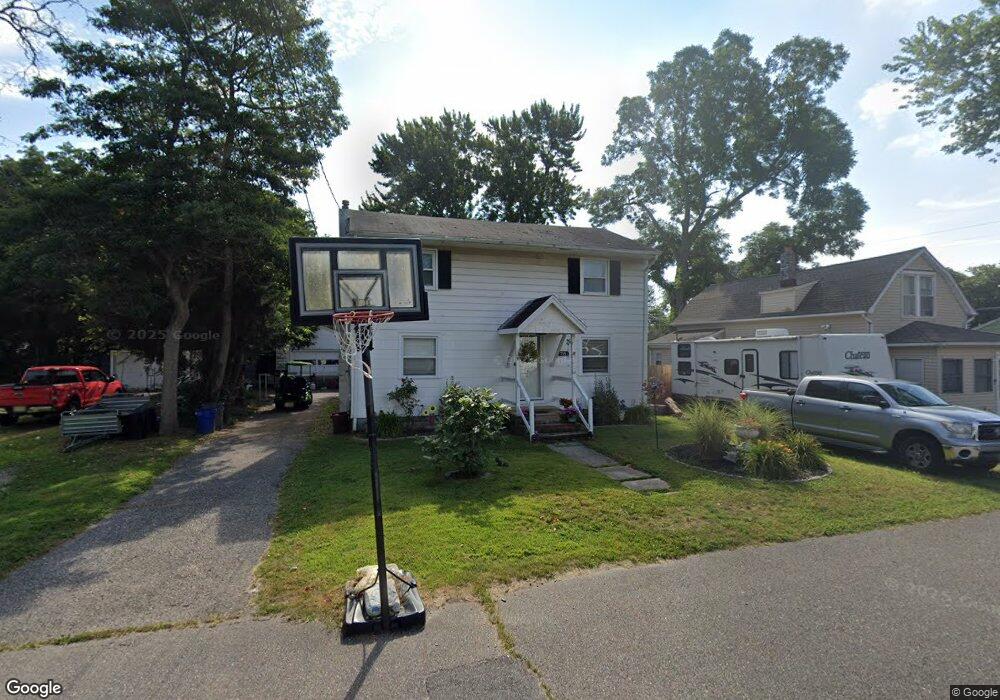
715 Navesink Ave Ocean Gate, NJ 08740
Estimated Value: $361,000 - $427,000
2
Beds
2
Baths
1,372
Sq Ft
$288/Sq Ft
Est. Value
About This Home
This home is located at 715 Navesink Ave, Ocean Gate, NJ 08740 and is currently estimated at $394,458, approximately $287 per square foot. 715 Navesink Ave is a home located in Ocean County with nearby schools including Ocean Gate Elementary School, Central Regional Middle School, and Central Regional High School.
Ownership History
Date
Name
Owned For
Owner Type
Purchase Details
Closed on
Jan 13, 2021
Sold by
Boyle Arnold E
Bought by
Boyle Kathleen Erin
Current Estimated Value
Home Financials for this Owner
Home Financials are based on the most recent Mortgage that was taken out on this home.
Original Mortgage
$167,500
Outstanding Balance
$149,389
Interest Rate
2.67%
Mortgage Type
New Conventional
Estimated Equity
$245,069
Purchase Details
Closed on
Apr 14, 2003
Create a Home Valuation Report for This Property
The Home Valuation Report is an in-depth analysis detailing your home's value as well as a comparison with similar homes in the area
Home Values in the Area
Average Home Value in this Area
Purchase History
| Date | Buyer | Sale Price | Title Company |
|---|---|---|---|
| Boyle Kathleen Erin | $209,375 | Westcor Land Title Ins Co | |
| Boyle Kathleen Erin | $209,375 | Land Title | |
| -- | -- | -- |
Source: Public Records
Mortgage History
| Date | Status | Borrower | Loan Amount |
|---|---|---|---|
| Open | Boyle Kathleen Erin | $167,500 | |
| Closed | Boyle Kathleen Erin | $167,500 |
Source: Public Records
Tax History Compared to Growth
Tax History
| Year | Tax Paid | Tax Assessment Tax Assessment Total Assessment is a certain percentage of the fair market value that is determined by local assessors to be the total taxable value of land and additions on the property. | Land | Improvement |
|---|---|---|---|---|
| 2025 | $5,294 | $322,000 | $163,000 | $159,000 |
| 2024 | $4,411 | $322,000 | $163,000 | $159,000 |
| 2023 | $4,063 | $146,100 | $65,400 | $80,700 |
| 2022 | $4,063 | $146,100 | $65,400 | $80,700 |
| 2021 | $3,889 | $146,100 | $65,400 | $80,700 |
| 2020 | $3,920 | $146,100 | $65,400 | $80,700 |
| 2019 | $3,825 | $146,100 | $65,400 | $80,700 |
| 2018 | $3,692 | $146,100 | $65,400 | $80,700 |
| 2017 | $3,664 | $146,100 | $65,400 | $80,700 |
| 2016 | $3,635 | $146,100 | $65,400 | $80,700 |
| 2015 | $3,844 | $188,600 | $107,500 | $81,100 |
| 2014 | $3,861 | $188,600 | $107,500 | $81,100 |
Source: Public Records
Map
Nearby Homes
- 36 W Point Pleasant Ave
- 553 Ocean Gate Dr
- 3 Sheila Ct
- 803 Ocean Gate Dr
- 32 E Long Branch Ave
- 0 Jane Ave
- 257 Ocean Gate Turnpike
- 142 E Lakewood Ave
- 253 Shore Blvd
- 39 Ivy Ct
- 238 Lakewood Ave
- 221 E Lakewood Ave
- 318 E Cape May Ave
- 227 Chelsea Ave
- 416 Monmouth Ave
- 87 Puffin Glade Unit 87
- 99 Holly Ln
- 530 E Point Pleasant Ave
- 409 Newport Ave
- 58 Ronald Ave S
- 719 Navesink Ave
- 711 Navesink Ave
- 47 W Cape May Ave
- 707 Navesink Ave
- 44 W Point Pleasant Ave
- 41 W Cape May Ave
- 803 Navesink Ave
- 716 Navesink Ave
- 706 Navesink Ave
- 48 W Cape May Ave
- 23 W Point Pleasant Ave
- 40 W Point Pleasant Ave
- 700 Navesink Ave
- 46 W Cape May Ave
- 100 W Cape May Ave
- 36 E Point Pleasant Ave
- 615 Navesink Ave
- 111 W Cape May Ave
- 40 W Cape May Ave
- 27 W Cape May Ave