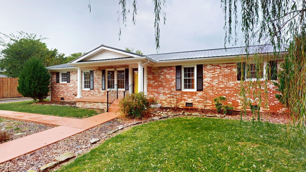
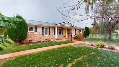
715 Poplar Bluff Rd E Auburntown, TN 37016
Cannon County NeighborhoodEstimated payment $1,847/month
Highlights
- Wood Flooring
- Great Room
- Stainless Steel Appliances
- Separate Formal Living Room
- No HOA
- Circular Driveway
About This Home
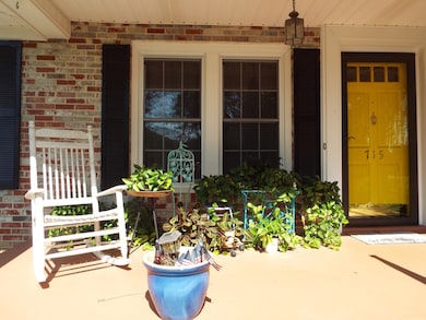
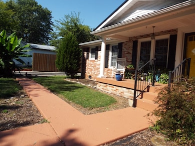
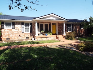
This home has been "WELL KEPT" and ready for a new owner to love it! Discover the perfect balance of rural tranquility and modern convenience in this impeccably maintained all brick ranch. The heart of the home is a kitchen featuring white cabinetry, glass fronts and stainless steel appliances--perfect for the home chef and a large formal dining room for those "special occasions." With over 2,050 sq ft of space, this home offers a versatile "flex room" for your home office or workout room, plus a massive 35 ft. sunroom with sliding glass wondows to catch the breeze. Situated on a level 0.6 acre lot with a circular drive and an existing concrete slab for a future garage or shop, this home is a rare find at $163 per sq ft.
Listing Agent
Agee & Johnson Realty & Auction, Inc Brokerage Phone: 6158044781 License #260893 Listed on: 09/25/2025
Home Details
Home Type
- Single Family
Est. Annual Taxes
- $853
Year Built
- Built in 1966
Lot Details
- 26,136 Sq Ft Lot
- Lot Dimensions are 195x143
- Back Yard Fenced
- Level Lot
- Cleared Lot
Home Design
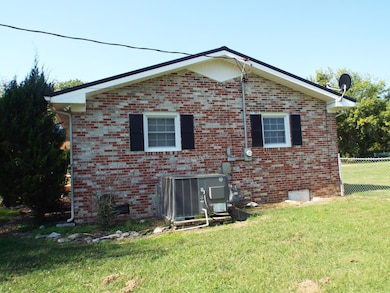
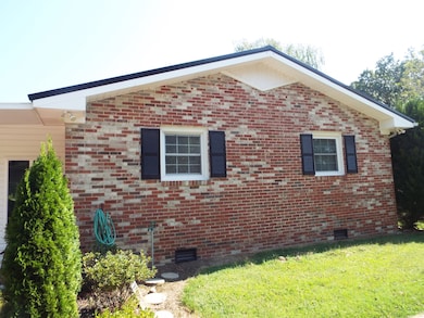
- Brick Exterior Construction
- Metal Roof
Interior Spaces
- 2,052 Sq Ft Home
- Property has 1 Level
- Ceiling Fan
- Great Room
- Separate Formal Living Room
- Utility Room
- Washer and Electric Dryer Hookup
- Crawl Space
Kitchen
- Ice Maker
- Dishwasher
- Stainless Steel Appliances
Flooring
- Wood
- Tile
- Vinyl
Bedrooms and Bathrooms
- 3 Main Level Bedrooms
- 1 Full Bathroom
Home Security
- Carbon Monoxide Detectors
- Fire and Smoke Detector
Parking
- 10 Open Parking Spaces
- 10 Parking Spaces
- Circular Driveway
Outdoor Features
- Patio
Schools
- Cannon County Elementary School
- Cannon County Middle School
- Cannon County High School
Utilities
- Central Heating and Cooling System
- Heating System Uses Natural Gas
- Septic Tank
- High Speed Internet
Community Details
- No Home Owners Association
- Excellent Level Lot Subdivision
Listing and Financial Details
- Assessor Parcel Number 003I A 00700 000
Map
Home Values in the Area
Average Home Value in this Area
Tax History
| Year | Tax Paid | Tax Assessment Tax Assessment Total Assessment is a certain percentage of the fair market value that is determined by local assessors to be the total taxable value of land and additions on the property. | Land | Improvement |
|---|---|---|---|---|
| 2025 | -- | $53,450 | $8,400 | $45,050 |
| 2024 | $0 | $53,450 | $8,400 | $45,050 |
| 2023 | $815 | $53,450 | $8,400 | $45,050 |
| 2022 | $779 | $31,650 | $4,000 | $27,650 |
| 2021 | $779 | $31,650 | $4,000 | $27,650 |
| 2020 | $779 | $31,650 | $4,000 | $27,650 |
| 2019 | $779 | $31,650 | $4,000 | $27,650 |
| 2018 | $755 | $31,650 | $4,000 | $27,650 |
| 2017 | $719 | $24,875 | $3,750 | $21,125 |
| 2016 | $684 | $24,875 | $3,750 | $21,125 |
| 2015 | $629 | $24,875 | $3,750 | $21,125 |
| 2014 | $712 | $28,150 | $3,750 | $24,400 |
Property History
| Date | Event | Price | List to Sale | Price per Sq Ft |
|---|---|---|---|---|
| 03/26/2026 03/26/26 | Pending | -- | -- | -- |
| 11/12/2025 11/12/25 | Price Changed | $335,000 | -2.9% | $163 / Sq Ft |
| 10/24/2025 10/24/25 | Price Changed | $345,000 | -2.8% | $168 / Sq Ft |
| 09/25/2025 09/25/25 | For Sale | $355,000 | -- | $173 / Sq Ft |
Purchase History
| Date | Type | Sale Price | Title Company |
|---|---|---|---|
| Quit Claim Deed | -- | None Listed On Document | |
| Quit Claim Deed | -- | None Listed On Document | |
| Warranty Deed | $77,500 | -- | |
| Warranty Deed | $89,000 | -- | |
| Warranty Deed | $57,000 | -- | |
| Deed | -- | -- |
Mortgage History
| Date | Status | Loan Amount | Loan Type |
|---|---|---|---|
| Previous Owner | $62,000 | New Conventional |
Source: Realtracs
MLS Number: 2994835
APN: 003I-A-007.00
Disclaimer: Certain information contained herein is derived from information provided by parties other than Homes.com. All information provided is deemed reliable, but is not guaranteed to be accurate and should be independently verified.
![]() Based on information submitted to the MLS GRID. All data is obtained from various sources and may not have been verified by broker or MLS GRID. Supplied Open House Information is subject to change without notice. All information should be independently reviewed and verified for accuracy. Properties may or may not be listed by the office/agent presenting the information. Some IDX listings have been excluded from this website.
Based on information submitted to the MLS GRID. All data is obtained from various sources and may not have been verified by broker or MLS GRID. Supplied Open House Information is subject to change without notice. All information should be independently reviewed and verified for accuracy. Properties may or may not be listed by the office/agent presenting the information. Some IDX listings have been excluded from this website.
Listings courtesy of Realtracs as distributed by MLS GRID
- 0 Highway 96 Unit 1
- 0 Poplar Bluff Rd W Unit RTC2811548
- 53 Re Davenport Ave
- 112 Re Davenport Ave
- 6029 Hurricane Creek Rd
- 220 W Main St
- 2063 Kennedy Creek Rd
- 2046 Kennedy Creek Rd
- 0 Statesville Rd
- 0 Marshall Creek Rd Unit RTC3152349
- 0 Hurricane Creek Rd
- 3960 Hurricane Creek Rd
- 1425 Fuston Hollow Rd
- 3780 Hurricane Creek Rd
- 659 Turney Rd
- 0 Turney Rd
- 5424 Auburntown Rd Unit 4
- 5424 Auburntown Rd Unit 3
- 6 Dimple Crest Dr
- 6565 Greenvale Rd

Ask me questions while you tour the home.