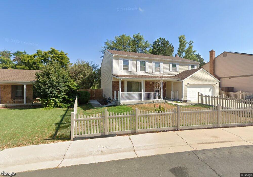
715 S Laredo Cir Aurora, CO 80017
Centre Pointe NeighborhoodEstimated Value: $481,000 - $542,000
3
Beds
3
Baths
2,152
Sq Ft
$234/Sq Ft
Est. Value
About This Home
This home is located at 715 S Laredo Cir, Aurora, CO 80017 and is currently estimated at $502,999, approximately $233 per square foot. 715 S Laredo Cir is a home located in Arapahoe County with nearby schools including Tollgate Elementary School of Expeditionary Learning, Mrachek Middle School, and Gateway High School.
Ownership History
Date
Name
Owned For
Owner Type
Purchase Details
Closed on
Sep 29, 2006
Sold by
Fisher Dennis H and Fisher Patricia A
Bought by
White John T
Current Estimated Value
Home Financials for this Owner
Home Financials are based on the most recent Mortgage that was taken out on this home.
Original Mortgage
$185,400
Outstanding Balance
$128,130
Interest Rate
9.75%
Mortgage Type
Purchase Money Mortgage
Estimated Equity
$374,869
Purchase Details
Closed on
Mar 1, 1979
Sold by
Conversion Arapco
Bought by
Conversion Arapco
Purchase Details
Closed on
Jul 4, 1776
Bought by
Conversion Arapco
Create a Home Valuation Report for This Property
The Home Valuation Report is an in-depth analysis detailing your home's value as well as a comparison with similar homes in the area
Home Values in the Area
Average Home Value in this Area
Purchase History
| Date | Buyer | Sale Price | Title Company |
|---|---|---|---|
| White John T | $206,000 | None Available | |
| Conversion Arapco | -- | -- | |
| Conversion Arapco | -- | -- |
Source: Public Records
Mortgage History
| Date | Status | Borrower | Loan Amount |
|---|---|---|---|
| Open | White John T | $185,400 |
Source: Public Records
Tax History Compared to Growth
Tax History
| Year | Tax Paid | Tax Assessment Tax Assessment Total Assessment is a certain percentage of the fair market value that is determined by local assessors to be the total taxable value of land and additions on the property. | Land | Improvement |
|---|---|---|---|---|
| 2024 | $2,404 | $32,569 | -- | -- |
| 2023 | $2,404 | $32,569 | $0 | $0 |
| 2022 | $1,925 | $26,125 | $0 | $0 |
| 2021 | $1,988 | $26,125 | $0 | $0 |
| 2020 | $1,917 | $25,561 | $0 | $0 |
| 2019 | $1,907 | $25,561 | $0 | $0 |
| 2018 | $1,753 | $23,774 | $0 | $0 |
| 2017 | $1,525 | $23,774 | $0 | $0 |
| 2016 | $1,718 | $18,284 | $0 | $0 |
| 2015 | $1,658 | $18,284 | $0 | $0 |
| 2014 | -- | $12,840 | $0 | $0 |
| 2013 | -- | $13,860 | $0 | $0 |
Source: Public Records
Map
Nearby Homes
- 16136 E Exposition Dr
- 16135 E Exposition Dr
- 16094 E Exposition Dr
- 611 S Laredo Cir
- 497 S Memphis Way Unit 17
- 477 S Memphis Way Unit 11
- 15875 E Custer Dr
- 16405 E Kentucky Ave
- 467 S Memphis Way Unit 17
- 447 S Memphis Way Unit 7
- 16001 E Alaska Place Unit 7
- 16001 E Alaska Place Unit 1
- 491 S Kalispell Way Unit 207
- 444 S Kittredge St Unit 205
- 481 S Kalispell Way Unit 306
- 1024 S Mobile St
- 431 S Kalispell Way Unit 308
- 401 S Kalispell Way Unit 104
- 401 S Kalispell Way Unit 206
- 17055 E Alameda Pkwy
- 717 S Laredo Cir
- 713 S Laredo Cir
- 711 S Memphis Way
- 719 S Laredo Cir
- 16278 E Exposition Dr
- 719 S Memphis Way
- 16258 E Exposition Dr
- 709 S Memphis Way
- 721 S Laredo Cir
- 718 S Laredo Cir
- 729 S Memphis Way
- 712 S Memphis Way
- 16238 E Exposition Dr
- 16306 E Exposition Dr
- 707 S Memphis Way
- 710 S Memphis Way
- 720 S Laredo Cir
- 723 S Laredo Cir
- 720 S Memphis Way
- 739 S Memphis Way