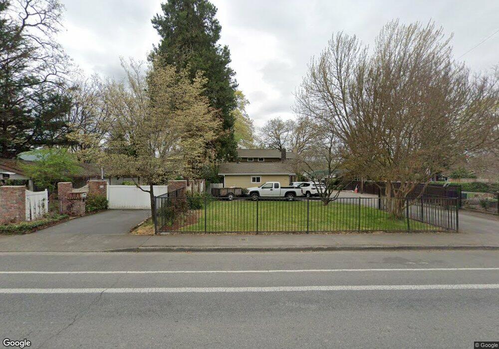
715 SE M St Grants Pass, OR 97526
Estimated Value: $572,000 - $630,718
5
Beds
4
Baths
2,754
Sq Ft
$218/Sq Ft
Est. Value
About This Home
This home is located at 715 SE M St, Grants Pass, OR 97526 and is currently estimated at $601,359, approximately $218 per square foot. 715 SE M St is a home located in Josephine County with nearby schools including Riverside Elementary School, South Middle School, and Grants Pass High School.
Ownership History
Date
Name
Owned For
Owner Type
Purchase Details
Closed on
Apr 25, 2015
Sold by
Moye Louie D
Bought by
Moye Sara C
Current Estimated Value
Purchase Details
Closed on
Oct 21, 2011
Sold by
Bac Home Loans Servicing Lp
Bought by
Moye Louie D and Moye Sara C
Purchase Details
Closed on
Dec 22, 2010
Sold by
Bac Home Loans Servicing Lp
Bought by
Bac Home Loans Servicing Lp and Citigroup Global Markets Realty Corp
Purchase Details
Closed on
Oct 8, 2010
Sold by
Drevets Keith P and Drevets Patricia F
Bought by
Bac Home Loans Servicing Lp
Purchase Details
Closed on
Mar 9, 2005
Sold by
Jones Kerri R
Bought by
Drevets Keith P and Drevets Patricia F
Home Financials for this Owner
Home Financials are based on the most recent Mortgage that was taken out on this home.
Original Mortgage
$97,700
Interest Rate
5.65%
Mortgage Type
Credit Line Revolving
Create a Home Valuation Report for This Property
The Home Valuation Report is an in-depth analysis detailing your home's value as well as a comparison with similar homes in the area
Home Values in the Area
Average Home Value in this Area
Purchase History
| Date | Buyer | Sale Price | Title Company |
|---|---|---|---|
| Moye Sara C | -- | None Available | |
| Moye Louie D | $249,375 | Fa | |
| Bac Home Loans Servicing Lp | -- | Accommodation | |
| Bac Home Loans Servicing Lp | $424,410 | Accommodation | |
| Drevets Keith P | $553,000 | First American |
Source: Public Records
Mortgage History
| Date | Status | Borrower | Loan Amount |
|---|---|---|---|
| Previous Owner | Drevets Keith P | $97,700 | |
| Previous Owner | Drevets Keith P | $400,000 |
Source: Public Records
Tax History Compared to Growth
Tax History
| Year | Tax Paid | Tax Assessment Tax Assessment Total Assessment is a certain percentage of the fair market value that is determined by local assessors to be the total taxable value of land and additions on the property. | Land | Improvement |
|---|---|---|---|---|
| 2025 | $6,076 | $467,880 | -- | -- |
| 2024 | $6,076 | $454,260 | -- | -- |
| 2023 | $5,900 | $441,030 | $0 | $0 |
| 2022 | $5,750 | $428,190 | -- | -- |
| 2021 | $5,400 | $415,720 | $0 | $0 |
| 2020 | $5,245 | $403,620 | $0 | $0 |
| 2019 | $5,093 | $391,870 | $0 | $0 |
| 2018 | $5,183 | $380,460 | $0 | $0 |
| 2017 | $5,144 | $369,380 | $0 | $0 |
| 2016 | $4,522 | $358,630 | $0 | $0 |
| 2015 | $4,238 | $348,190 | $0 | $0 |
| 2014 | -- | $346,300 | $0 | $0 |
Source: Public Records
Map
Nearby Homes
- 737 SE M St
- 711 SE Riverside Ave
- 619 SE M St
- 710 SE 12th St
- 861 SE M St
- 1288 Tobin Ct
- 900 SE Mystic Dr
- 702 SE 9th St
- 120 Gold River Ln
- 415 SE J St
- 115 Gold River Ln
- 409 SE J St
- 115 Rogue River Hwy Unit 302
- 115 Rogue River Hwy Unit 307
- 1059 SE Belle Aire Dr
- 1034 SE Clarey Ave
- 805 Bower Ln
- 1195 E Park St
- 1201 E Park St
- 1060 SE Oriole St