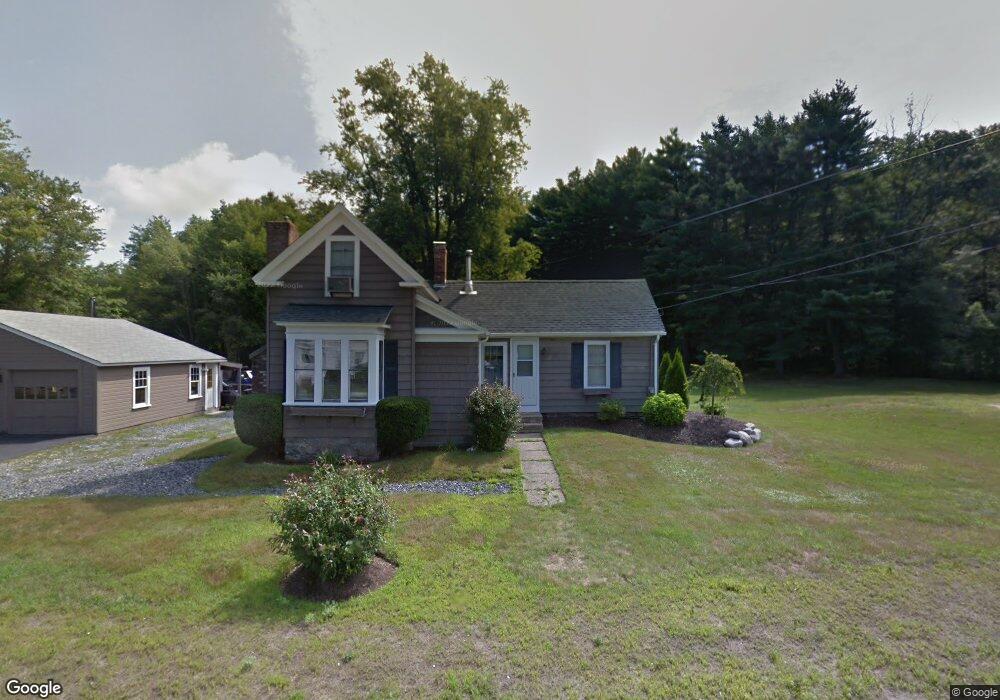
715 South St Wrentham, MA 02093
Estimated Value: $541,000 - $821,000
3
Beds
2
Baths
1,291
Sq Ft
$519/Sq Ft
Est. Value
About This Home
This home is located at 715 South St, Wrentham, MA 02093 and is currently estimated at $669,629, approximately $518 per square foot. 715 South St is a home located in Norfolk County with nearby schools including Delaney Elementary School and Charles E Roderick.
Ownership History
Date
Name
Owned For
Owner Type
Purchase Details
Closed on
Dec 28, 2011
Sold by
Banian Charles J
Bought by
Banian Charles J and Banian Lisa
Current Estimated Value
Home Financials for this Owner
Home Financials are based on the most recent Mortgage that was taken out on this home.
Original Mortgage
$222,000
Outstanding Balance
$127,468
Interest Rate
4%
Mortgage Type
Purchase Money Mortgage
Estimated Equity
$542,161
Purchase Details
Closed on
Mar 1, 2005
Sold by
Potts Lawrence J and Potts Sally
Bought by
Hamel Edward J and Scannell Lisa
Home Financials for this Owner
Home Financials are based on the most recent Mortgage that was taken out on this home.
Original Mortgage
$45,000
Interest Rate
5.73%
Mortgage Type
Purchase Money Mortgage
Purchase Details
Closed on
Feb 27, 2004
Sold by
Rogers Edith L
Bought by
Potts Lawrence J and Potts Sally
Home Financials for this Owner
Home Financials are based on the most recent Mortgage that was taken out on this home.
Original Mortgage
$238,500
Interest Rate
5.65%
Mortgage Type
Purchase Money Mortgage
Create a Home Valuation Report for This Property
The Home Valuation Report is an in-depth analysis detailing your home's value as well as a comparison with similar homes in the area
Home Values in the Area
Average Home Value in this Area
Purchase History
| Date | Buyer | Sale Price | Title Company |
|---|---|---|---|
| Banian Charles J | -- | -- | |
| Hamel Edward J | $300,000 | -- | |
| Potts Lawrence J | $265,000 | -- |
Source: Public Records
Mortgage History
| Date | Status | Borrower | Loan Amount |
|---|---|---|---|
| Open | Banian Charles J | $222,000 | |
| Previous Owner | Hamel Edward J | $45,000 | |
| Previous Owner | Hamel Edward J | $240,000 | |
| Previous Owner | Potts Lawrence J | $238,500 |
Source: Public Records
Tax History Compared to Growth
Tax History
| Year | Tax Paid | Tax Assessment Tax Assessment Total Assessment is a certain percentage of the fair market value that is determined by local assessors to be the total taxable value of land and additions on the property. | Land | Improvement |
|---|---|---|---|---|
| 2025 | $5,774 | $498,200 | $299,400 | $198,800 |
| 2024 | $5,600 | $466,700 | $299,400 | $167,300 |
| 2023 | $5,420 | $429,500 | $272,600 | $156,900 |
| 2022 | $4,789 | $350,300 | $217,800 | $132,500 |
| 2021 | $4,448 | $316,100 | $185,300 | $130,800 |
| 2020 | $4,107 | $288,200 | $154,200 | $134,000 |
| 2019 | $4,020 | $284,700 | $154,200 | $130,500 |
| 2018 | $3,812 | $267,700 | $154,400 | $113,300 |
| 2017 | $3,642 | $255,600 | $151,400 | $104,200 |
| 2016 | $3,516 | $246,200 | $147,000 | $99,200 |
| 2015 | $3,432 | $229,100 | $141,400 | $87,700 |
| 2014 | $3,399 | $222,000 | $136,000 | $86,000 |
Source: Public Records
Map
Nearby Homes
- 791 South St Unit 5
- Lot 1 - Blueberry 2 Car Plan at King Philip Estates
- Lot 8 - Blueberry 2 Car Plan at King Philip Estates
- Lot 5 - Hughes 2 car Plan at King Philip Estates
- Lot 6 - Blueberry 3 Car Plan at King Philip Estates
- Lot 2 - Camden 2 Car Plan at King Philip Estates
- Lot 7 - Cedar Plan at King Philip Estates
- Lot 4 - Hemingway 2 Car Plan at King Philip Estates
- Lot 3 - Blueberry 2 Car Plan at King Philip Estates
- Lot 3 - 14 Earle Stewart Ln
- 11 Earle Stewart Ln
- 131 Creek St Unit 7
- 319 Taunton St
- 1204 South St
- 1222 South St
- 50 Green St
- 440 Chestnut St
- 80 Carriage House Ln
- 10 Nature View Dr
- 15 Nature View Dr
- 708 South St
- 721 South St
- 714 South St
- 685 South St Unit L
- 685 South St Unit E
- 685 South St Unit 2
- 685 South St
- 685 South St Unit G
- 685 South St Unit A
- 685 South St Unit F or G
- 685 South St Unit F
- 685 South St Unit B
- 686 South St Unit 3
- 686 South St Unit 6A
- 686 South St Unit 9
- 686 South St Unit 4
- 686 South St Unit R
- 686 South St Unit 2
- 686 South St Unit 6
- 674 South St