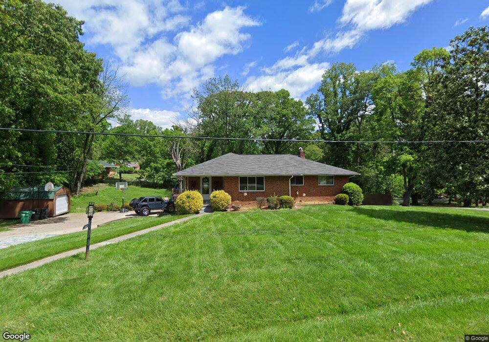
715 Summit Rd High Point, NC 27265
Greater High Point NeighborhoodEstimated Value: $219,000 - $271,000
3
Beds
2
Baths
1,890
Sq Ft
$136/Sq Ft
Est. Value
About This Home
This home is located at 715 Summit Rd, High Point, NC 27265 and is currently estimated at $257,158, approximately $136 per square foot. 715 Summit Rd is a home located in Guilford County with nearby schools including Montlieu Academy of Technology, Welborn Academy of Science & Technology, and T.W. Andrews High School.
Ownership History
Date
Name
Owned For
Owner Type
Purchase Details
Closed on
Nov 25, 2009
Sold by
Valued Investment Properties Llc
Bought by
Olasin Michael and Olasin Barbara
Current Estimated Value
Home Financials for this Owner
Home Financials are based on the most recent Mortgage that was taken out on this home.
Original Mortgage
$89,500
Interest Rate
4.94%
Mortgage Type
Purchase Money Mortgage
Purchase Details
Closed on
Jul 29, 1999
Sold by
Aguilar Patricia H
Bought by
Hutchinson Patricia
Home Financials for this Owner
Home Financials are based on the most recent Mortgage that was taken out on this home.
Original Mortgage
$94,500
Interest Rate
7.66%
Purchase Details
Closed on
Apr 19, 1999
Sold by
Aguilar Jose J
Bought by
Aguilar Patricia Hutchinson
Create a Home Valuation Report for This Property
The Home Valuation Report is an in-depth analysis detailing your home's value as well as a comparison with similar homes in the area
Home Values in the Area
Average Home Value in this Area
Purchase History
| Date | Buyer | Sale Price | Title Company |
|---|---|---|---|
| Olasin Michael | $91,500 | None Available | |
| Hutchinson Patricia | -- | -- | |
| Aguilar Patricia Hutchinson | -- | -- |
Source: Public Records
Mortgage History
| Date | Status | Borrower | Loan Amount |
|---|---|---|---|
| Closed | Olasin Michael | $89,500 | |
| Previous Owner | Hutchinson Patricia | $94,500 |
Source: Public Records
Tax History
| Year | Tax Paid | Tax Assessment Tax Assessment Total Assessment is a certain percentage of the fair market value that is determined by local assessors to be the total taxable value of land and additions on the property. | Land | Improvement |
|---|---|---|---|---|
| 2025 | $2,055 | $149,100 | $31,500 | $117,600 |
| 2024 | $2,055 | $149,100 | $31,500 | $117,600 |
| 2023 | $2,055 | $149,100 | $31,500 | $117,600 |
| 2022 | $2,010 | $149,100 | $31,500 | $117,600 |
| 2021 | $1,441 | $104,600 | $26,300 | $78,300 |
| 2020 | $1,441 | $104,600 | $26,300 | $78,300 |
| 2019 | $1,441 | $104,600 | $0 | $0 |
| 2018 | $1,434 | $104,600 | $0 | $0 |
| 2017 | $1,441 | $104,600 | $0 | $0 |
| 2016 | $1,052 | $75,000 | $0 | $0 |
| 2015 | $1,058 | $75,000 | $0 | $0 |
| 2014 | $1,076 | $75,000 | $0 | $0 |
Source: Public Records
Map
Nearby Homes
- 423 Dogwood Cir
- 1227 Greensboro Rd
- 211 Spencer St
- 122 Orville Dr
- 120 Orville Dr
- 113 Red Plum Ln
- 2373 Dukes Hollow Ct
- 1217 Lakeview Heights Dr
- 1456 London Dr
- 3226 Derby Cir
- 2700 Edenridge Dr
- 2606 Wexford Place
- 2429 Dukes Hollow Ct
- 2674 Splitbrooke Dr
- 1451 Finsbury Ln
- 2101 Arbrook Ln
- 2706 Edenridge Dr
- 2462 Dukes Hollow Ct
- 1746 Stoneybrook Dr
- 2507 E Lexington Ave
- 711 Summit Rd
- 317 Dogwood Cir
- 209 Dogwood Cir
- 306 Dogwood Cir
- 300 Dogwood Cir
- 709 Summit Rd
- 710 Summit Rd
- 205 Dogwood Cir
- 319 Dogwood Cir
- 208 Dogwood Cir
- 314 Dogwood Cir
- 708 Summit Rd
- 707 Summit Rd
- 204 Dogwood Cir
- 318 Dogwood Cir
- 203 Dogwood Cir
- 719 Locust Place
- 706 Summit Rd
- 202 Dogwood Cir
- 323 Dogwood Cir
Your Personal Tour Guide
Ask me questions while you tour the home.