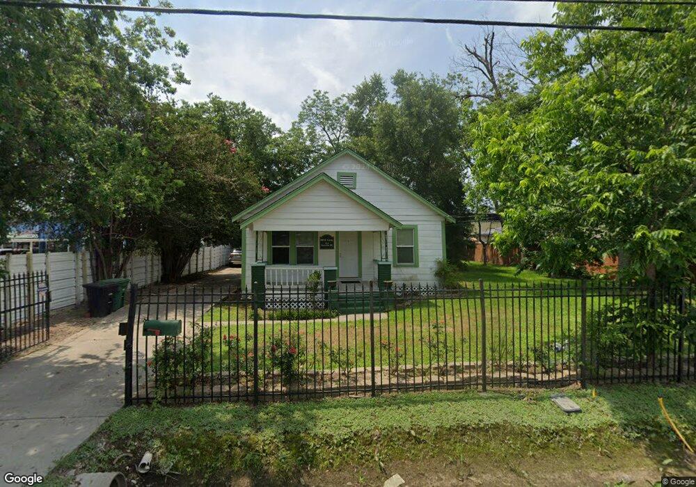
715 Thornton Rd Houston, TX 77018
Oak Forest-Garden Oaks NeighborhoodEstimated Value: $359,000 - $477,000
2
Beds
1
Bath
1,088
Sq Ft
$374/Sq Ft
Est. Value
About This Home
This home is located at 715 Thornton Rd, Houston, TX 77018 and is currently estimated at $406,591, approximately $373 per square foot. 715 Thornton Rd is a home located in Harris County with nearby schools including Durham Elementary School, Frank Black Middle School, and Waltrip High School.
Ownership History
Date
Name
Owned For
Owner Type
Purchase Details
Closed on
Jan 17, 2005
Sold by
Miller Family Partnership
Bought by
American Cornerstone Inc
Current Estimated Value
Home Financials for this Owner
Home Financials are based on the most recent Mortgage that was taken out on this home.
Original Mortgage
$101,500
Interest Rate
5.68%
Mortgage Type
Purchase Money Mortgage
Purchase Details
Closed on
Nov 8, 2004
Sold by
Griffith Lessly D and Griffith Karla K
Bought by
Miller Family Partnership
Home Financials for this Owner
Home Financials are based on the most recent Mortgage that was taken out on this home.
Original Mortgage
$80,000
Interest Rate
5.87%
Mortgage Type
Purchase Money Mortgage
Create a Home Valuation Report for This Property
The Home Valuation Report is an in-depth analysis detailing your home's value as well as a comparison with similar homes in the area
Home Values in the Area
Average Home Value in this Area
Purchase History
| Date | Buyer | Sale Price | Title Company |
|---|---|---|---|
| American Cornerstone Inc | -- | Stewart Title Houston | |
| Miller Family Partnership | -- | Stewart Title Houston |
Source: Public Records
Mortgage History
| Date | Status | Borrower | Loan Amount |
|---|---|---|---|
| Closed | American Cornerstone Inc | $101,500 | |
| Previous Owner | Miller Family Partnership | $80,000 |
Source: Public Records
Tax History Compared to Growth
Tax History
| Year | Tax Paid | Tax Assessment Tax Assessment Total Assessment is a certain percentage of the fair market value that is determined by local assessors to be the total taxable value of land and additions on the property. | Land | Improvement |
|---|---|---|---|---|
| 2025 | $8,469 | $436,051 | $421,680 | $14,371 |
| 2024 | $8,469 | $380,000 | $371,480 | $8,520 |
| 2023 | $8,469 | $354,571 | $321,280 | $33,291 |
| 2022 | $6,781 | $307,985 | $301,200 | $6,785 |
| 2021 | $6,575 | $282,120 | $281,120 | $1,000 |
| 2020 | $6,177 | $255,089 | $230,920 | $24,169 |
| 2019 | $5,099 | $201,504 | $170,680 | $30,824 |
| 2018 | $4,069 | $160,800 | $120,480 | $40,320 |
| 2017 | $3,210 | $126,949 | $60,240 | $66,709 |
| 2016 | $3,210 | $126,949 | $60,240 | $66,709 |
| 2015 | -- | $124,807 | $60,240 | $64,567 |
| 2014 | -- | $109,278 | $60,240 | $49,038 |
Source: Public Records
Map
Nearby Homes
- 752 Curtin St
- 750 Curtin St
- 748 Curtin St
- 744 Curtin St
- 742 Curtin St
- 719 Thornton Rd Unit B
- 719 Thornton Rd Unit E
- 719 Thornton Rd Unit A
- 719 Thornton Rd Unit F
- 9388 Plan at Thornton Oaks
- 9384 Plan at Thornton Oaks
- 811 Thornton Rd Unit B
- 817 Thornton Rd Unit G
- 812 Thornton Rd Unit B
- 535 Azaleadell Dr
- 808 Woodcrest Dr Unit A
- 4703 Thornton Grove
- 807 Martin St Unit D
- 807 Martin St Unit C
- 4711 Thornton Grove
- 719 Thornton Rd
- 4617 Shepherd Dr
- 704 Thornton Rd
- 721 Thornton Rd
- 710 Curtin St
- 706 Curtin St
- 714 Curtin St
- 803 Thornton Rd
- 803 Thornton Rd Unit D
- 803 Thornton Rd Unit J
- 803 Thornton Rd Unit I
- 803 Thornton Rd Unit C
- 803 Thornton Rd Unit B
- 803 Thornton Rd Unit H
- 803 Thornton Rd Unit G
- 803 Thornton Rd Unit E
- 803 Thornton Rd Unit A
- 803 Thornton Rd Unit F
- 4715 N Shepherd Dr
- 809 Thornton Rd