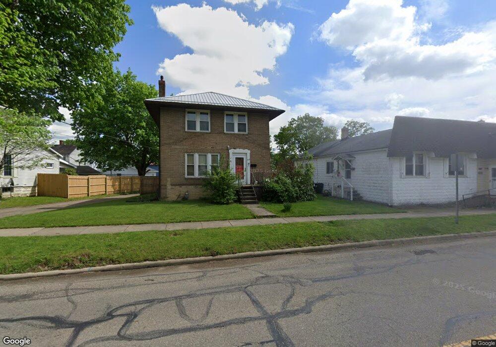
715 W State St Newcomerstown, OH 43832
Estimated Value: $93,000 - $170,000
3
Beds
1
Bath
1,352
Sq Ft
$97/Sq Ft
Est. Value
About This Home
This home is located at 715 W State St, Newcomerstown, OH 43832 and is currently estimated at $131,727, approximately $97 per square foot. 715 W State St is a home located in Tuscarawas County with nearby schools including West Elementary School, East Elementary School, and Newcomerstown Middle School.
Ownership History
Date
Name
Owned For
Owner Type
Purchase Details
Closed on
Jan 29, 2025
Sold by
Mick Lawrence M and Mick Melissa
Bought by
Mick Michael L and Mick Diane M
Current Estimated Value
Purchase Details
Closed on
Oct 25, 2024
Sold by
Mick Renee D
Bought by
Mick Michael L and Mick Diane M
Purchase Details
Closed on
Feb 24, 2023
Sold by
Canfield Darlene S
Bought by
Mick Michael L and Mick Diane M
Purchase Details
Closed on
Jan 28, 1986
Sold by
Canfield James P and Canfield Darlene
Bought by
Canfield James P and Canfield Darlene S
Create a Home Valuation Report for This Property
The Home Valuation Report is an in-depth analysis detailing your home's value as well as a comparison with similar homes in the area
Home Values in the Area
Average Home Value in this Area
Purchase History
| Date | Buyer | Sale Price | Title Company |
|---|---|---|---|
| Mick Michael L | -- | None Listed On Document | |
| Mick Michael L | -- | None Listed On Document | |
| Mick Michael L | -- | None Listed On Document | |
| Mick Michael L | -- | -- | |
| Canfield James P | -- | -- |
Source: Public Records
Tax History Compared to Growth
Tax History
| Year | Tax Paid | Tax Assessment Tax Assessment Total Assessment is a certain percentage of the fair market value that is determined by local assessors to be the total taxable value of land and additions on the property. | Land | Improvement |
|---|---|---|---|---|
| 2024 | $461 | $32,040 | $3,430 | $28,610 |
| 2023 | $1,210 | $91,550 | $9,800 | $81,750 |
| 2022 | $516 | $32,043 | $3,430 | $28,613 |
| 2021 | $383 | $27,395 | $2,846 | $24,549 |
| 2020 | $381 | $27,395 | $2,846 | $24,549 |
| 2019 | $392 | $27,395 | $2,846 | $24,549 |
| 2018 | $959 | $23,120 | $2,400 | $20,720 |
| 2017 | $960 | $23,120 | $2,400 | $20,720 |
| 2016 | $963 | $23,120 | $2,400 | $20,720 |
| 2014 | $871 | $21,250 | $2,230 | $19,020 |
| 2013 | $879 | $21,250 | $2,230 | $19,020 |
Source: Public Records
Map
Nearby Homes
- 429 Spaulding Ave
- 439 Tuscarawas Ave
- 465 Spaulding Ave
- 435 Oxford Ave
- 460 Barnett Ave
- 303 Beaver St
- 60949 County Road 9
- 621 Tuscarawas Ave
- 598 Martin Luther King Dr
- 465 Martin Luther King Dr
- 540 Mulvane St
- 516 Mulvane St
- 0 Johnson Hill Rd
- 579 Chestnut St
- 100 Crestview Dr
- 241 N College St
- 279 E Canal St
- 21277 County Road 106
- 541 E Canal St
- 134 Chapman Ave
- 735 W State St
- 713 W State St
- 739 W State St
- 707 W State St
- 428 Spaulding Ave
- 701 W State St
- 423 Tuscarawas Ave
- 355 Tuscarawas Ave
- 430 Spaulding Ave
- 431 Tuscarawas Ave
- 716 W State St
- 716 W State St
- 704 W State St
- 704 W State St
- 432 Spaulding Ave
- 805 W State St
- 806 W State St
- 806 W State St
- 811 W State St
- 346 Tuscarawas Ave