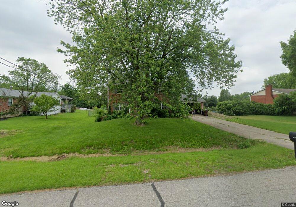
7151 Becky Dr Liberty Township, OH 45044
Estimated Value: $328,000 - $385,000
4
Beds
3
Baths
1,776
Sq Ft
$194/Sq Ft
Est. Value
About This Home
This home is located at 7151 Becky Dr, Liberty Township, OH 45044 and is currently estimated at $345,200, approximately $194 per square foot. 7151 Becky Dr is a home located in Butler County with nearby schools including Independence Elementary School, Liberty Junior School, and Lakota East High School.
Ownership History
Date
Name
Owned For
Owner Type
Purchase Details
Closed on
Sep 23, 2005
Sold by
Rhodus Daniel E and Rhodus Patricia A
Bought by
Mulcahey Henry W
Current Estimated Value
Home Financials for this Owner
Home Financials are based on the most recent Mortgage that was taken out on this home.
Original Mortgage
$128,000
Outstanding Balance
$68,824
Interest Rate
5.93%
Mortgage Type
Fannie Mae Freddie Mac
Estimated Equity
$276,376
Purchase Details
Closed on
May 29, 2002
Sold by
Randolph Jane S
Bought by
Rhodus Daniel E and Rhodus Patricia A
Home Financials for this Owner
Home Financials are based on the most recent Mortgage that was taken out on this home.
Original Mortgage
$129,600
Interest Rate
6.25%
Mortgage Type
Purchase Money Mortgage
Create a Home Valuation Report for This Property
The Home Valuation Report is an in-depth analysis detailing your home's value as well as a comparison with similar homes in the area
Home Values in the Area
Average Home Value in this Area
Purchase History
| Date | Buyer | Sale Price | Title Company |
|---|---|---|---|
| Mulcahey Henry W | $160,000 | Members Title Agency Llc | |
| Rhodus Daniel E | $144,000 | -- | |
| Randolph Jane S | -- | -- |
Source: Public Records
Mortgage History
| Date | Status | Borrower | Loan Amount |
|---|---|---|---|
| Open | Mulcahey Henry W | $128,000 | |
| Previous Owner | Rhodus Daniel E | $129,600 |
Source: Public Records
Tax History Compared to Growth
Tax History
| Year | Tax Paid | Tax Assessment Tax Assessment Total Assessment is a certain percentage of the fair market value that is determined by local assessors to be the total taxable value of land and additions on the property. | Land | Improvement |
|---|---|---|---|---|
| 2024 | $3,202 | $82,020 | $21,190 | $60,830 |
| 2023 | $3,162 | $82,020 | $21,190 | $60,830 |
| 2022 | $3,107 | $63,130 | $21,190 | $41,940 |
| 2021 | $3,090 | $63,130 | $21,190 | $41,940 |
| 2020 | $3,171 | $63,130 | $21,190 | $41,940 |
| 2019 | $4,889 | $50,750 | $17,080 | $33,670 |
| 2018 | $2,848 | $50,750 | $17,080 | $33,670 |
| 2017 | $2,890 | $50,750 | $17,080 | $33,670 |
| 2016 | $2,919 | $50,750 | $17,080 | $33,670 |
| 2015 | $3,348 | $58,250 | $19,600 | $38,650 |
| 2014 | $2,917 | $58,250 | $19,600 | $38,650 |
| 2013 | $2,917 | $49,000 | $10,980 | $38,020 |
Source: Public Records
Map
Nearby Homes
- 5933 Old Pebble Path
- 6919 Millikin Rd
- 7113 Shady Brook Bend
- 7120 Shady Brook Bend
- 5913 Stones Throw Way
- 7108 Shady Brook Bend
- 6300 Lindsey Ct
- 7241 Stonebrook Ct
- 6335 Gem Stone Dr
- 6816 Devon Dr
- 7162 Wyandot Ln
- 7644 Millikin Rd
- 5725 Hawthrone Reserve Dr
- 7377 Burton Dr
- 6405 Cincinnati Dayton Rd
- 7232 Eaglestone Ct
- 6777 Mahogany Ct
- 7109 Maple Creek Dr
- 5602 Schlade Ct
- 7497 Burton Dr
- 7139 Becky Dr
- 6075 Jackie Dr
- 7127 Becky Dr
- 7150 Becky Dr
- 7138 Becky Dr
- 7115 Becky Dr
- 7162 Jackie Dr
- 6070 Jackie Dr
- 7126 Becky Dr
- 6080 Jackie Dr
- 6046 Jackie Dr
- 7107 Becky Dr
- 7151 Millikin Rd
- 7106 Becky Dr
- 7139 Millikin Rd
- 7163 Millikin Rd
- 7127 Millikin Rd
- 7115 Millikin Rd
- 7183 Millikin Rd
- 7103 Millikin Rd