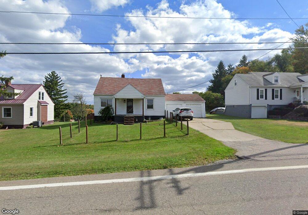
71549 Colerain Rd Bridgeport, OH 43912
Estimated Value: $146,214 - $203,000
4
Beds
2
Baths
1,120
Sq Ft
$151/Sq Ft
Est. Value
About This Home
This home is located at 71549 Colerain Rd, Bridgeport, OH 43912 and is currently estimated at $169,054, approximately $150 per square foot. 71549 Colerain Rd is a home located in Belmont County with nearby schools including Anna Marie Ayers Elementary School, Martins Ferry Middle School, and Martins Ferry High School.
Ownership History
Date
Name
Owned For
Owner Type
Purchase Details
Closed on
Dec 22, 2010
Sold by
Hoge John M
Bought by
Dubil Jason R
Current Estimated Value
Home Financials for this Owner
Home Financials are based on the most recent Mortgage that was taken out on this home.
Original Mortgage
$82,901
Outstanding Balance
$54,604
Interest Rate
4.16%
Mortgage Type
New Conventional
Estimated Equity
$114,450
Purchase Details
Closed on
Oct 21, 1998
Sold by
Hoge John M
Bought by
Hoge John M
Purchase Details
Closed on
Jan 1, 1986
Sold by
Hoge Phyllis A
Bought by
Hoge Phyllis A
Create a Home Valuation Report for This Property
The Home Valuation Report is an in-depth analysis detailing your home's value as well as a comparison with similar homes in the area
Home Values in the Area
Average Home Value in this Area
Purchase History
| Date | Buyer | Sale Price | Title Company |
|---|---|---|---|
| Dubil Jason R | $79,500 | Attorney | |
| Hoge John M | -- | -- | |
| Hoge Phyllis A | -- | -- |
Source: Public Records
Mortgage History
| Date | Status | Borrower | Loan Amount |
|---|---|---|---|
| Open | Dubil Jason R | $82,901 |
Source: Public Records
Tax History Compared to Growth
Tax History
| Year | Tax Paid | Tax Assessment Tax Assessment Total Assessment is a certain percentage of the fair market value that is determined by local assessors to be the total taxable value of land and additions on the property. | Land | Improvement |
|---|---|---|---|---|
| 2024 | $1,254 | $35,140 | $2,560 | $32,580 |
| 2023 | $918 | $24,050 | $2,560 | $21,490 |
| 2022 | $918 | $24,044 | $2,558 | $21,486 |
| 2021 | $914 | $24,063 | $2,555 | $21,508 |
| 2020 | $845 | $20,920 | $2,220 | $18,700 |
| 2019 | $847 | $20,920 | $2,220 | $18,700 |
| 2018 | $865 | $20,920 | $2,220 | $18,700 |
| 2017 | $869 | $20,430 | $2,180 | $18,250 |
| 2016 | $873 | $20,430 | $2,180 | $18,250 |
| 2015 | $879 | $20,430 | $2,180 | $18,250 |
| 2014 | $863 | $20,990 | $1,980 | $19,010 |
| 2013 | $826 | $20,990 | $1,980 | $19,010 |
Source: Public Records
Map
Nearby Homes
- 53979 Colerain Pike
- 71850 Colerain Rd
- 71900 Cope St
- 70798 Lollini Rd
- 53760 Farmington Rd
- 70610 Chermont Rd
- 70571 Pine Hollow Rd
- 70540 Colerain Rd
- 55379 Barnes Rd
- 0 Terra Ridge Ln
- 69657 Chermont Rd
- 73881 Colerain Mount Pleasant Rd
- 69895 Woods Rd
- 68960 Pine Terrace Rd
- 70392 Barton Rd
- 54980 Maple Ave
- 55273 Poplar Ave
- 56745 Ferryview Rd
- 68511 Liston Ave
- 69282 Zelda Ave
- 71563 Colerain Rd
- 71541 Colerain Rd
- 71523 Colerain Rd
- 71538 Colerain Rd
- 71583 Colerain Rd
- 71579 Colerain Rd
- 71511 Colerain Rd
- 71585 Colerain Rd
- 71501 Colerain Rd
- 71601 Colerain Rd
- 71561 Lake End Rd
- 54060 Highview Row
- 54060 Highview Row
- 54043 Robinwood Dr
- 54080 Reflection Dr
- 71479 Colerain Rd
- 54061 Robinwood Dr
- 54094 Reflection Dr
- 54091 Robinwood Dr
- 54116 High View Row